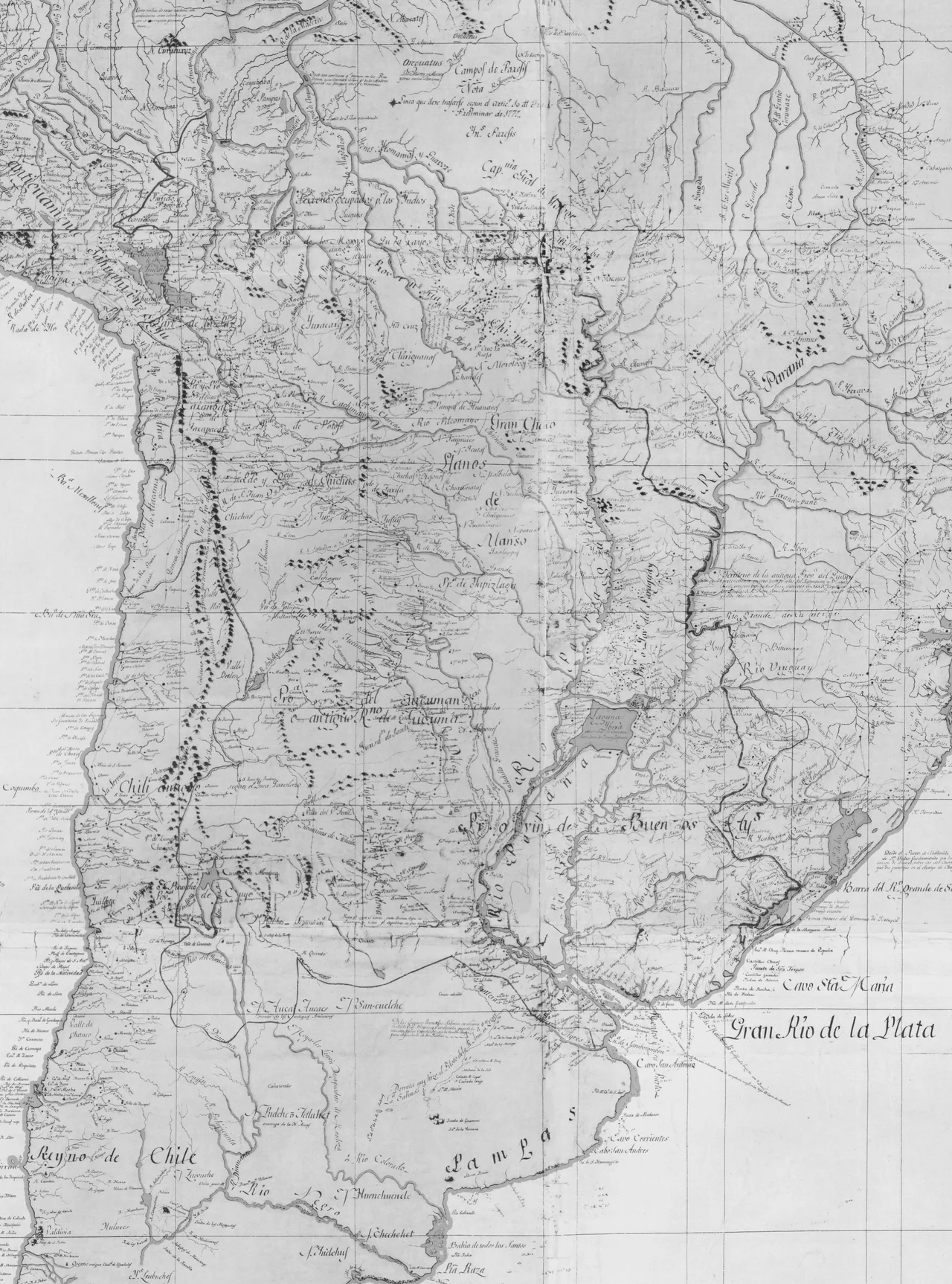

Viceroyalty of the Río de la Plata
The river was named for a treasure it never held. Río de la Plata means "River of Silver," and Argentina takes its very name from the Latin word for the metal - yet no silver was ever pulled from this broad, brown estuary. The wealth came overland, in mule trains from the mountains of Potosí, and it was the desire to guard those silver routes that finally turned a muggy smuggling port into the seat of an empire's last great experiment in the Americas. In 1776, King Charles III of Spain carved the Viceroyalty of the Río de la Plata out of the sprawling Viceroyalty of Peru and gave it a capital on the western shore of this estuary: Buenos Aires. It would be the newest of Spain's American viceroyalties, and the shortest-lived. Within thirty-five years, the city Spain had chosen to anchor its southern frontier would lead the revolution that ended Spanish rule.
Why the Crown Drew a New Line
For two centuries, almost all of South America had been governed from distant Lima, capital of the Viceroyalty of Peru. The arrangement made less and less sense the farther south you traveled. Buenos Aires sat thousands of miles and many months from the Peruvian capital, and into that gap flowed contraband. The port had become one of the great smuggling centers of the Atlantic world, a back door through which silver slipped out and foreign goods slipped in. Meanwhile Portugal pressed westward from Brazil, founding the outpost of Colônia do Sacramento directly across the water from Buenos Aires, and British and French ships prowled the Patagonian coast. The Bourbon kings in Madrid, intent on tightening and modernizing their empire, concluded that this turbulent edge of the continent needed a government of its own. The new viceroyalty would stretch across what are today Argentina, Uruguay, Paraguay, Bolivia, and parts of northern Chile and southern Brazil - and, on paper, even the African islands that became Equatorial Guinea.
A Soldier Becomes a Viceroy
The man Charles III chose to launch the project was Pedro de Cevallos, an experienced general who in 1776 was governor of Madrid. His first task was not administration but war: to push the Portuguese back behind the line drawn long before by the Treaty of Tordesillas. His expedition was enormous for the age - some 116 ships crossing the Atlantic. Cevallos took Santa Catalina Island, forced the surrender of Colônia do Sacramento, and was driving toward Rio Grande when word arrived that Spain and Portugal had made peace. The 1777 Treaty of San Ildefonso confirmed Spanish control of Colônia, and on 27 October 1777 the king made the viceroyalty permanent. His reasoning was plain: Lima was simply too far away to govern this country well. Cevallos handed power to his successor, Juan José de Vértiz y Salcedo, and sailed home, dying weeks later. The frontier experiment would outlive its founder by only a few decades.
The Door That Trade Opened
What truly transformed Buenos Aires was not the sword but the ledger. In 1778, the Crown issued its Regulations for Free Trade, ending the old monopoly that had funneled all commerce through a handful of Spanish ports. Suddenly Buenos Aires and Montevideo could trade legally with Spain, and over the following decade commerce between Spain and its American colonies surged by roughly 700 percent. A river that had thrived on smuggling now thrived on legitimate cargo. Cattle multiplied across the grasslands until the region was producing hundreds of thousands of head a year. With prosperity came population, and with population came something the Crown had not bargained for: a confident class of criollos - American-born descendants of Spaniards - who increasingly saw the viceroyalty not as Madrid's possession but as their home, and themselves as its rightful stewards.
The City That Defended Itself
The turning point came from an unlikely direction. In 1806, with Spain entangled in Napoleon's wars, a British force seized Buenos Aires almost without a fight; the viceroy fled inland with the treasury. But the city did not stay conquered. A militia raised across the river in Montevideo, joined by hundreds of local volunteers, retook Buenos Aires forty-six days later - an event Argentines still call La Reconquista. When the British returned in 1807 with a far larger army, the people of Buenos Aires fought them in the streets, neighbors hurling boiling water and debris from rooftops until the invaders surrendered. They named it La Defensa, the Defence. The lesson was unmistakable and intoxicating: ordinary porteños had twice beaten a world power while Spain sent no help at all. That memory of self-reliance fed directly into the May Revolution of 1810, when Buenos Aires deposed its last viceroy. By 1814 the viceroyalty had effectively dissolved, and the provinces that stayed loyal to Buenos Aires became the seedbed of independent Argentina.
From the Air
The historic core of the former viceroyalty centers on Buenos Aires at roughly 34.61°S, 58.40°W, where the Plaza de Mayo and the Cabildo - the colonial town hall where the May Revolution unfolded - still stand a short walk from the river. The Río de la Plata estuary is unmistakable from the air: an immense, silt-brown wedge of water up to 220 km wide where it meets the Atlantic, with Buenos Aires on the southwestern shore and Montevideo, Uruguay, on the northeastern. A viewing altitude of 6,000-9,000 ft over the city gives the best sense of how the grid of the old capital fans out from the waterfront. Aeroparque Jorge Newbery (SABE) sits directly on the estuary shore beside downtown; Ministro Pistarini International (SAEZ, Ezeiza) lies about 22 km southwest. Clear, dry autumn and winter days (April-August) offer the sharpest visibility across the wide, hazy plain of the Pampas.
Nearby Stories
- Tigre, Buenos Aires 6 km away
- Luján, Buenos Aires 17 km away
- Anchorena National Park 21 km away
- La Plata Museum 22 km away
- Lobos 23 km away
- San Antonio de Areco 43 km away
- Chascomús 82 km away
- Tronador (rocket) 96 km away