Wadi Halfa
The ferry arrives on Mondays. For two days after, the market opens, the restaurants unlock their doors, tea glasses fill the shade beside the main square, and Wadi Halfa remembers it is a town. Then the ferry leaves for Aswan and the town exhales back into quiet, waiting for the next arrival across Lake Nasser. This is what happens when a place is built around a weekly crossing. Wadi Halfa is the border town at Sudan's northernmost edge, a dusty grid of immaculate low buildings surrounded by the golden dunes of the Nubian Desert, and its rhythm is not the rhythm of a city but of a tide.
The Town That Moved
There are two Wadi Halfas, and the important one is gone. The original town stood farther north, on the banks of the Nile where Nubian families had traded, fished, and farmed for thousands of years. In 1971, when the Aswan High Dam's reservoir finished filling, the old town vanished beneath Lake Nasser. Sudan's military government forcibly relocated approximately 50,000 inhabitants of the wider flooded region, moving many of them far to the east into the harsh Butana region. Malaria and unfamiliar diseases killed many of the resettled. Some Wadi Halfans refused to leave the river entirely and built new settlements along the rising shore, abandoning and rebuilding each time the water caught up, until the flooding stabilized at the site the modern town now occupies.
Arrivals
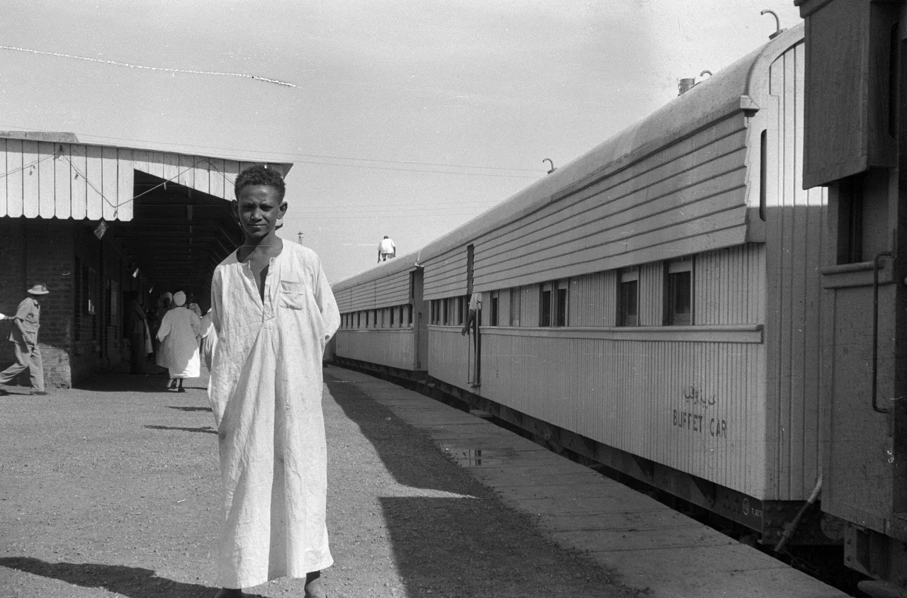
Most travelers reach Wadi Halfa by the weekly ferry from Aswan across Lake Nasser - southbound on Mondays, northbound on Wednesdays, docking at the Customs and Immigration terminal about five kilometers outside the center. A sand track leads into town, and vehicles wait at the terminal for paying passengers. Some people walk. Some bicycle. The rail alternative is a scheduled overnight train from Khartoum via Atbara, timed with the ferry, but the word supposedly does a lot of work in that sentence: the train is prone to cancellation and the journey, when it runs, takes forty-eight hours. By road, an air-conditioned bus from Khartoum covers the distance in about twelve hours on a good day. A periodically open border crossing from Egypt also allows bus service from Aswan via Abu Simbel when the road is not closed.
The Main Square
Almost everything happens around the main square. The eateries serve fuul - stewed fava beans - with bread, or fried Nile perch with bread, and most open only in the two-day window after the ferry docks. There is an excellent food market beside the square when it is open early in the morning. Alcohol is illegal in Sudan, so the social life runs on tea: Wadi Halfans, Egyptian tradesmen, the occasional tourist and overland traveler gathering around the glass cups to watch the afternoon pass. Transport within town is by foot or, popularly, by donkey, which remains the conveyance of choice for many residents. Hotels nearby offer string beds, bucket showers, mud floors, and a courtyard - all variations on the same practical theme.
Borders and Paperwork
It is, in the town's own self-description, the stereotypical border town: small, full of paperwork, hassle, and dirt. The paperwork starts at immigration when the ferry docks and does not really end until you have either boarded a bus south or presented yourself at the police station for a Permit to Travel, a document required for independent travel beyond the main route to Khartoum. Obtaining the permit typically takes the better part of a day. Sudan's broader political instability - the State Department has maintained travel advisories for years, warning against areas of conflict like Darfur - makes Wadi Halfa itself one of the safer cities in the country. What does the damage here is not violence but heat.
The Hottest Summer
Wadi Halfa is one of the hottest places on earth. Summer temperatures routinely reach 50°C on the thermometer, with extremes climbing to 54°C. The rainfall averages about half a millimeter per year - essentially none. The town receives roughly ninety-seven or ninety-eight percent of possible sunshine, which is a statistical way of saying that clouds are an event. Travelers who want to see Wadi Halfa are universally advised to avoid summer, stick to winter, and even then wear protective clothing and apply sunscreen with the seriousness of a desert expedition. The Nubian pyramids and archaeological sites farther south - some of them older than the Egyptian pyramids - are worth the trip, and several are currently threatened by a new series of dams under construction along the Sudanese Nile.
What Remains
What Wadi Halfa offers is less a destination than an encounter: with a Nubian community that has lost one home to water and built another on the edge of dunes; with the slow pace of a town whose pulse is a weekly ferry; with the tea houses around the square where generations of travelers have waited out the heat and the paperwork. Plans have surfaced repeatedly - in 2005, again more recently - to build a museum and interactive Nubian village here, preserving the heritage the reservoir submerged. So far the plans have not been realized. Wadi Halfa keeps going anyway, waiting for Monday's ferry.
From the Air
Coordinates: 21.793°N, 31.378°E. Wadi Halfa sits on the southern shore of Lake Nasser at Sudan's northern border. The town is visually distinct against the surrounding Nubian Desert. Nearest airport: Wadi Halfa Airport (HSSW) immediately west of the settlement; Khartoum (HSSS) lies 900 km south. Summer temperatures make daytime operations hazardous; winter months offer best conditions. Recommended cruising altitude 10,000+ feet for context; visibility typically excellent outside of sandstorm periods.
Nearby Stories
- Jebel Sahaba 14 km away
- Kulb 51 km away
- Kulubnarti 78 km away
- Meinarti 104 km away
- Bi'r Tawīl 181 km away
- Temple of Dendur 185 km away
- Dar al-Manasir 277 km away
- Kharga Oasis 367 km away