Dar al-Manasir
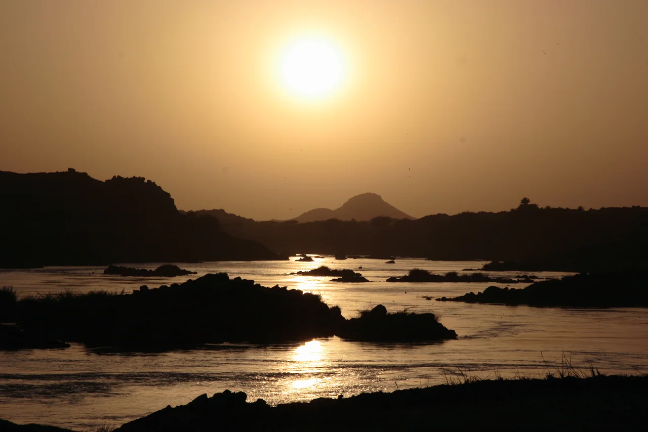
Imagine a flock of goats scattered across a river. That is how the British colonial traveler T. Gray described the Fourth Cataract of the Nile in 1949: a cataract area where islands are so thick that in any ten kilometers you might count a dozen silt-covered river banks where villages had taken hold. This was Dar al-Manasir, the homeland of the Manasir Arab tribe, the most impassable stretch of the whole Nile, where the river blocked by rock pivoted southwest for 280 kilometers in a great S-bend between the Bayudah and Nubian Deserts. For generations the water, the rocks, and the fourteen inhabited islands together made a world. Then the Merowe Dam came, the water rose, and most of that world disappeared under its own surface.
The Shape of the River Here
The Nile at Dar al-Manasir does not flow the direction a river is supposed to flow. At the height of Muqrat Island, around 19 degrees 30 minutes north, the water meets a geological structure called the Central African Shear Zone and pivots sharply southwest for nearly three hundred kilometers before resuming its northward course. In the middle of this reversed loop the river fragments into a braided network of channels, dropping silt wherever an eddy allows. The result was not one Nile but a thousand small Niles, and on the islands between them the Manasir grew dates, raised cattle, and built villages whose names you would not find in any atlas. Fourteen islands; twelve of them permanently inhabited: al-Qanaweit, Shiri, Kidir, Sherari, Sur, Us, Tibit, Dumag, Buni, Arag, Dirbi, and Birti.
A Community of Dates
The economy of Dar al-Manasir was built on dates. Tiny pockets of alluvial sediment along the riverside, seasonally inundated and intensively irrigated, produced the region's signature cash crop, still celebrated in the Wikipedia article on Date cultivation in Dar al-Manasir. When rains were good and the grazing grounds of the adjacent Bayudah Desert greened up, many Manasir men would join cousins from the tribe in the wider interior to herd cattle. The region received about fifty millimeters of rain in a good year, and it fell unpredictably between August and October, coinciding with the Nile flood. People lived close to the water's edge because that was where life happened. N. McL. Innes, writing in 1930, called the landscape at once 'the most barren and the most beautiful' stretch along the Nile. The inhabitants called it, in Arabic, 'our rocks.'
The Place That Was Forgotten
Administratively, Dar al-Manasir belonged to Sudan's River Nile state, with its center at Shiri on Shiri Island, which hosted the only local police station, a branch of the Agricultural Bank, and secondary schools for boys and girls. Otherwise, the region was among the most neglected in northern Sudan. There were no tarred roads, no bridges, no ferry boats, no hospitals. The Manasir saw two sides of this neglect. On the one hand, they lacked the infrastructure other Sudanese communities had. On the other, they were proud of the safety, tranquility, and cleanness of life in a place where people drank Nile water straight from the river. They had a phrase, in the Nubian Arabic of the region, for the exceptional honesty of their communities: fi aman, 'in trust.' Anthropologist Kurt Beck and sociologist Abdel Moneim Salih documented this culture in rich ethnographic detail in the 1990s and 2000s, aware that what they were recording would soon be gone.
The Dam Arrives
The Merowe Dam, built on the Fourth Cataract between 2003 and 2009 with Chinese and Arab financing, was designed to generate electricity and supply irrigation water for a newly independent Sudan. Its reservoir would flood the entire length of Dar al-Manasir, every one of its inhabited islands, every date palm, every village rooted along the Nile for centuries. The Manasir formed a committee, the Lagnah al-Tanfidhiyah lil-Muta'thirin, the Executive Committee of the Affected, to negotiate their relocation. Their book, Khasan al-Hamdab wa Qissah Tahgir Ahali al-Manasir, is the Manasir's own account of what happened to them. The government promised resettlement in the desert far from the Nile. The Manasir resisted. In 2008 protests turned violent, with security forces firing on demonstrators. Many families refused to leave and were eventually flooded in place or forcibly removed. The relocation sites offered land too arid to sustain the date agriculture that had made Manasir life possible.
What the Water Covered
When the reservoir filled, the Fourth Cataract rapids drowned. The goat-scattered islands became underwater geography. The old villages became coordinates on a map of a lake. Many of the Manasir families were forced to leave their riverine homeland for desert resettlement schemes that could not replicate what they had lost, and the community has been dispersed ever since. The ethnographic record preserved by Beck and Salih, and by the Humboldt University Nubian Expedition that documented the region from 2004 to 2007 before the flood, now serves as the only detailed memory of a world that no longer exists. For travelers flying over the Fourth Cataract region today, what lies below is blue reservoir water where, within living memory, women harvested dates along channels their grandmothers had irrigated. The Manasir themselves remain a tribe, but they no longer have their rocks.
From the Air
Located at 18.98 N, 32.42 E on the Nile in Sudan's River Nile State, in the Fourth Cataract region. The area is now partly submerged beneath the Merowe Dam reservoir. Nearest airport: Merowe Airport (ICAO HSMR), approximately 60 km downstream. Active Sudanese civil war makes civilian overflight hazardous. From cruise altitude, the S-bend of the Nile is a striking navigation feature, with the Merowe reservoir now filling the former island region.
Nearby Stories
- Nuri 11 km away
- Jebel Barkal 44 km away
- Monastery in Ghazali 66 km away
- Dongola Reach 157 km away
- Pyramids of Meroë 203 km away
- Dongola 214 km away
- Nubian pyramids 230 km away
- Bi'r Tawīl 310 km away