Dongola
The name means red brick. In Nubian, Donqal, Doñqal, is the word for the material that built ancient Nubia, and the word became the name of a city that built itself from the same clay. Modern Dongola, sometimes called Urdu or New Dongola, is the capital of Sudan's Northern State and sits on the east bank of the Nile in the heart of the Dongola Reach. It should not be confused with Old Dongola, the medieval Christian capital of Makuria, eighty kilometers upstream on the opposite bank. New Dongola inherited the older city's name, not its site. What the two share is a continuous human presence along this particular curve of the Nile, stretching back to civilizations old enough that the word for brick became the word for home.
From Christian Capital to Mamluk Refuge
Old Dongola was the capital of Makuria, a Christian Nubian kingdom that held out against the expansion of Islam for nearly a thousand years. Its churches, palaces, and administrative buildings testify to one of the most durable Christian states outside Europe. By the mid-fourteenth century, the kingdom had shrunk and the capital had effectively fallen. Makuria's remnant lands were absorbed into the Islamic Funj Sultanate in the sixteenth century, and Old Dongola itself was virtually abandoned by the 1820s. Meanwhile, in 1812, the Mamluk rulers of Egypt, driven out by Muhammad Ali Pasha's modernization campaigns, fled south into the Dongola region and established a small state centered on the village of Maragha. The town grew significantly under the Mamluks and came to be called Dongola Urdu, meaning Dongola Camp, or New Dongola. In 1820 Muhammad Ali's army invaded Sudan. The three hundred Mamluks abandoned their new town and fled further south.
A Provincial Capital, Then a Front Line
The Egyptians turned Dongola into a provincial capital of their expanding Sudanese dominion. It held that status for most of the nineteenth century until the Mahdist revolt erupted in the 1880s. The Nile Expedition of 1884-1885, the British force sent to relieve Charles Gordon at Khartoum, passed through Dongola on its way up the river. The expedition left one strange legacy: British regiments were challenged to race each other up the Nile by boat, and the competition became popular enough back in Britain that it spawned an English regatta sport called dongola racing. In 1896, General Herbert Kitchener won the Battle of Dongola against Mahdist forces here, turning the town into a British-Egyptian military base for the larger reconquest of Sudan. Dongola was used as a collection point for weapons and supplies, and the first English press release from the campaign, the Dongola Star, was issued here.
Echoes in Other Countries
Kitchener's victory at Dongola became famous enough in late Victorian Britain that streets across the English-speaking world were named for it. Dongola Road and Dongola Avenue run through the Bishopston area of Bristol. Another Dongola Road sits in Tottenham, North London, right next to a Kitchener Road. Another Dongola Road appears in Jersey in the Channel Islands, another in Plaistow in East London, another in Ayr in Scotland. In the United States, the town of Dongola, Illinois, was founded in the 1850s and named for the Sudanese city. There is a Dongola Lane in Shakopee, Minnesota, and a Dongola Highway in Conway, South Carolina. Each of these small namings represents a moment when a distant Sudanese victory was pressed, by imperial enthusiasm, into the fabric of everyday streetscapes on three continents. The ruthlessness of the campaign itself, in which Kitchener's forces killed approximately ten to twelve thousand Mahdist soldiers at Omdurman in 1898 and then, according to many accounts, continued killing the wounded to produce a total death toll including wounded and captured that may have reached twenty-eight thousand, was mostly edited out of the naming.
A Climate Extreme Enough to Set Records
Modern Dongola sits in the Sahara. Its climate is hot desert by any classification, one of the hottest, sunniest, and driest climates on Earth. January, the coolest month, averages 17.6 degrees Celsius with nightly lows of 8.5. June pushes daily highs to an average of 43.4 degrees. August nights rarely dip below 25.2. On June 22, 2010, Dongola recorded a temperature of 49.7 degrees Celsius, the highest temperature ever officially recorded anywhere in Sudan. The town receives just 12.3 millimeters of rain per year, with six months receiving no rain at all. It gets 3,813.8 hours of sunshine annually, roughly eighty-seven percent of all possible sunshine. Humidity stays low year-round. The trans-African Cairo-Cape Town Highway passes through Dongola, linking it to the continental infrastructure that has otherwise largely bypassed this part of northern Sudan.
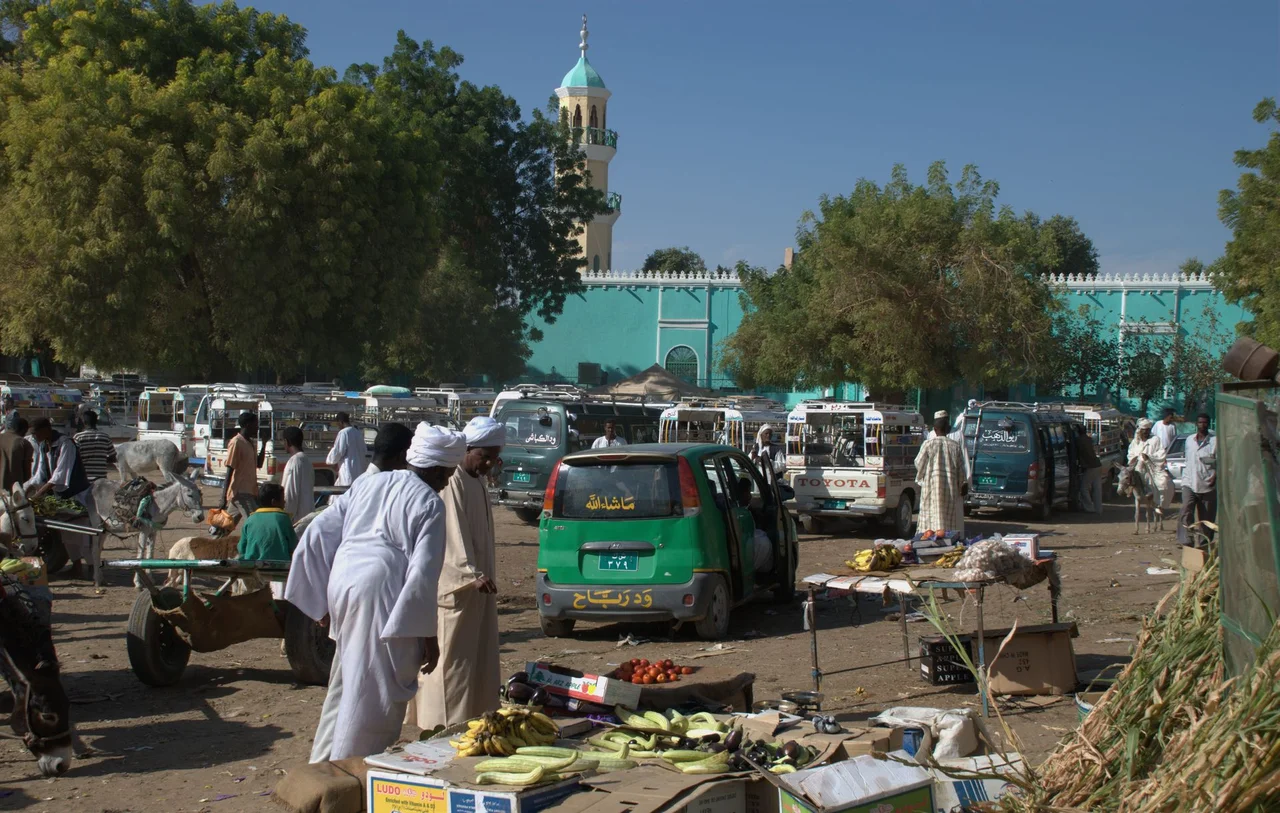
A City Still on the Nile
From the air, Dongola reveals itself as a linear settlement hugging the east bank of the Nile, its irrigated fields stretching back from the water in a narrow green strip against the hard tan of the surrounding desert. The city's airport, Dongola Airport, serves domestic traffic, and during peaceful periods before 2023 it was a gateway for archaeological teams working at Old Dongola and along the Dongola Reach. The current Sudanese civil war, which began in April 2023, has made Northern State relatively secure compared to Darfur and Khartoum, but the situation remains fragile. What Dongola represents, in the long view, is continuous habitation on a river corridor that has held humans for fifty thousand years, a capital of something in nearly every era, and a name that spread across the world without most of the people on those distant streets ever knowing which red brick city their street was named for.
From the Air
Located at 19.18 N, 30.48 E on the east bank of the Nile in Sudan's Northern State. Nearest airport: Dongola Airport (ICAO HSDN), a domestic facility serving northern Sudan. Active Sudanese civil war makes civilian overflight hazardous. From cruise altitude the linear ribbon of irrigated fields along the Nile against surrounding Sahara desert is visible in clear weather; Old Dongola, the medieval ruined capital of Makuria, lies 80 km upstream on the opposite bank.
Nearby Stories
- Kerma 9.9 km away
- El Khandaq 46 km away
- Nubia 61 km away
- Napata 122 km away
- Northern State (Sudan) 159 km away
- Selima Oasis 215 km away
- Semna (Nubia) 221 km away
- Lake Ptolemy 408 km away