Selima Oasis
Around 8300 BCE, a freshwater lake sat where Selima Oasis now lies. The surrounding vegetation was savannah. Palaeolithic hunters left their stone tools by the water's edge, and lacustrine animals - fish, waterbirds, crocodiles - lived the short lives they would leave as fossils. Then, slowly, the climate changed. Around 4300 BCE the freshwater turned brackish, a saltwater sabkha. By 2700 BCE the water was gone. What remained was a patch of palm trees in a sea of sand, and a reason to stop walking. For the next five thousand years, people kept walking here.
The Forty Days' Road
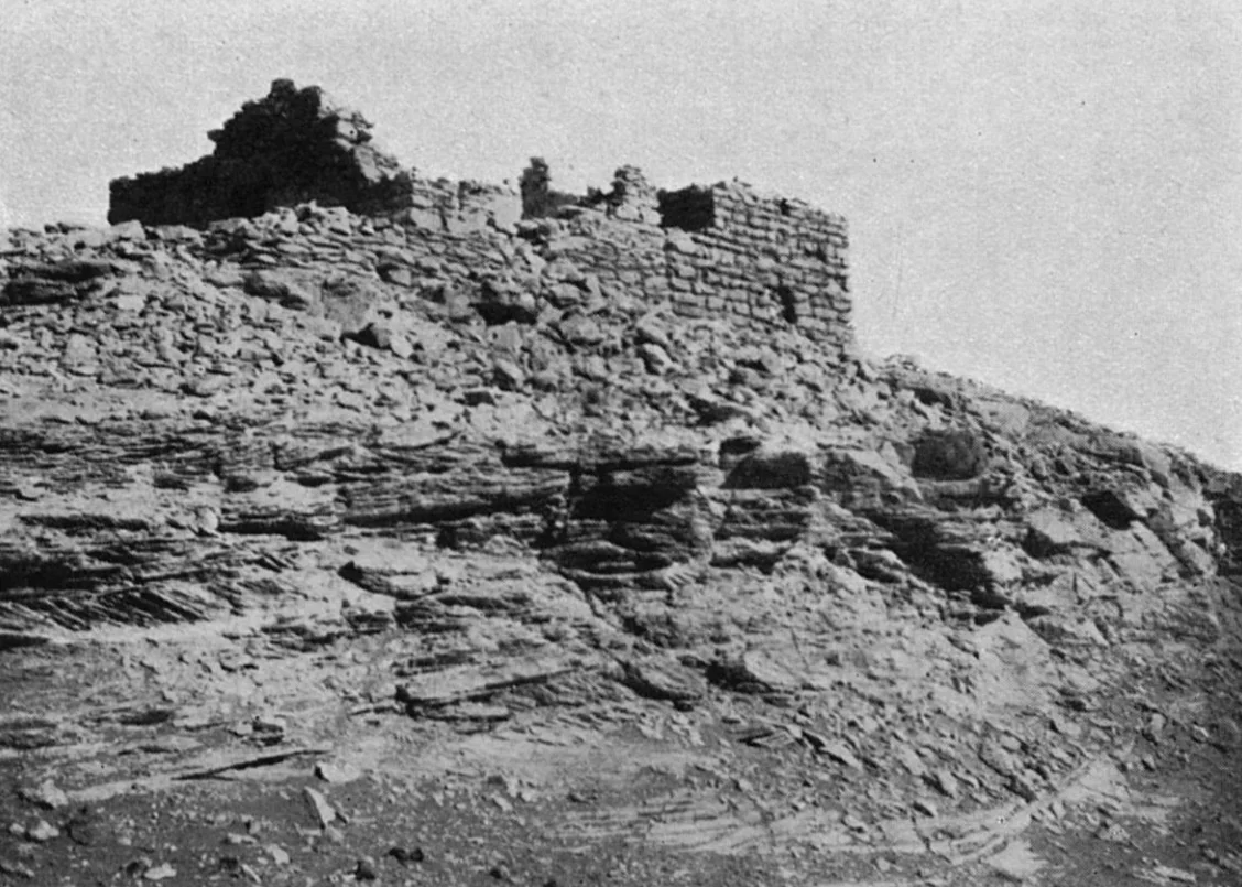
Selima sits about 90 kilometers west of the Third Cataract of the Nile, in Sudan's Nubian Desert. It lies on the Darb al-Arbain - the Forty Days' Road - a desert track that linked Kordofan, south of the Sahara, with the Nile valley and ultimately Egypt. Just north of Selima the track forks: one branch bends northeast toward Kharga Oasis, another heads northwest toward Dunqul Oasis. Caravans carrying salt, dates, and more tragically for centuries enslaved people moved along this route for more than a thousand years. The oasis was a waterhole and a toll point, a place where tired camels rested and travelers drank and paid. The Catholic missionary Theodor Krump passed through in 1700 and described what he took to be the ruins of an eight-celled monastery - possibly one of two monasteries described in the 10th-century Persian geography Hudud al-Alam as lying in the desert between the Nuba and the Sudan.
Palms in the Wind
The flora at Selima is not varied but it is stubborn. Date palms, dom palms, tamarisk, camelthorn, a few reeds and grasses that somehow find enough moisture to keep leaves open. In 1902, observers counted upwards of 2,500 date palms at the oasis. By 2011, just over 1,000 remained. Climate change, water table decline, and the interruption of the old caravan economy all reduced the palm groves - though date-growing was never the oasis's main business. The water sits in the Nubian Sandstone Aquifer System, one of the largest fossil-water reservoirs on Earth, slowly draining after the last rains that fell here ended thousands of years ago. The name Selima itself is attached to Beit es-Selima, the "house of Selima," a small built structure covered in inscriptions in Arabic and Libyco-Berber - but not Greek or Coptic. Someone, for centuries, kept writing on its walls: camel brands, tribal marks, names, a few figural drawings.
Salt and Memory
In 1928 the archaeologist Thomas Leach reported that salt was still being mined at Selima by groups arriving on donkey and camel from Sukkot, Argo Island, and the Mahas. The salt caravans followed a track from Sagiat el-Abd in the Nile valley - a hard desert crossing in exchange for a commodity that made food keep. According to oral tradition recorded in 2014 near the Dal Cataract, the last salt caravan to Selima left in 1980. That date matters. It means that within living memory, people were still walking routes that had been walked in the same way for at least a millennium. The trade is over now, in any commercial sense. The memories, carried by the descendants of the caravan drivers, are still being recorded by researchers who recognize that oral tradition is an archive, and that the men who last drove salt home from Selima still remember what the track felt like underfoot.
A Border Post in the Sand
Today Selima has a military post, a police office, and a customs station. The caravan trade is gone. What traffic does pass through is mostly contraband and people moving north toward Libya - refugees, migrants, sometimes smugglers. The oasis that once watered pilgrimage caravans and salt trains now waters the Sudanese border authority. The palms are still there, thinner than they were. The inscriptions on Beit es-Selima are still there, some of them still unread. And the Libyco-Berber script on the walls is a reminder that this was never just a Nubian or an Arab place but a crossroads where Saharan peoples from North Africa came as well, all of them leaving small marks as they passed through on their way to somewhere else.
From the Air
Located at 21.37N, 29.32E in Sudan's Northern State, in the Nubian Desert about 90 km west of the Nile's Third Cataract and about 400 km west-southwest of Wadi Halfa. Recommended viewing altitude: 4,000-6,000 feet AGL to see the distinct green patch of the oasis against otherwise featureless desert. The palm grove and associated buildings form a compact oval visible for many kilometers in clear conditions. Nearest airport with regular service is Wadi Halfa (HSSW area) far to the northeast; most overflights would be part of trans-Saharan VFR transits. Expect excellent desert visibility year-round; Selima is one of the more useful navigation waypoints in this extremely remote region.
Nearby Stories
- Battle of Ginnis 70 km away
- Meinarti 82 km away
- Soleb 125 km away
- Askut 126 km away
- Mirgissa 188 km away
- Lake Ptolemy 344 km away
- Gilf Kebir National Park 388 km away
- Nubian Sandstone Aquifer System 426 km away