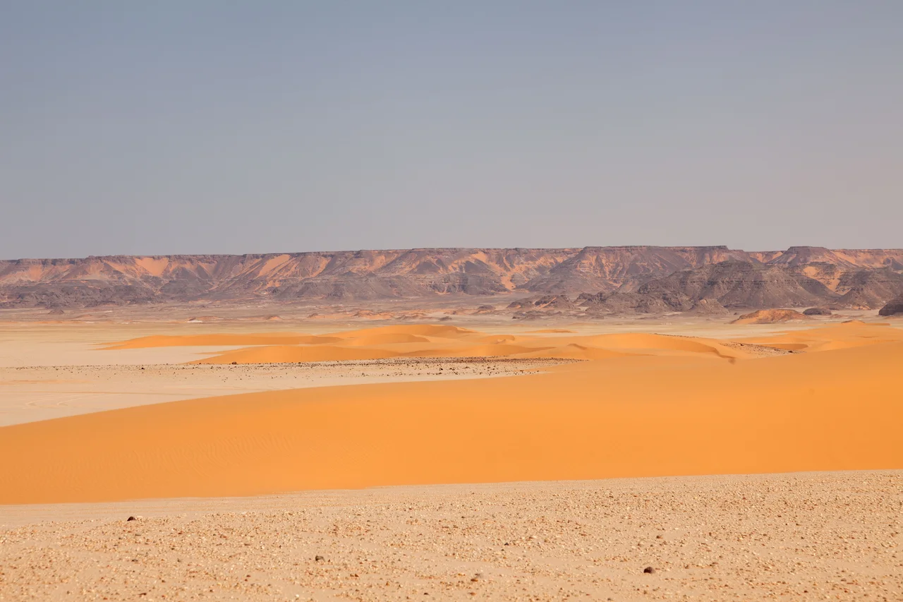

Gilf Kebir National Park
Getting here is the whole story. There is no road to the Gilf Kebir, no village, no signpost, no place to refill a canteen. Reaching it means a desert expedition of two to three weeks, a convoy of four-wheel-drives loaded with spare tires, fuel, water, and a satellite phone, guided by drivers who know which featureless dune to turn at. The reward is one of the largest and most remote protected areas in Egypt: a vast sandstone plateau on the triple border where Egypt, Libya, and Sudan meet, rising abruptly from the sand in the Sahara's deepest interior. Its Arabic name means simply "the Great Barrier." For most of human history almost no one ever saw it.
The Great Barrier
The plateau gives the park its name and its character. The Gilf Kebir covers roughly 7,770 square kilometers, an area about the size of Puerto Rico, and stands some 300 meters above the desert floor, a dark wall of rock cut by deep dry valleys, or wadis, that knife into its flanks. Around it the landscape is pure Sahara at its most extreme: dunes, yardangs sculpted by the wind, canyons, and the southern reaches of the Great Sand Sea. Rain is so rare it barely registers, falling for minutes at a time once every few years, yet in December and January the desert nights can drop below freezing. In spring the khamsin winds rise, hot gales that lift the sand into the air and erase the horizon, grounding flights and swallowing the plateau whole. This is a place that does not forgive a missing spare part or an empty water can.
Life at the Limit
Almost nothing should be able to live out here, and yet a surprising cast does. The park shelters the Nubian ibex, the Dorcas gazelle, the desert fox, and the elegant, pale Rüppell's fox, animals tuned to wring survival from near-total drought. Among them moves the addax, a desert antelope so rare it is critically endangered across its entire range, able to go without drinking and to find moisture in the sparse plants it grazes. These creatures are the living end of a long retreat. They are what remains of a far richer fauna that thrived when the Sahara was green, the descendants and relatives of the herds whose images the people of that wetter age painted onto the rock. To find them now you must cross hundreds of kilometers of apparent lifelessness, which is exactly where they have learned to hide.
Galleries of a Lost World
The Gilf Kebir holds some of the most extraordinary prehistoric art on Earth, and it holds it for the same reason the desert held the addax: because almost no one could reach it. In Wadi Sura, on the plateau's western edge, the Cave of Swimmers carries painted human figures drifting as if through water, found by the explorer László Almásy in 1933 and later woven into The English Patient. About ten kilometers away lies a still greater find, made only in 2002: the Cave of Beasts, also called Wadi Sura II, a single rock shelter crowded with around five thousand figures, more than seven thousand years old, swimmers and hunters and strange headless creatures painted across the stone. Both were made when this was not a wasteland at all but a watered land where people lived, an entire vanished world preserved on rock walls that the emptiness around them kept safe.
Footprints in the Sand Sea
The plateau's remoteness has drawn a particular kind of visitor across the centuries, and a few left marks of their own. During the Second World War the long-range desert patrols that ranged across this frontier scratched an improvised airstrip out of the sand at a spot in the southeast called Eight Bells, marking it with huge navigation arrows laid out in petrol cans, some of which still lie there today. They are a reminder that even the emptiest place on the map has a history, layered like the rock. To visit the Gilf Kebir is to travel through all of it at once: the green Sahara of the cave painters, the wartime tracks of men who crossed the dunes by compass, and the modern expeditions that still measure the journey in weeks. Bring everything you need, the guides say, especially water. The desert provides nothing, and forgets no one who underestimates it.
From the Air
Gilf Kebir National Park centers on the plateau at roughly 23.75°N, 25.83°E, in the far southwest of Egypt where the Libyan and Sudanese borders converge. This is among the most isolated airspace anywhere on the continent: no towns, no roads, no lights, and almost no traffic. The defining landmark is the plateau itself, a dark sandstone mass roughly 7,770 square kilometers in extent rising about 300 meters above pale surrounding dunes, with deep wadis, the Cave of Swimmers and Cave of Beasts among them, cutting into its western flank at Wadi Sura. Best appreciated from medium altitude (8,000 to 13,000 feet AGL) in low morning or evening sun, when the wadis and the bordering Great Sand Sea throw long shadows. There are no nearby airports; the closest fields are Kufra (HLKF) across the border in Libya and, far to the northeast, Kharga (HEKG) and the Nile Valley airports at Asyut (HEAX) and beyond. Visibility is normally exceptional, but the khamsin sandstorms can reduce it to near zero within minutes. Self-sufficiency is absolute out here; there is no help on the ground for hundreds of kilometers.
Nearby Stories
- Cave of Swimmers 26 km away
- Lady Be Good (aircraft) 320 km away
- Dakhla Oasis 325 km away
- Selima Oasis 389 km away
- Nubian Sandstone Aquifer System 397 km away
- White Desert National Park 426 km away
- Lake Ptolemy 451 km away
- Great Man-Made River 454 km away