.jpg)
Dakhla Oasis
Two hundred and twenty miles of empty sand separate Dakhla from the Nile. Drive west from the river and the green simply stops, replaced by gravel plains and the pale wall of the Libyan escarpment, until - after hours of nothing - palm fronds appear on the horizon. Springs that have welled up here for thousands of years feed a ribbon of cultivation roughly eighty kilometres long, a string of villages and orchards the locals call "the inner oasis." People have been living off this water since before the pyramids, and almost every century since has left something behind in the mud and stone.
Older Than the Pyramids
Long before pharaohs ruled from Memphis, hunters tracked game across a Dakhla that was wetter and greener, leaving rock carvings scattered across the surrounding hills - more than 1,300 panels have now been mapped, showing animals, hunters, and pregnant women scratched into the stone. By the Sixth Dynasty, around 2300 BC, the oasis mattered enough to Egypt that the crown installed governors here. Their town survives at Balat, on the eastern edge of the oasis, where the mudbrick mastaba tombs of these desert administrators still rise against the sky. One belonged to Medunefer, an official who served under the long-reigning Pepi II; excavators found gold jewelry among the funerary goods. This was a frontier posting at the very limit of the kingdom, and the men buried here governed a green island in an ocean of sand.
When Rome Came to the Sand
Ten kilometres west of the medieval town stands Deir el-Hagar, the "Monastery of Stone" - though it was never a monastery at all. It is a sandstone temple raised under the emperor Nero and decorated under Vespasian, Titus, and Domitian, dedicated to the Theban gods Amun-Ra, Mut, and Khonsu, alongside Seth, the storm god the oasis claimed as its own. Roman emperors appear on its walls dressed as pharaohs, making offerings in the old Egyptian style. North of the modern town of Mut lies another Roman-era surprise: the painted tombs of al-Muzawaka, cut into a low hill. Two of them, belonging to men named Petosiris and Petubastis, blaze with color - funeral processions, zodiac ceilings, and offerings to the dead, rendered in a style that blends Egyptian convention with Greco-Roman flourish.
The Fortress of Mud
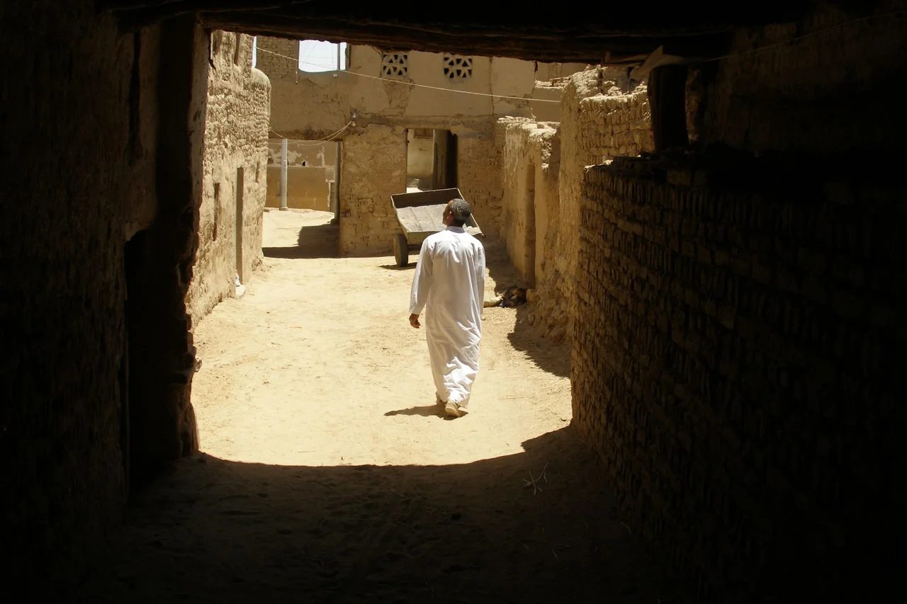
The town of Al-Qasr - the name simply means "the fortress" - climbs in tiers of mudbrick at the northwestern edge of the oasis, raised in the 12th century on the footprint of an older Roman fort. Its lanes are deliberately narrow and often roofed over, a design that traps shade and turns the fiercest afternoon into something bearable. Builders here were thrifty: many doorways are framed with carved stone blocks scavenged from a far older temple of Thoth at nearby Amheida, so a passerby may find ancient hieroglyphs holding up a medieval house. At the heart of the warren rises the minaret of the Nasr al-Din mosque, a slender mudbrick tower some 21 metres tall. For centuries this was a stopping point on the caravan routes that crossed the desert, and the town still feels built for a slower age.
A Living Laboratory
Because Dakhla preserves so complete a record - prehistoric lakebeds, pharaonic shrines, Roman towns, Christian remains, Islamic villages, all stacked in one watered basin - it has drawn archaeologists for decades. The Dakhleh Oasis Project, launched in 1978 by Canadian and Australian institutions, set out to study something larger than any single ruin: how human life and a changing climate have shaped each other here across tens of thousands of years. Their digs at Kellis, at Mut el-Kharab (where a temple to Seth, Lord of the Oasis, once stood), and elsewhere have turned Dakhla into one of the most thoroughly studied desert landscapes on Earth. The springs that made all of this possible still run, and farmers still work the same green fields their distant predecessors did.
From the Air
Dakhla Oasis lies at roughly 25.52°N, 29.17°E in Egypt's New Valley Governorate, about 350 km (220 mi) west of the Nile. From altitude it reads unmistakably: an elongated green smudge of irrigated fields and palm groves perhaps 80 km long, hemmed on the north by the pale limestone scarp of the Libyan Plateau and surrounded on all sides by tan desert. The town of Mut sits near the center. Dakhla has its own airstrip, Dakhla Oasis Airport (ICAO HEDK); the nearest larger field is El Kharga (HEKG), about 160 km east at the neighboring Kharga Oasis. Skies here are almost always clear with exceptional visibility, though the Saharan haze of a khamsin sandstorm can blot out the ground entirely in spring.
Nearby Stories
- Italian Invasion of Egypt 50 km away
- Kharga Oasis 103 km away
- White Desert National Park 162 km away
- Red Monastery 235 km away
- White Monastery 275 km away
- Gilf Kebir National Park 319 km away
- Esna 357 km away
- Senussi Campaign 392 km away