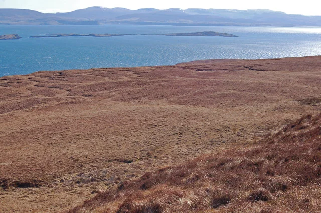

Waternish
To reach Waternish you cross the Fairy Bridge. The bridge itself is small and ordinary - just a hump where the A850 vaults a burn near the junction with the peninsula road - but local custom held that the fairies waited there, and travellers tied ribbons to the surrounding hawthorns for safe passage. Beyond it, the road narrows and climbs, and you enter a place where Clan MacNicol once buried twenty-eight chiefs in a single chapel and where, in 1578, MacDonalds locked their cousins inside a church and burned it down.
The Older Clan
Before the MacLeods, Waternish belonged to the MacNicols - Clan MacNeacail in Gaelic, sometimes anglicised as Nicolson. Tradition has it that the MacNicols held the Isle of Lewis from the Kings of Mann, until around the time of Bannockburn in the early 14th century, when their last chief died leaving only a daughter. She married Torquil MacLeod, a younger son of MacLeod of Lewis, who promptly absorbed the MacNicol lands by Crown charter. The clan retreated to Skye, settling at Scoirebreac near Portree. At St Columba's Isle, on a river islet at the head of Loch Snizort, an old chapel called Nicolson's Aisle still holds the effigy of a warrior in quilted coat and conical helmet - one of twenty-eight MacNicol chiefs said to lie there in ancient ground that served as the cathedral seat of the Bishops of the Isles from 1079 to 1498.
Trumpan
In May 1578, a party of MacDonalds from Uist landed at Ardmore Bay and discovered the Waternish MacLeods at Sunday service inside Trumpan Church. They barred the doors and set the thatch alight. One woman is said to have escaped through a narrow window, raising the alarm. The MacLeods of Dunvegan came down in force, and what followed - the Battle of the Spoiling Dyke - left almost all the raiders dead before they could refloat their galleys, the tide having abandoned them on the strand. The churchyard at Trumpan still stands above the cliff. It is also the burial ground of Rachel Chiesley, Lady Grange, who was kidnapped in 1732 by her husband to silence her - confined first on the Monach Isles, then St Kilda, then Skye, where she died in 1745 having never been freed.
Stein and the Oldest Inn
On a sheltered curve of Loch Bay, the village of Stein sits in a single line of low whitewashed cottages, planned in 1787 by the British Fisheries Society and never quite finished. At one end of the row stands the Stein Inn, opened around 1790 - the oldest pub on Skye. Its slate floor is original, its peat fire often burning, its single-malt list improbably long for a place this remote. Outside, the loch flattens at low tide into shining mud and the Ascrib Islands sit offshore. Otters work the kelp at the water's edge. In the evening, light running off the water turns the white walls of Stein the colour of bone, then ash, then nothing as the dusk thickens.
Crofts and Comeback
By the late 19th century Waternish had been hollowed out by the Highland Clearances. The local school at Knockbreck nearly closed in 2015, with only four pupils left. But the peninsula has been quietly repopulating - artists, potters, woodworkers, weavers, and a new generation of crofters who keep small flocks on land their grandparents abandoned. The highest point is Ben Geary at 284 metres; the most northerly is Waternish Point, where a Stevenson lighthouse blinks at the empty water between Skye and the Outer Hebrides. From Hallin or Gillen the views run uninterrupted across the Minch to Harris, the kind of horizon that swallows weather and gives nothing back.
From the Air
Waternish peninsula extends north-northwest from central Skye at approximately 57.54 N, 6.58 W. Best viewing altitude 1,500-3,000 ft AGL. The peninsula is roughly 12 km long and bounded by Loch Dunvegan to the west and Loch Snizort to the east. Ben Geary (284 m) sits roughly central; Waternish Point with its lighthouse marks the northern tip. Nearest airports are Inverness (EGPE, ~90 nm east) and Stornoway (EGPO, ~45 nm northwest across the Minch). Strong westerlies common; rotor turbulence possible in the lee of Trotternish to the east.
Nearby Stories
- Talisker 4 km away
- Corriechatachan 8.4 km away
- Eilean Glas Lighthouse 8.6 km away
- Lochmaddy 8.8 km away
- Rua Reidh Lighthouse 10 km away
- BUTEC 12 km away
- South Uist 18 km away
- Flannan Isles Lighthouse 60 km away