
Weeting Castle
Hugh de Plais had something to prove. He had married well — Philippa Montfichet brought him the Weeting estate — and now he needed to demonstrate that he belonged among the Norfolk gentry. Around 1180, he built a stone manor house 750 meters north of the village of Weeting, with a three-storey tower, a substantial hall, and a separate kitchen placed across a courtyard to reduce fire risk to the main building. He built it to resemble, as closely as he could manage, the hall at the center of Castle Acre Castle, then being redeveloped by his feudal lord Hamelin de Warenne. The stone walls and the tower borrowed the architectural language of castle keeps without being a castle. It was the medieval equivalent of building a house that looks like your boss's house, but slightly smaller.
The House That Wanted to Be a Castle
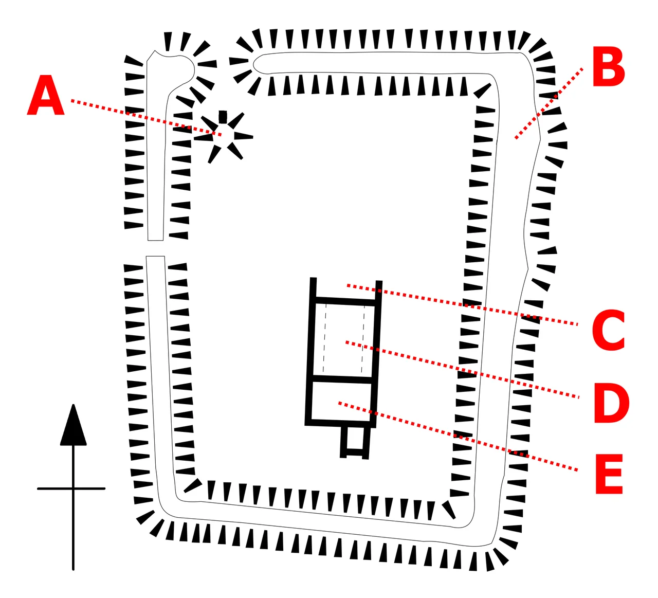
Weeting Castle was a high-status domestic dwelling, not a fortification. The chamber block — the tower — stood three storeys tall, with thick walls of flint rubble and ashlar. The ground floor formed an undercroft, supporting a solar above: private chambers for the household's senior members. The two-storey hall measured 14.7 meters internally, with wooden arcades running down each side creating aisles where benches would have stood. At the northern end, a raised dais framed by blind stone arcading held the great table, the place of formal dining and display. Service rooms containing a pantry and a buttery connected to the north. The architectural vocabulary was borrowed from castles — thick walls, tower, arcading — but Hugh de Plais was not building for war. He was building to be seen.
The Moat Arrives
A century after Hugh built his manor house, someone decided it needed a moat. In the mid-13th century, a channel ten meters wide was dug around the site, creating an island approximately 85 meters across internally, accessed by a bridge from the west. The male line of the Plais family died out in the late 14th century, and the estate passed through marriage to Sir John Howard, the Earl of Norfolk. Without the family that had built it, the manor house served no particular purpose. It fell into ruin — slowly, quietly, as abandoned buildings do in wet Norfolk winters. By the time it became something people noticed again, it was already a picturesque wreck.
Ornament and Acquisition
In 1770, the ruins became fashionable. Charles Henry Coote, the Earl of Mountrath, rebuilt the nearby Weeting Hall and incorporated the castle ruins as an ornamental feature in his grounds — a romantic fragment of the medieval past arranged to be admired from the gardens. The 18th century had a taste for exactly this: controlled decay, framed and preserved for aesthetic effect. The ruins served this purpose for more than a century and a half until, in 1926, the Ministry of Labour purchased Weeting Hall for use as a residential work camp. The castle came with the estate. Trainees were put to work clearing the undergrowth that had grown up around the ruins. Weeting Hall was demolished in 1954; its ice house, built to store ice harvested from the moat, survives on the island as a brick and earthen mound about 16 meters across.
What Remains
Archaeological excavations between 1964 and 1966 consolidated the remaining stonework. The moat still partially floods in winter, giving the site the appearance of a genuine island in the wet season. Visitors now cross by an earth causeway in the northwest corner, possibly created when Weeting Hall was built in the 18th century. English Heritage manages the site and keeps it open to visitors. The flint-rubble walls of the hall, the tower, and the service block still stand to varying heights, clear enough to read the plan of a medieval household. The dais at the northern end of the hall once held the table where Hugh de Plais demonstrated his status. The arcading that framed it is still partially visible. The building succeeded in its original purpose, even if the family that built it is long gone.
From the Air
Weeting Castle is located at approximately 52.47°N, 0.62°E, approximately 750 meters north of the village of Weeting in Norfolk, England. The moated island is distinguishable from low-level passes in clear weather. Brandon, the nearest town, lies approximately 2 miles to the east. Nearest airports: Cambridge (CBG) approximately 30 miles south, Norwich (NWI) approximately 40 miles northeast.
Nearby Stories
- Bourn Windmill 5.6 km away
- Needham Market 6.1 km away
- Castle Rising Castle 7.6 km away
- Norfolk Tank Museum 10 km away
- Spalding War Memorial 11 km away
- Clare, Suffolk 14 km away
- RAF Wyton 15 km away
- RAF Matlaske 17 km away