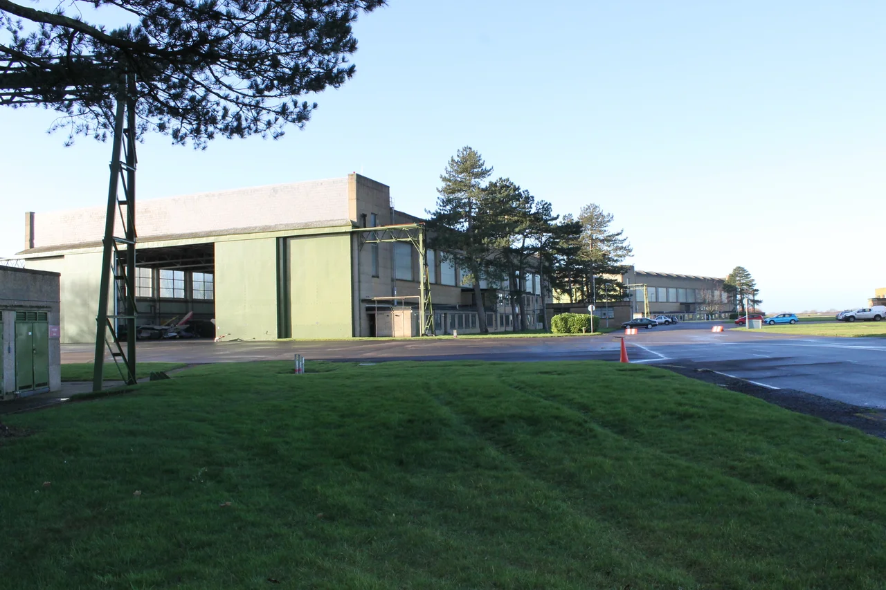

RAF Wyton
Within ninety minutes of Britain declaring war on Germany in September 1939, RAF Wyton had launched its first sortie. The aircraft that lifted off that morning from this flat Huntingdonshire field were Bristol Blenheims of No 139 Squadron, headed for a reconnaissance run over the German fleet at Wilhelmshaven. They returned with the first aerial photographs of enemy territory taken by the Royal Air Force in the Second World War. Wyton has been quietly doing the kind of work that does not make headlines for more than a century now. The runway opened in 1916 for the Royal Flying Corps. The runway closed for fast jets in the mid-1990s. The intelligence work continues, and has only grown more central to British defence.
Pathfinders in the Dark
In August 1942 RAF Bomber Command established a new and controversial formation at Wyton: No 8 (Pathfinder) Group, under Group Captain Donald Bennett. The Pathfinders flew ahead of the main bomber stream, marking targets with coloured flares so that the heavier waves of Lancasters and Halifaxes following behind could put their bombs on something more precise than a city. They were elite by selection and by attrition - the casualty rates were brutal, the work exhausting, the night sky over Germany filled with searchlights and flak. Bennett insisted on volunteers and on rigorous training. By the time the war ended, the Pathfinder Force had transformed RAF Bomber Command's accuracy and its self-image. Wyton was their birthplace and headquarters. Aircraft from this field flew on the final Bomber Command raid against Germany in 1945.
The Canberra Years
After the war Wyton found a new role. From 1953 the station hosted English Electric Canberras configured for photo-reconnaissance - the PR.3 and PR.7 variants, capable of high-altitude imagery missions that mattered enormously during the Cold War. For four decades the station was associated with strategic reconnaissance: Canberras, Victor V-bombers, later tanker aircraft, and a long parade of specialist units. In a four-month stretch in 1989, two squadrons of United States Air Force A-10 Thunderbolt II tank-busters operated out of Wyton while their home runway at nearby RAF Alconbury was resurfaced. In the early 1990s one of the resident pilots was the England rugby winger Rory Underwood, then a Flight Lieutenant. The Canberra finally retired from Wyton in 1995. Both Wyton and Alconbury were officially decommissioned as flying stations the same year.
The Jewel in the Crown
The Telegraph called it the jewel in the crown of British defence intelligence. The Joint Forces Intelligence Group moved here from Feltham in 2013, bringing with it the collection of signals, geospatial, imagery and measurement-and-signature intelligence under one roof. The £180 million PRIDE programme - Programme to Rationalise and Integrate the Defence Estate - built a complex called the Pathfinder Building, completed in 2012, naming it for the squadrons that had once flown from this same earth. In 2016 the National Centre for Geospatial Intelligence stood up at Wyton, absorbing the work of multiple former units. Recent years have seen Wyton's analysts tracking HMS Diamond's encounters with Houthi missiles in the Red Sea, examining captured Russian Orlan-10 drones and Iranian Shahed-131 UAVs, monitoring the development of Chinese DF-17 hypersonic missiles, and watching North Korean munitions move into Russian forces in Ukraine. The Salisbury Novichok investigation passed through here too - the trail of a Russian nerve agent traced by people sitting at desks in Cambridgeshire.
What Remains of the Runway
Light aircraft still flew from Wyton until 2015, when the Cambridge and London University Air Squadrons moved their training operations to RAF Wittering. The decision in 2013 to relocate all flying units was driven by the cost of maintaining a runway no one really needed - the analysts in the Pathfinder Building do not require flight lines. The Royal Engineers' 42 Engineer Regiment, the geographic specialists, arrived in 2014. No. 1 Intelligence Surveillance Reconnaissance Squadron came over from RAF Marham in 2017. Today RAF Wyton is more office park than airbase, more screens than control towers - but the work is still pathfinding, in its way. The squadrons that once flew ahead of the bombers to mark targets in the dark are now teams in secure rooms looking at satellite imagery of conflicts they hope will never reach this Cambridgeshire field. The town of Huntingdon gave the station the Freedom of the Town on 17 September 1955. Seventy years on, that bond is still strong.
From the Air
RAF Wyton (ICAO: EGUY) sits at 52.3572N, 0.107778W, about three miles north-east of Huntingdon. The runway is no longer in use for fast jets but the station remains active military property with restricted airspace - check current NOTAMs before approach. The site is identifiable from the air by its disused but intact runway crossing east-north-east, the cluster of modern intelligence buildings on the south side, and the open Cambridgeshire farmland around it. The A141 passes immediately south. Nearest active fields: Conington (EGSF) about five miles north, Cambridge Airport (EGSC) about 16 miles south-east, RAF Wittering (EGXT) some 20 miles north-west.
Nearby Stories
- Red Bull Racing 1.3 km away
- Flag Fen 2 km away
- Denver Windmill 3.1 km away
- Uppingham School 3.6 km away
- Sywell Aviation Museum 5.8 km away
- Newmarket, Suffolk 6.8 km away
- Letchworth 6.9 km away
- Castle Hedingham 18 km away