
Flag Fen
Sixty thousand oak posts, driven into wet ground. They march in five long rows across what was once a freshwater basin east of Peterborough, a wooden causeway over a kilometre long, built and added to by people who left no writing and no names. They started construction around 1365 BC and stopped sometime after 967 BC: nearly four centuries of work, generation after generation extending the same line of timber across the same fen. Halfway along they made an artificial island. Into the water beside it they threw swords, spearheads, tiny gold earrings, brooches, and small polished white stones not local to the area, carried in from somewhere far enough that the journey itself was part of the offering. The Bronze Age ended. The Iron Age came. The peat closed over the timber, and by the early Roman period most of Flag Fen lay invisible beneath the ground.
Reading the Tree Rings
Francis Pryor saw a piece of waterlogged wood in 1982 in a drainage ditch east of Fengate, a place archaeologists had been excavating for years. The wood looked worked. Once they started looking, they kept finding more of it, in five long alignments running south-east to north-west across what the team came to call the Flag Fen Basin. Dendrochronological analysis - dating posts by counting and matching their annual growth rings - eventually gave construction dates between 1365 and 967 BC. The site is not one project but many. Different sections were cut and driven in over four centuries, by different generations of the same communities. The men who started Flag Fen would have been long dead before the men who finished it were born.
What They Threw Into the Water
Bronze Age people deposited objects into wet places across northern Europe, but Flag Fen is one of the largest concentrations ever found. Beside the small island in the middle of the causeway, archaeologists have recovered swords, spearheads, daggers, gold earrings, pins, brooches, polished white stones not native to the local geology, and the bones of animals that had been deliberately killed and placed. Many of the swords had been bent or broken before being thrown in, ritually killed in the way Bronze Age weapons often were when they were given to the gods. The deposition continued for around 700 years across the wider basin, far longer than the causeway itself was being built. Whatever the religious meaning was, it outlasted the engineering project. Or perhaps the engineering was the religious meaning.
The Other Settlement Nearby
Two kilometres south of Flag Fen lies Must Farm, a Bronze Age settlement of round houses on stilts that burned and collapsed into the river around 1000 BC. The fire preserved an astonishing amount of ordinary life: textiles, wooden bowls, fish in pottery jars, querns mid-grinding, log boats. The popular press called it Britain's Pompeii, and the comparison is not silly. Several of the Must Farm log boats are now preserved and displayed at Flag Fen, partly because the two sites belonged to the same world and partly because preserving waterlogged Bronze Age timber is a specialist business. The wider Flag Fen landscape is itself part of the Greater Fens Museum Partnership, a network of archaeological sites and museums in and around the East Anglian fens.
Building It Back
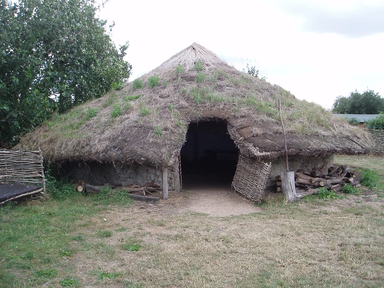
Flag Fen runs a visitor centre with reconstructed roundhouses, both Bronze and Iron Age. You can walk inside the smoky dark of a thatched conical building and understand, suddenly, why hearths sat in the centre. Wooden posts mark the surface line of the original causeway across the field. In the Preservation Hall, a section of the actual Bronze Age timber lies in shallow water, exactly as it was found, slowly being conserved by polyethylene glycol replacing the water in the wood cell by cell. In 2012 the company DigVentures ran what was billed as the world's first crowdfunded excavation here, raising thirty thousand pounds and bringing in 250 volunteers from eleven countries to dig for three weeks. Francis Pryor, by then long retired from active fieldwork but still associated with the site, wrote afterwards that it worked: the archaeology was professionally excavated, to a very high standard, and the visitors had a good time.
The Slow Disappearance of Wet Ground
Flag Fen survives because the peat survived. When the fens were drained from the seventeenth century onwards, vast wetlands shrank back to ribbons and ditches, and the organic remains that the wet ground had preserved began to dry out and decay. Modern conservation pumps water back into select areas to keep the timbers alive. Without that intervention, the causeway would simply rot. Around the site now is a mosaic of grassland, hedgerow, woodland, and an actual freshwater mere maintained for wildlife. A 2014 BioBlitz recorded 190 species on the site in a single day, including the endangered European water vole, the barn owl, and 53 species of lichen. Bronze Age people would have known the grey wolf, the brown bear, and the Eurasian beaver here. Two of those three are extinct in Britain; the third is being reintroduced. The wet ground keeps doing its quiet work of preservation, and Flag Fen, three and a half millennia old, keeps emerging from it piece by piece.
From the Air
Located at 52.57 degrees north, 0.19 degrees west, about 3 nautical miles east of Peterborough city centre, between the city and the village of Whittlesey. The site is a small museum and reserve, recognisable from low altitude by the cluster of reconstructed roundhouses and the rectilinear ditched enclosure. Surrounding country is flat drained fenland, with the River Nene to the south and the Mustdyke drainage channel cutting across the site. Best viewed from 1,000 to 2,500 feet in clear weather. Nearest airfield is RAF Wittering (EGXT) 11 nautical miles west-northwest; Cambridge City Airport (EGSC) lies 32 nautical miles south. Conington former airfield is 8 nautical miles southwest.
Nearby Stories
- Oakham Castle and Its Forfeited Horseshoes 3.2 km away
- Huntingdon 5.2 km away
- RAF Downham Market 5.6 km away
- Hunstanton 8.9 km away
- RAF Mildenhall 9 km away
- Sywell Aerodrome 10 km away
- Heckington Windmill 11 km away
- Bingham, Nottinghamshire 17 km away