
West Cork
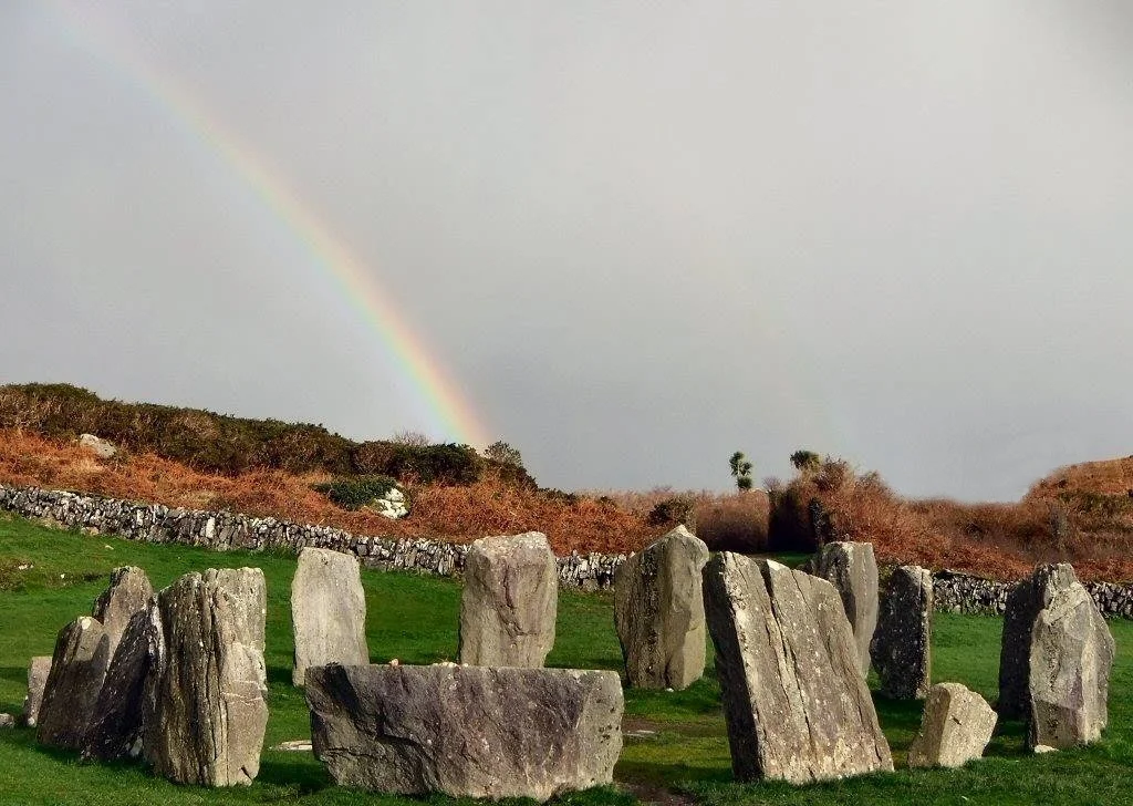
The road signs simply say 'The West.' No further direction is required, because anyone driving this far already knows where they are going. West of Cork city, past the River Lee, the country narrows into peninsulas and the Atlantic takes over. Three long fingers of land - Beara, Sheep's Head, and Mizen Head - reach out into open ocean, and on a clear evening you can stand on Mizen and see nothing between you and Newfoundland but water. Stone circles older than the pyramids sit in cattle fields. Pirates once docked in harbours that still launch fishing boats at dawn. West Cork is where Ireland refuses, gracefully, to end.
Bones of an Older World
The rock underfoot is between 360 and 374 million years old. When these sandstones formed during the Devonian period, Ireland sat south of the equator, attached to a larger continental landmass that had not yet broken apart. The mountains that rose then - the MacGillycuddy's Reeks just to the north, the Caha Mountains running through Beara - are the same ridges that still corral the peninsulas today. Iron Age and Bronze Age peoples found this landscape and read it carefully. They left dolmens, standing stones, wedge tombs, and stone circles scattered across the hills. The Altar Wedge Tomb near Schull dates to roughly 3000 to 2000 BC. Drombeg stone circle near Glandore was active between 1100 and 800 BC. These monuments were not curiosities then. They were the architecture of belief, aligned to the sun and to the dead.
The Hundred Isles
The historic barony of Carbery once stretched from the Bandon River to the Beara Peninsula - the largest barony in Ireland until the nineteenth century. Off its coast lies a scatter of islands the locals still call Carbery's Hundred Isles: Bere Island, Sherkin, Cape Clear, and dozens of smaller rocks that break the surface only at low tide. Some are inhabited. Most are not. Many carry the memory of older inhabitants - early Christian hermits, monks, pirates, smugglers. In the early 17th century, the townland of Leamcon near Schull was a pirate stronghold, and pirates traded openly in Baltimore and Whiddy Island, well beyond the reach of any English law. The sea was the highway then, and the islands were stops along it.
Battles and Famines
In October 1601, a Spanish expedition made landfall here, hoping to link up with Irish rebels against English rule. It ended at the Battle of Kinsale, just east of West Cork, in a defeat that one historian called 'one of the decisive battles of the world's history' - had the Irish won, England's grip on Ireland might have shattered. They did not win. Two and a half centuries later, the Great Famine struck this coast hard. Skibbereen became one of the most notorious names in the catastrophe; the workhouse there filled and overflowed, and entire villages emptied through death and emigration. The remembrance is not abstract here. Almost every parish has a famine grave, often unmarked, often on the edge of land that nobody wanted to farm afterwards.
The Wild Atlantic Way
The coast road threads through Skibbereen, Clonakilty, Bantry, Castletownbere, and on to Mizen Head, the southwesternmost point of Ireland. The Wild Atlantic Way tourist route runs the full length, looping out along peninsulas where the Atlantic crashes against cliffs that drop hundreds of feet into white water. Inchydoney, Owenahincha, and Barleycove offer broad sandy beaches between the headlands. Inland, the villages keep their colour - bright pubs, painted shopfronts, a market square that hosts cattle fairs and music sessions on the same weekend. Glengarriff sits in a sheltered bay where the gulf-warmed air supports gardens that look improbably tropical. Garnish Island, just off shore, holds Italianate gardens that flourish beside the rocky Irish coast.
Carrying the Names
The names on West Cork's road signs read like a layered text - some Norman, some Gaelic, some English, sometimes all three at once. Clonakilty derives from Cloch na gCoillte, 'the castle of the woods.' Skibbereen comes from Sciobairín, 'place of the little boats.' Glandore is Cuan Dor, 'harbour of the oak trees.' Each name carries a piece of history. The region has had a distinct identity since the ancient Dáirine kingdom of Corcu Loígde, long before any English county was drawn. In 2016, West Cork's municipal district signed a twinning agreement with Scituate, Massachusetts - where so many famine emigrants and their descendants ended up that the connection feels less like a formality than a quiet recognition of an old family bond.
From the Air
West Cork stretches across roughly 51.5 to 51.7 degrees north, with the cluster of peninsulas reaching to about 9.5 degrees west at Mizen Head. From cruising altitude the three fingers of Beara, Sheep's Head, and Mizen are unmistakable, separated by long sea inlets - Bantry Bay between Beara and Sheep's Head, Dunmanus Bay between Sheep's Head and Mizen. Cork Airport (EICK) sits just east of the region near Cork city; Kerry Airport (EIKY) lies to the northwest near Killarney. Recommended viewing altitude 4,000-7,000 feet for the full peninsular spread; lower for coastal detail. Atlantic weather changes quickly here - clear mornings can give way to sea fog by afternoon, particularly along the western headlands.
Nearby Stories
- Cloghan Castle, Lough Hyne 1.2 km away
- Headford Ambush 2.2 km away
- Caragh Lake 2.6 km away
- Bandon, County Cork 3.9 km away
- Ardgroom 4.6 km away
- Horse Racing in Ireland 13 km away
- The Sinking of the Lusitania: The Torpedo That Changed the War 20 km away
- HMHS Llandovery Castle 23 km away