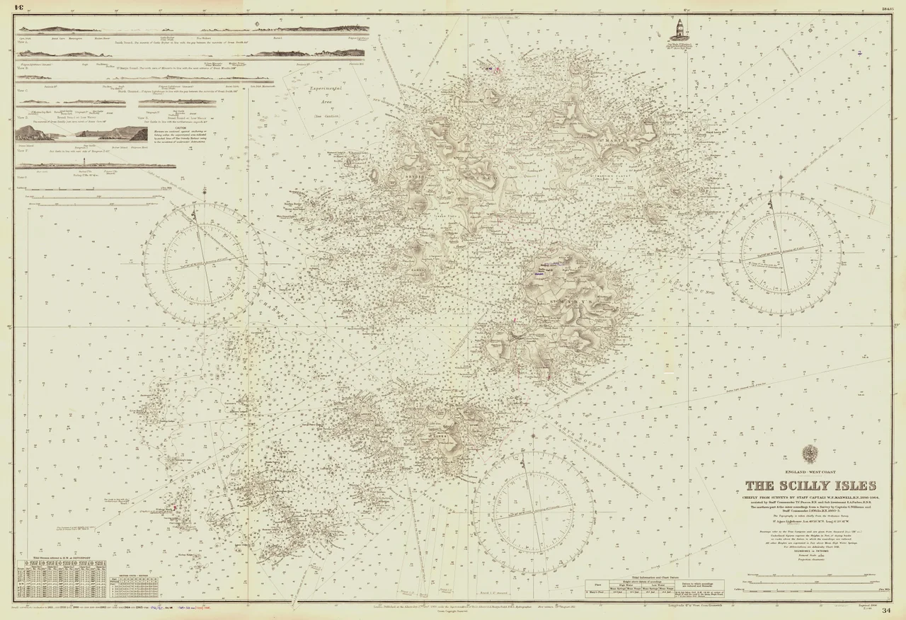

Western Rocks, Isles of Scilly
Pednathise Head is the southernmost point of the United Kingdom. There is no marker. No tea room. No road to it. It is a tooth of late Carboniferous granite poking above the Atlantic, ringed by a tumble of smaller rocks with names that sound like a sailor's curse: Gilstone, Hellweathers, Rosevear, Crebawethan, Gorregan, Melledgan, Jacky's Rock, Silver Carn. Together they make up the Western Rocks - an archipelago of uninhabited skerries that has done more damage to British shipping than any reef in the country. It is also, somehow, a wildlife reserve so rich that landing on most of the islands is forbidden, and the storm petrels that nest here are of national importance.
Granite That Refused to Match the Charts
All of the Western Rocks are made of the same stuff - Hercynian granite from the late Carboniferous, the deep stone backbone of Cornwall and Brittany surfacing for one last gesture into the Atlantic. They sit southwest of St Mary's, with Annet and St Agnes immediately to the northeast and Bishop Rock to the west. For centuries they were a navigator's nightmare. Pre-1750 charts placed the Isles of Scilly some ten miles north of where they actually lie. The sea currents in the western approaches push sailing ships further north than expected, compounding the error. Add fog, add a westerly gale, add a captain working by dead reckoning and an hourglass, and the result is that ships kept finding the rocks before the rocks found a way onto an accurate chart. The Gilstone Reef, on the western edge of the group, accounts for many of the worst losses.
Shovell, Cargill, Schiller
On the night of 22 October 1707, Admiral Sir Cloudesley Shovell led a fleet of twenty-one ships homeward from the Mediterranean. His flagship HMS Association struck the Gilstone. Three more ships went down with her. More than 1,400 men drowned in a single night - the deadliest peacetime disaster in Royal Navy history. Seventy-seven years later, in 1784, the packet ship Nancy hit the same reef. Some crew and passengers took to a small boat that was smashed onto Rosevear, killing everyone aboard. Among the dead was the English actress Ann Cargill, returning from India; her body was found clinging to a young child. She was eventually interred in the churchyard at Old Town on St Mary's. In 1841 the paddle steamer SS Thames mistook the St Agnes light for the Longships off Land's End, turned the wrong way, and broke up between Rosevear and Crebawethan. Sixty-two of sixty-four aboard drowned; the pilot gig Whale plucked three women alive from the wreckage. Her figurehead is now in the Valhalla Museum at Tresco Abbey Gardens. Then in 1875, the German liner SS Schiller struck the Retarrier Ledges on a night so black her captain knew he was near Bishop Rock but did not realise his ship was already inside the reef. Three hundred and thirty-five people died. The Western Rocks did not stop killing until lighthouse and radar together took away the worst of the guesswork.
Where the Petrels Nest
In 1971 the rocks were designated a Site of Special Scientific Interest - not for what they had taken from the sea, but for what they gave back. Eleven species of seabird breed here. European shag and European storm petrel are of national importance; the eleven Scilly colonies of storm petrel are the only breeding sites for the species in England. Melledgan once held the third largest colony in the country, with 140 occupied sites recorded during the Seabird 2000 survey; by 2006 the count had dropped to 69 and the title had passed to Rosevear, where 129 pairs were nesting. Razorbill, guillemot, kittiwake, fulmar, puffin, cormorant, and three species of gull all breed somewhere on the rocks. Grey seals haul out and pup on Daisy, Gorregan, Melledgan, and Rosevean - the rookery at Melledgan is so well used that the seals' droppings have built up the shingle plant community on the island. In August 2022, divers off Melledgan found Babakina anadoni, a rare colourful sea slug whose presence had never been recorded in British waters.
Salvage and Solitude
Some of the rocks have been inhabited, briefly. Rosevear is the largest of the Western Rocks at just over two hectares. In 1709 and 1710, salvage crews lived on its relatively flat top while they worked the wreck of HMS Association and the other ships lost in 1707. A century and a half later, in the 1840s and 1850s, workmen returned to Rosevear to build the Bishop Rock lighthouse - lodging on the bare rock, ferrying stone out across some of the most dangerous water in Britain, raising a tower on a single reef that had been killing ships for as long as ships had passed. Today landing on the islands is difficult and discouraged. The Isles of Scilly Wildlife Trust manages them principally for breeding seabirds and seals. Most of what humans see of the Western Rocks now is what divers see - cannon, ballast, anchor flukes, and the long, slowly disintegrating evidence that for centuries the wind in the western approaches knew exactly where these rocks were even when the sailors did not.
From the Air
The Western Rocks lie centred near 49.87°N, 6.40°W, in the southwest corner of the Isles of Scilly. From the air the archipelago shows as a scatter of dark granite teeth ringed by white water, with Bishop Rock lighthouse standing alone on a tall granite needle to the west and St Agnes and Annet immediately to the northeast. Pednathise Head, on the southern edge of the group, is the southernmost point of the United Kingdom. Nearest airport: St Mary's (EGHE), about 4 nm to the northeast. Land's End (EGHC) lies roughly 30 nm east on the Cornish mainland. Recommended viewing altitude 1,500-3,500 ft AGL for the contrast of granite and surf. Expect rapid weather changes and Atlantic squalls - the same conditions that wrecked so many ships still operate.
Nearby Stories
- Wolf Rock Lighthouse 17 km away
- The Brisons 18 km away
- SS Irma (1905) 22 km away
- HMS Brisk (1851) 31 km away
- Cape Cornwall Mine 57 km away
- SM U-27 73 km away
- Wolfpack Prien 162 km away
- Tower of Hercules 696 km away