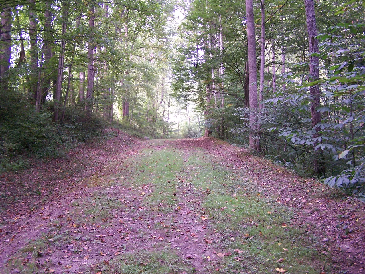

Weston and Gauley Bridge Turnpike
The road still climbs the ridges the way the surveyors laid it out in 1847. Modern engineering would have put it in the valley bottoms, taking the easier grade beside the river - and US-19, built in the 1920s and following much of the original alignment, did exactly that. But on the high ground above the Elk River near Burnsville, ten miles of the original Weston and Gauley Bridge Turnpike still trace the spine of the hills, unpaved and twenty feet wide, exactly as it ran before the highways came down off the ridges. The Army Corps of Engineers administers it now as a hiking trail. It was added to the National Register of Historic Places in 1995.
An Unusual North-South Route
Most Virginia turnpikes ran east to west, carrying traffic between the Tidewater and the trans-Appalachian frontier. The Weston and Gauley Bridge Turnpike, chartered in the 1840s and built starting in 1847, was different: it was meant to run north and south through the mountains, connecting the Northwestern Turnpike (the east-west road from Winchester to Parkersburg) to the Parkersburg-to-Staunton turnpike further south. The idea was to give farmers, millers, and salt makers in Lewis, Braxton, and Nicholas counties a reliable wagon road by which to ship their products to market. The route would also link grist mills and sawmills at Sutton and Burnsville, and the salt works and timber operations at Bulltown, to a larger commercial network. The construction was funded partly by selling stock in the turnpike company - a common nineteenth-century arrangement that often ended in trouble.
Mismanagement and a Suspension Bridge
Trouble found this turnpike. Construction was delayed by repeated instances of mismanagement and conflicts of interest among the directors of the joint-stock company. Work proceeded in fits and starts through the late 1840s and into the 1850s. The largest single engineering feature of the road - a cable suspension bridge spanning 460 feet across the Elk River at Sutton - was finished before 1857. That bridge was a substantial piece of engineering for its day and place, comparable in technology if not scale to the much larger Roebling bridges then being built over the Niagara and the Ohio. It has not survived, but the alignment it carried still climbs the ridge above Sutton in the form of the preserved trail.
A War Road
The turnpike was barely complete when the Civil War transformed it from a commercial road into a military one. In 1861, Union troops used it to move into western Virginia and seize control of the loyalist counties that would shortly become West Virginia. Two years later, on October 13, 1863, the road carried the federal supply trains and the Confederate raiders who fought the daylong skirmish at Bulltown, a few miles up the line. Whoever held the turnpike could move artillery, infantry, and dispatches between the Greenbrier and Kanawha valleys. Whoever lost it lost the ability to coordinate forces across the central West Virginia mountains. The Battle of Bulltown was, in essence, a struggle over a stretch of this road and the river crossing it served.
Bypassed and Preserved
The turnpike soldiered on after the war as a working road, but the twentieth century pushed it aside. When US Route 19 was laid out across central West Virginia in the 1920s, planners followed the easier grades in the valley bottoms wherever possible. Long sections of the old turnpike were incorporated into the new highway; longer sections were simply bypassed. Those bypassed sections, lifted out of the flow of traffic, were left alone. They never received pavement, never received guardrails, never received the widenings and re-alignments that modern road maintenance demands. By the late twentieth century, ten miles of original turnpike survived along the ridges near Burnsville in essentially their 1850s condition - twenty feet wide, unpaved, with the wheel ruts of nineteenth-century wagons still faintly visible in places. The Army Corps of Engineers acquired this stretch as part of the Burnsville Lake project and reopened it as a marked hiking trail. The 1995 National Register listing protects it as a working example of an antebellum turnpike, complete with the ridge-running alignment that modern highway engineers would never choose today.
From the Air
The preserved 10-mile trail segment runs along ridges near Burnsville at approximately 38.83 N, 80.54 W in Braxton County, central West Virginia. Best viewed at 3,000-5,000 feet AGL; look for the ridge lines paralleling US Route 19 and the Elk River valley. Burnsville Lake to the southwest provides the dominant landmark. Nearest airports: Braxton County (K48I) about 8 nm southwest at Sutton; Mid-Ohio Valley Regional (KPKB) about 50 nm northwest. The old turnpike alignment is often visible as a faint linear clearing across forested ridge tops, easier to spot in winter when leaves are down.
Nearby Stories
- Audra State Park 8.1 km away
- Robey Theatre 13 km away
- Snowshoe Mountain 17 km away
- Trans-Allegheny Lunatic Asylum 18 km away
- Tygart Valley Homesteads Historic District 22 km away
- Volcano, West Virginia 24 km away
- Nicholas County, West Virginia 25 km away
- Mount Olive Correctional Complex 29 km away