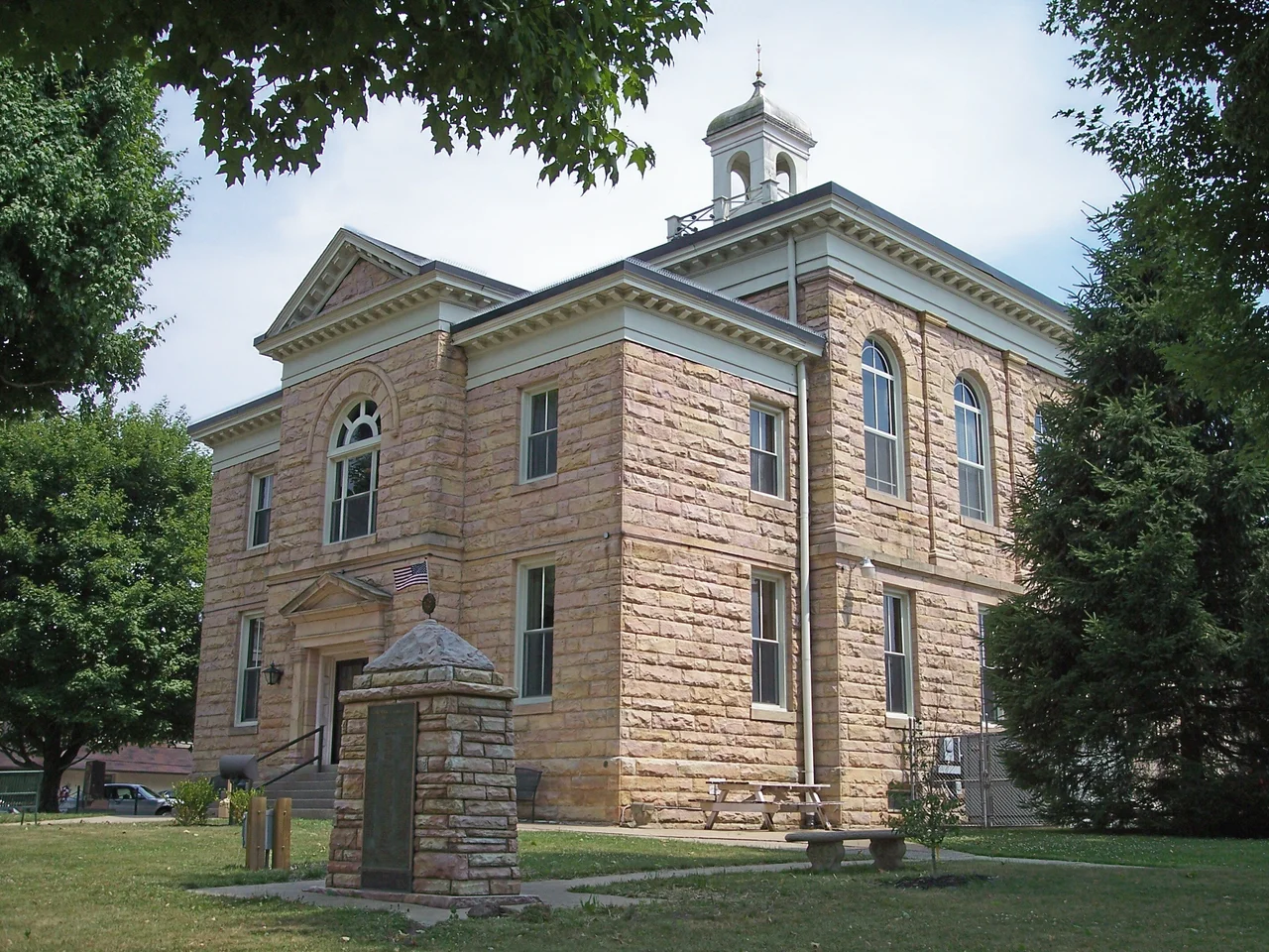

Nicholas County, West Virginia
Somewhere in the official West Virginia gazetteer of 1872, a county commissioner wrote down the name of a new civil district: Mumble-the-peg. Nicholas County, in the central highlands, was one of those rare places where the bureaucratic record actually preserved a piece of childhood. Mumble-the-peg is a knife-throwing game played by farm boys with too much time and too few rules. For a year and a half, it was also the legal designation of a magisterial district in the West Virginia hills, until somebody decided that the name was undignified and changed it to Hamilton.
How the County Got Its Name
The county was carved out of three older Virginia counties in 1818, when this part of the Allegheny Plateau was still nominally Virginia and would remain so until secession reshuffled the map in 1863. The new county took its name from Wilson Cary Nicholas, who had served as the 19th governor of Virginia and would die just two years later, in 1820. He had never set foot in the country that would carry his name. He was a tidewater planter, comfortable on the James River, and the rough country west of the Alleghenies was an abstraction to him - the kind of place where Virginia sent surveyors and forgot about them. The county that bears his name covers 654 square miles of ridges, hollows, and rivers, and as of the 2020 census, it had 24,604 residents - roughly the same population it had in 1900.
Water as Industry
The Gauley River cuts across the southern part of the county, and for six weeks each autumn when the U.S. Army Corps of Engineers draws down Summersville Lake, that river becomes one of the most challenging stretches of commercially run whitewater in North America. Class V rapids with names like Iron Ring, Insignificant, and Sweet's Falls draw paddlers from around the world for what locals call Gauley Season. The Gauley River National Recreation Area protects 25 miles of the gorge, and the economic shape of Nicholas County shifts every September when rafting outfitters fill motels that sit empty most of the year. The water is colder than it looks. The drops are bigger than they appear from shore.
Carnifex Ferry
On September 10, 1861, a Confederate force dug in along a bluff above the Gauley River near a place called Carnifex Ferry. A Union army under William Rosecrans attacked them. The fight ended in a tactical Confederate withdrawal that effectively secured western Virginia for the Union, helping clear the political path for West Virginia statehood two years later. The battlefield is now a state park, and you can still walk the earthworks the Confederates threw up in a hurry. A few miles away at Kesslers Cross Lanes, an earlier skirmish in August 1861 ended badly for federal troops - the locals called it the 'Cross Lanes Races' for the speed of the Union retreat. Both sites sit within the modern county boundaries, two small chapters of a much larger war fought in farmyards and along forest paths.
Place Names
The Nicholas County map reads like a poem written by someone who fell asleep with a Bible open on their lap. Mount Nebo, where Moses saw the Promised Land before dying within sight of it. Gilboa, where Saul fell on his sword. Mount Lookout, named for what it does. Then the secular ones: Muddlety, Hookersville, Bentree, Canvas. Zela may be the shortest place name in the state. Mumble-the-peg, the lost district, has no marker. The unincorporated places in this county tend to be a handful of houses, a church, sometimes a post office that closed decades ago. You drive through them without realizing you've arrived, and you only know you've left when the sign for the next one appears.
Summersville
The county seat is a small town built around a courthouse square, but the dominant feature of the modern landscape is Summersville Lake, finished in 1966 when the Corps of Engineers dammed the Gauley to control floods downstream. The lake drowned farms, cemeteries, and the entire town of Gad - whose residents were relocated and whose name survives only as Gad Bridge over the impoundment. Summersville Lake is now one of the largest in West Virginia, beloved by scuba divers for its visibility and by boaters for its sandstone cliffs. What the dam taketh, the dam giveth - though the ledger of that exchange depends entirely on whose great-grandparents had to leave.
From the Air
Located at 38.29 degrees N, 80.80 degrees W in central West Virginia. The county covers 654 square miles between the Allegheny Plateau and the Appalachian ridge-and-valley province. Summersville Lake is the most prominent landmark visible from the air, with its blue water and sandstone cliffs. Nearest tower-controlled airport is Yeager Airport (KCRW) about 45 nm to the west. Summersville Airport (KSXL) is a small uncontrolled field within the county. Recommended viewing altitude 4,500 to 7,500 feet MSL. Mountain wave activity common with westerly winds; expect valley fog mornings during cool season.
Nearby Stories
- Mount Olive Correctional Complex 2.4 km away
- Marlinton 5.4 km away
- Westsylvania 15 km away
- New River and Greenbrier Valleys 17 km away
- Greenbrier County, West Virginia 21 km away
- Alleghany County, Virginia 25 km away
- Cheat Mountain 27 km away
- Robey Theatre 29 km away