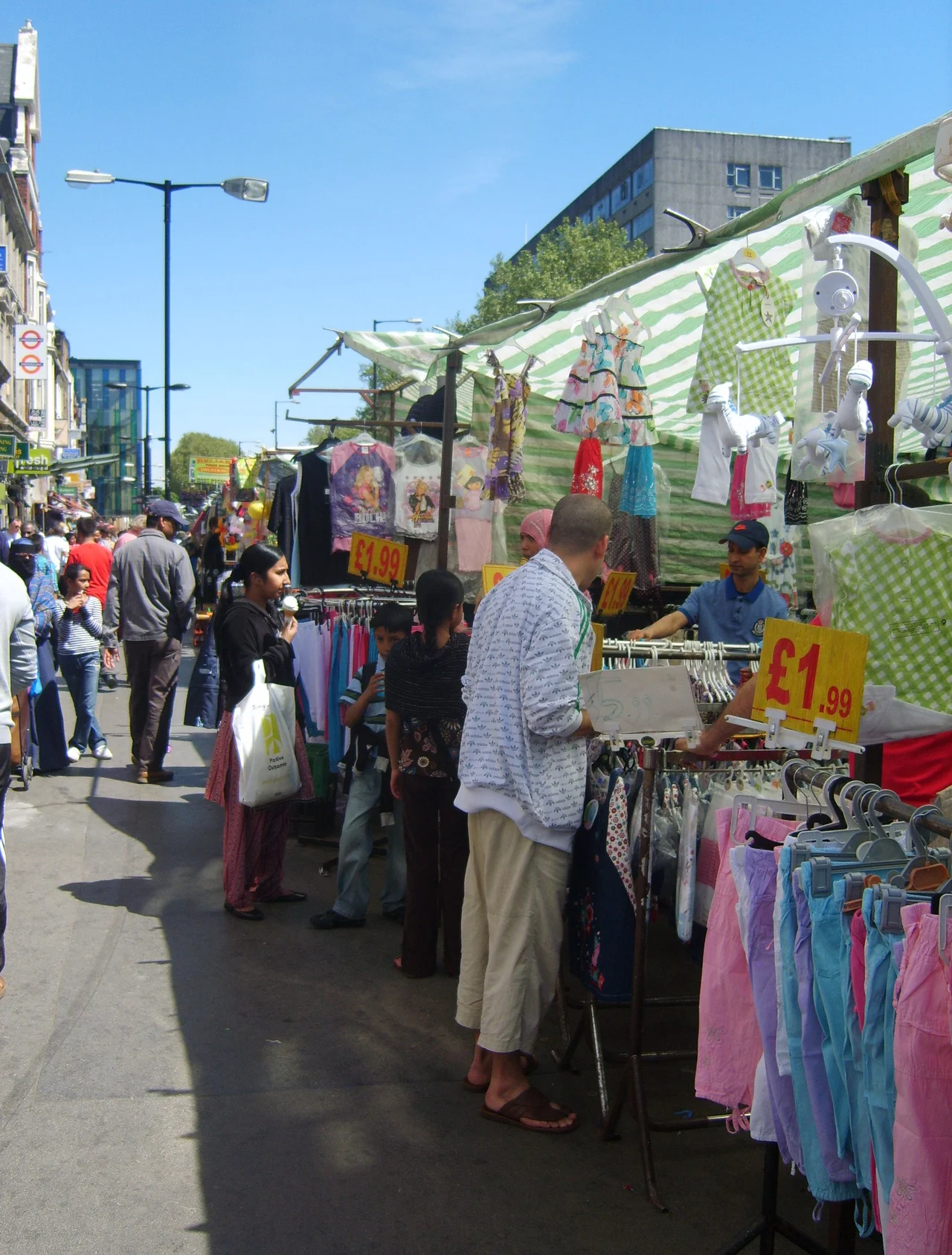

Whitechapel Road
On the British Monopoly board, Whitechapel Road sits at the cheapest corner: sixty pounds, brown, the second square past Go. Old Kent Road and Whitechapel Road have shared that anchor position since the game arrived in Britain in 1936, and successive generations of children have been taught - without anyone meaning to teach them - that the East End is where London stops being expensive. In real life, this road has been the most important Roman highway out of the city for two thousand years, the centre of a Jewish community from the 1850s to the 1930s, the heart of the British Bangladeshi community from the 1970s to today, and the home of a foundry that cast Big Ben. The Monopoly square does not begin to cover it.
From Londinium to Camulodunum
The asphalt under the buses is a Roman road. Whitechapel Road is part of the A11, and the A11 follows the line the Romans surveyed from Londinium north-east to Camulodunum - Colchester - and onward to Caistor St Edmund near Norwich. For two millennia, anyone leaving the City of London on official business eastward has rolled along this same line. The name Whitechapel comes from a fourteenth-century chapel of ease dedicated to St Mary, built to serve the parishioners of Stepney whose parish church was an inconvenient walk away. The pale stone of the chapel gave it the everyday name White Chapel, and the road that ran past it took the same name. The chapel itself, St Mary Matfelon, was destroyed in the Blitz, and the ground is now Altab Ali Park.
The Bell Foundry
At numbers 32 to 34, behind a Georgian facade dating from 1670, the Whitechapel Bell Foundry cast church bells for nearly three centuries. The buildings had originally been the Artichoke coaching inn; the foundry moved in around 1738 and stayed until 2017. From this address came the Bow Bells of Cheapside - the bells that traditionally define a true Cockney by birth - and Big Ben itself, hauled the few miles west to the Houses of Parliament in 1858. The closure of the foundry was one of those losses that mark the end of an era. Bells will still be made; just not here, where bells had been made longer than the United States has been a country.
A Jewish High Street
From the 1850s through the 1930s, this was the Jewish heart of London. Ashkenazi families fleeing pogroms in Russia and Eastern Europe settled in the streets behind the road, opening kosher butchers, tailoring shops, and Yiddish theatres. The Pavilion Theatre at numbers 191 to 193 became the centre of Yiddish theatre in Britain, accommodating over a thousand people after a 1856 rebuild, before closing in 1934 as the community dispersed to the suburbs of north London. Walk the same pavement today and the Yiddish has been replaced by Bengali. Whitechapel Market - the stalls running along the north side of the road - sells okra and mangoes, salwar kameez and pashminas, sim cards for cheap calls to Sylhet. The East London Mosque, opened in 1985, holds three thousand worshippers; the London Muslim Centre next door opened in 2003.
Altab Ali
On 4 May 1978, Altab Ali was walking home from his job as a textile worker. He was twenty-four years old, a Bangladeshi man living in an East End where racist violence had become routine. Three teenagers attacked him near St Mary's churchyard. He died from his injuries. The murder mobilised the East End's South Asian community as nothing before; seven thousand people marched behind his coffin from Whitechapel to Downing Street. The disused churchyard where he was attacked has been renamed Altab Ali Park, and it stands at the western end of Whitechapel Road as a quiet, dignified memorial. The arches and gateposts incorporate Bengali motifs. People sit on the benches and eat their lunch. The naming was not a gesture; it was a community insisting that this road would be theirs.
The Whitechapel Murders
In the autumn of 1888, five women were murdered in the streets around Whitechapel Road. Their names were Mary Ann Nichols, called Polly, a forty-three-year-old struggling to feed five children after her marriage ended; Annie Chapman, forty-seven, with a fatal lung condition; Elizabeth Stride, forty-four, originally from Sweden; Catherine Eddowes, forty-six, who had walked from Bermondsey to look for hop-picking work; and Mary Jane Kelly, twenty-five, the youngest, killed in her own room. Martha Tabram, thirty-nine, killed in George Yard Buildings just off the road on 7 August, is often counted among the victims. They were not symbols. They were poor working-class women in the East End, trying to survive a Victorian London that gave them few options, and they were murdered by a man the press chose to mythologise rather than name. The killer was never caught. The road remembers the women, and refuses the killer's invented name.
The Blind Beggar
At number 337 sits the Blind Beggar, a Victorian pub with two famous moments. In 1865, William Booth held an open-air meeting outside the door that became the founding event of the Salvation Army. A century later, on 9 March 1966, the gangster Ronnie Kray walked into the saloon bar and shot a rival named George Cornell in the head while The Walker Brothers' The Sun Ain't Gonna Shine Anymore played on the jukebox. The Krays' East End reign had become impossible to ignore after that night, and the police case that eventually convicted them began here. The pub is still open. The bullet hole has been plastered over many times. Most visitors come for the beer and the history, in roughly equal measure.
From the Air
Whitechapel Road runs east-west at 51.52°N, 0.06°W in Tower Hamlets, central London. From the air, look for the long straight artery of the A11 running between the City of London and Mile End. The Royal London Hospital's blue glass towers are the most prominent landmark on the south side. London City Airport (EGLC) is about three nautical miles east. Best viewed at low altitude on approach to London City Airport from the east.
Nearby Stories
- Stevenage 5.7 km away
- Malling Abbey 5.7 km away
- 1952 Farnborough Airshow Crash 7.7 km away
- Ingatestone Hall 8.2 km away
- Hellfire Caves 9.1 km away
- The Carrington Event: The Solar Storm That Could Happen Again 9.8 km away
- Bletchley Park 16 km away
- Castle Hedingham 23 km away