
Wollumbin National Park
For decades, this park was defined by a single act: the climb. Hundreds of thousands of people a year laced up boots in the dark to reach the summit of Wollumbin for sunrise, and the park's identity bent around that ritual. Today the park tells a different story - one about what it means to hold a place sacred. Wollumbin National Park is a modest 642 kilometres north of Sydney, near the Queensland border, but its small footprint protects something immense: the living core of an ancient volcano, a stronghold of rare creatures, and a site of deep significance to the Bundjalung people who have always cared for it.
A Refuge in the Rainforest
The park is small, but it punches far above its size. It belongs to the Scenic Rim Important Bird Area, recognised by BirdLife International for the threatened bird species that shelter here, and its dense forest hides an unlikely cast of residents - carpet pythons coiled in the canopy, the glossy black land mullet (one of Australia's largest skinks), the secretive lace monitor, and the long-nosed potoroo snuffling through the undergrowth. This abundance is a direct inheritance from the volcano. The rich basalt soils and the sheltered, humid folds of the old eruption created a sanctuary where Gondwana-era rainforest could persist, long after such forests vanished across most of the drying continent.
From Reserve to National Park
Protection came in stages. The area was first set aside for public recreation in 1928, then formally dedicated as a national park in 1966 - originally under the name Mount Warning National Park. In 1986 it was inscribed as part of the Gondwana Rainforests of Australia World Heritage Site, joining a network of reserves that together preserve the most extensive subtropical rainforest on Earth and an unbroken record of ecological history stretching back tens of millions of years. The Australian National Heritage List added the area in 2007. Each layer of protection recognised something different: first the scenery, then the science, and finally - in the renaming to Wollumbin - the culture that had defined the mountain all along.
The Decision to Close the Summit
In March 2020, the summit track closed. What began as a pandemic-era safety measure became something larger as the National Parks and Wildlife Service opened consultation with Aboriginal custodians about the mountain's future. For the Bundjalung, the summit is sacred ground, traditionally restricted under Lore to certain initiated people - and the prospect of returning the peak to that care reshaped the conversation. The closure has been extended while those discussions continue, with decisions about the summit's future to rest with the Aboriginal custodians and the parks service. The choice has not been universally welcomed; some in the local community and tourism industry have pushed to reopen the track. But at its heart, the closure asks a simple question - whether a place held sacred for thousands of years should be governed by the wishes of the people who hold it so.
Walking Lightly Here
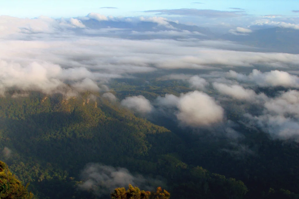
Even with the summit set aside, the park remains a place to encounter the wider landscape with respect. Lower forest tracks and lookouts open onto the great green bowl of the Tweed Valley, where the eroded ranges of the caldera rim curve away toward Queensland. Mist drifts through ancient trees; birdsong threads the canopy; the sacred peak rises at the centre of it all, cloud gathering at its crown. The park asks something unusual of its visitors - not to conquer the mountain, but to understand it. To stand in the forest the volcano made, beneath a summit that was never meant for everyone, and to recognise that some places are most powerful when they are simply left to be.
From the Air
Wollumbin National Park sits at approximately 28.39 degrees south, 153.27 degrees east, in the Tweed Valley of far northern New South Wales, wrapped around the 1,157-metre peak of Wollumbin / Mount Warning. From the air, the park reads as a dark, forested island of steep terrain surrounding the unmistakable sharp summit at the centre of a vast eroded volcanic basin. The McPherson and Tweed ranges form the caldera rim along the New South Wales-Queensland border; Murwillumbah lies to the northeast and the Pacific coast beyond. The nearest field is Gold Coast Airport (ICAO YBCG), roughly 47 km north, with Ballina Byron Gateway Airport (ICAO YBNA) to the south. Cloud commonly caps the peak, and mountain weather can build rapidly. Observe from a respectful distance: this is a sacred Bundjalung site, and the summit is closed to public access.
Nearby Stories
- Cape Byron Marine Park 5.5 km away
- Spicers Gap Road 17 km away
- The Channon 18 km away
- Glow-Worm Caves Tamborine Mountain 23 km away
- Cape Byron 27 km away
- Allan Cunningham Monument 42 km away
- Bald Rock National Park 56 km away
- HMS Porpoise (1799) 682 km away