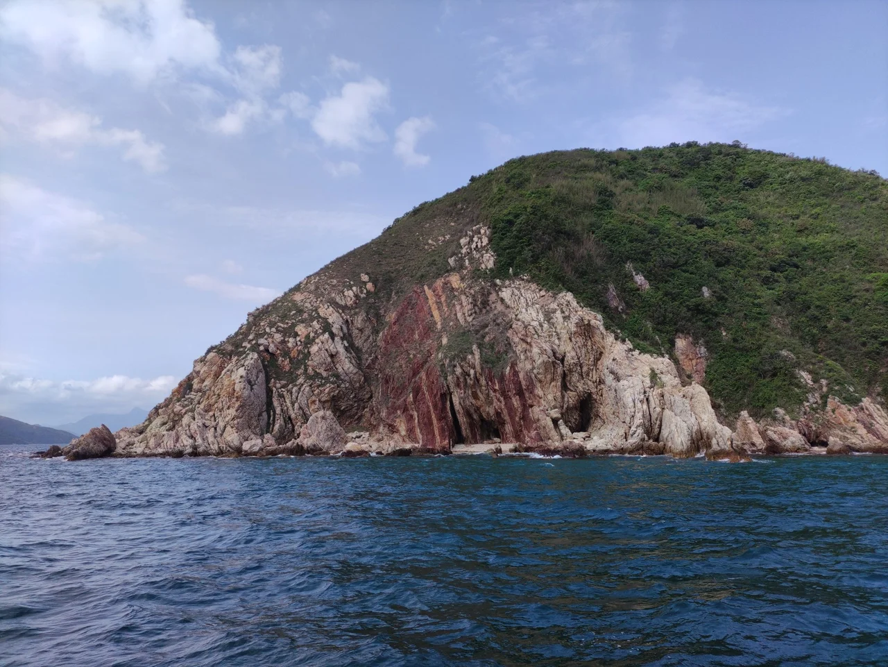

Wong Chuk Kok Tsui (Bluff Head)
The British sailors who charted this corner of the New Territories called it Bluff Head. The name was practical — the cape rises sharply from the water, a natural landmark for vessels threading the narrows between Tolo Channel and Mirs Bay — but it also carried a hint of warning. Bluff, in the nautical sense, suggests a headland that announces itself, that makes clear where the passage turns. Wong Chuk Kok Tsui is that kind of place: emphatic, unambiguous, at the edge of the accessible world.
Where Two Channels Meet
Wong Chuk Kok Tsui occupies a pivotal position on Hong Kong's northeastern coast. To its south lies the North Channel, the upper reach of the Tolo Channel that connects to Tolo Harbour and the urban waterways of the New Territories interior. To its north, Wong Chuk Kok Hoi opens out toward Mirs Bay and eventually the South China Sea. The cape itself forms the dividing point — the geographic hinge where these two very different bodies of water meet. In 1949, the colonial government drew a formal administrative boundary here, designating the line from Wong Chuk Kok Tsui to Ngo Keng Tsui as the official dividing line between Tolo Channel and Mirs Bay for the purposes of a nighttime curfew on watercraft. A legal definition fixed in law what navigators had always known: this cape marks a threshold.
The Oldest Rocks in Hong Kong
Beneath the grass and scrub of Wong Chuk Kok Tsui, the ground holds a remarkable distinction. The rocks here are among the oldest in Hong Kong — a geological title worth pausing on in a territory where almost everything is ancient by human measure but recent by geological standards. Hong Kong's landscape is dominated by rocks formed during Jurassic and Cretaceous volcanic episodes, but the basement rock at Wong Chuk Kok Tsui predates those events. The cape's inclusion in the Hong Kong National Geopark and the broader UNESCO Global Geopark network recognizes this significance. For geologists, it is a rare surface exposure of some of the deepest, oldest material in the region — rock that has been through more of the earth's history than almost anything else in the territory.
Extreme Remoteness
Wong Chuk Kok Tsui has a reputation for being difficult to reach, and the reputation is earned. It lies within Plover Cove Country Park, which itself occupies a long finger of land extending northeast from the New Territories interior, but the cape at the far end of that finger is not served by any road that a casual visitor would find. Hikers who come here tend to do so deliberately, building the cape into a longer route through the northeastern country parks. There are no facilities, no ferries, no concession stands. What there is: the wind off Mirs Bay, the sound of waves against old rock, and a view that takes in both the sheltered channel to the south and the open expanse of the bay to the north. The cape is the extremity of the northeastern New Territories in every sense — geographic, administrative, atmospheric.
At the Boundary of Everything
Standing at Wong Chuk Kok Tsui, you are at one of the least-visited points in Hong Kong, which is itself one of the most densely inhabited places on earth. That contrast is not incidental: the country parks of the northeastern New Territories exist partly because the British colonial government made deliberate decisions to preserve large tracts of land from development, creating a ring of green around the urban core. The Cape's wild character is the result of policy as much as geography. But the geology is not policy. The old rocks here predate Hong Kong, predate China, predate any human category. They will outlast the legal boundary that runs a few kilometres to the north, and the airport across the territory, and everything else that humans have arranged around them. Wong Chuk Kok Tsui has been a bluff — emphatic, unyielding — for longer than anyone can calculate.
From the Air
Wong Chuk Kok Tsui sits at approximately 22.51°N, 114.34°E at the northeastern tip of the Plover Cove Country Park peninsula, where North Channel (Tolo Channel) meets Wong Chuk Kok Hoi and the southern approaches to Mirs Bay. From 3,000–5,000 feet, the cape's promontory shape is clearly visible: a blunt headland where the narrow Tolo Channel opens into the broader bay. The long reservoir embankment of Plover Cove is visible to the west. Tung Ping Chau is visible to the northeast in clear weather. Primary airport: VHHH (Hong Kong International Airport), approximately 55 km to the southwest. The Shenzhen coast (ZGSZ) is visible across Mirs Bay to the north. The cape is a useful navigation fix for flights transiting between the Pearl River Delta and the northeastern Hong Kong coast.
Nearby Stories
- Basalt Island 7.1 km away
- Ngong Ping 360 7.5 km away
- China Southern Airlines Flight 3456 11 km away
- Huizhou (Guangdong) 27 km away
- Dongguan 27 km away
- Battle of Penghu 471 km away
- Penghu Air Raids 477 km away
- Checheng Fu'an Temple 593 km away