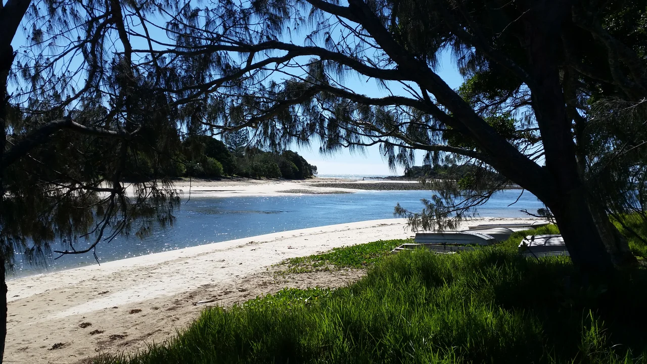

Yuraygir National Park
Stand on a headland in Yuraygir and look north, then south, and you will see the same thing both ways: beach giving way to rocky point giving way to beach, on and on, with scarcely a roof or a road in sight. This is the longest stretch of undeveloped coastline in New South Wales - 65 kilometres of cliffs, isolated beaches and quiet lakes - and walking the whole length takes four full days. The name comes from the Aboriginal people who lived here, a word once written down a dozen different ways by settlers who could not agree on the spelling: Jeigir, Yagir, Yegera, Youngai. The land kept its name. It also, against the odds and against the spread of every coastal town to its north and south, kept its wildness.
A Coast Stitched Back Together
Yuraygir's wholeness is hard-won. The park was created in 1980 by merging and enlarging two earlier reserves, Angourie and Red Rock National Parks, both declared in 1975. But at first it was a patchwork - blocks of protected land with private holdings punched through it. Over the following two decades, parcel by parcel, the missing pieces were bought up to knit the coast into one continuous whole. Some of those purchases came easily; others meant drawn-out negotiations and outright legal disputes with landholders reluctant to sell. The map you see today, a single unbroken green ribbon along the sea, is the result of that long, stubborn campaign.
Walking the Path of the Emu
The four-day Yuraygir Coastal Walk is the park's signature, and it traces the route of the coastal emu - one of the last wild emu populations on this part of the coast, its numbers now perilously low. There are 48 beaches strung along the way, among them the much-admired Shelley Beach, 800 metres of pale sand. As the largest coastal park in New South Wales, Yuraygir packs an extraordinary variety into its 65 kilometres. Behind the dunes the land shifts constantly between worlds: open heath that erupts into wildflowers each spring, dark paperbark swamps, coastal forest, and quiet lakes lying still behind the surf. You can walk for hours and meet no one, which is precisely the point - this is what the New South Wales coast looked like before the holiday towns and high-rises arrived, a window into the shoreline as it was.
The Country and Its Custodians
The walk crosses the homelands of two Aboriginal nations: the Gumbaynggirr people in the south and the Yaegl people in the north. They have cared for this coast for thousands of years, and their connection to it continues today - the park is not an empty wilderness but Country, with people whose stories, songlines and responsibilities are woven through these headlands and beaches. The same heath and wetland that draw walkers were, and remain, living larders and sacred ground. The park's very name is a reminder of that long presence: Yuraygir comes from the Aboriginal people of the area, a word colonial record-keepers wrote down in at least eight different ways before settling on one. The land was here, and named, long before the surveyors arrived.
What Still Lives Here
An intact coast shelters animals that vanish where development spreads. Thirty mammal species have been recorded in Yuraygir, including the threatened rufous bettong - a small hopping marsupial - the tiger quoll, the brush-tailed phascogale and the gliding squirrel glider. In the swamps and wet heath, two of Australia's most elusive birds make their home: the eastern ground parrot, which runs rather than flies, and the eastern grass owl. Their survival is not guaranteed. Feral pigs, cats, foxes and horses prowl the park, and aggressive weeds like bitou bush and lantana crowd the native heath - the constant, unglamorous cost of keeping a wild coast wild.
From the Air
Yuraygir National Park runs along the Mid North Coast of New South Wales, centred near 29.82 degrees south, 153.27 degrees east, between Yamba in the north and Red Rock to the south. From the air it is unmistakable: roughly 65 km of near-continuous beach, headland and coastal lake with almost no built structures, a green-and-gold band between the Pacific surf and the forested hinterland. Shelley Beach and the larger coastal lagoons are useful waypoints. The nearest fields are Grafton Airport (ICAO YGFN) inland to the west and Coffs Harbour Airport (ICAO YCFS) to the south. Best viewed at low to medium altitude in clear weather; coastal haze and afternoon cloud build are common.
Nearby Stories
- Woodford Island 3.1 km away
- Woolgoolga, New South Wales 11 km away
- Washpool National Park 30 km away
- Gibraltar Range National Park 36 km away
- Ebor Falls 45 km away
- Cape Byron Marine Park 95 km away
- Cape Byron Light 129 km away
- SS Elingamite: Gold, Fog, and a Captain Wrongly Blamed 1790 km away