
Woodford Island
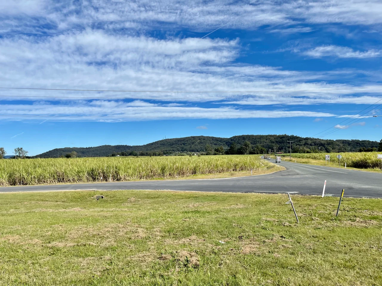
Drop a finger on the Clarence River where it leaves Grafton and runs for the sea, and somewhere around the village of Brushgrove the river does something strange: it splits in two. The South Arm and the North Arm peel apart, embrace a vast wedge of flat green country, and only rejoin themselves nearly thirty kilometres downstream at the sugar town of Maclean. What they enclose is Woodford Island. At 37 square kilometres it is the largest island in New South Wales, inland or off the coast, and one of the largest non-delta river islands in the Southern Hemisphere. Roughly three hundred people live on it, mostly out of sight of one another, among cane that grows taller than a car.
An Island You Can Drive Onto
For a place ringed entirely by water, Woodford Island is oddly easy to reach. Two bridges and a ferry stitch it to the mainland. At the southern tip, the Wingfield Bridge crosses from Brushgrove to Cowper; at the northern end, the McFarlane Bridge carries you into Maclean, its name honouring John McFarlane, a local member of the New South Wales Legislative Assembly. On the western side, an old cable ferry still hauls cars across to Woodford Dale. Tourist Drive 22 runs the length of the island between the Lawrence car ferry and the McFarlane Bridge, threading past cane paddocks, a pioneer cemetery, and the slow brown river that is the whole reason any of this exists.
Cedar, and Blood
Woodford Island was among the first places Europeans settled on the Far North Coast, and the reason was timber. The settler John Small arrived drawn by stands of Australian red cedar, the so-called red gold that pulled cutters up every navigable river in the colony. The original inhabitants were Bundjalung people, and the cedar rush brought catastrophe. In 1838, some twenty Bundjalung people were murdered here by cedar-getters in a reprisal killing, one of the many frontier massacres that scarred the Northern Rivers as the timber economy advanced. The island's Aboriginal heritage has not vanished: the village of Ilarwill on the island remains a place of real significance, a reminder that this country had owners long before it had a name on a colonial map.
When Brushgrove Was Boom Town
It is hard to picture now, but Brushgrove at the island's southern end was once a roaring river port. Sitting on the Clarence with steamers calling at its wharves, the town shipped out timber, sugar and produce, and the wealth that flowed back built schools, shops, a police station, a pub and all the apparatus of a place that expected to grow. Then the roads came, and the railways, and the river trade that had made Brushgrove suddenly made no sense at all. Over the past century the town has quietly shrunk. The last school on the island, at Woodford Dale, closed its doors in 2011. What remains is the architecture of an earlier confidence, scattered among the cane.
A Ridge Above the Floods
Run a line through the island's near-exact centre and you strike a mountain ridge, an unexpected spine of high ground in a landscape that is otherwise pure floodplain. It gives Woodford Island both the largest area and the highest point of any island in the Clarence. Everything else lies low, and everything low floods; the Clarence has drowned these flats many times over, and the threat of high water shapes how people live here. The economy reflects the geography: sugar cane in the wet paddocks, dairy cattle on the pasture, a small fishing fleet working the river, and most residents driving off-island to Maclean or Grafton for anything more than the basics. In 1999 the Woodford Island Nature Reserve was proclaimed to protect the higher, drier forest along the ridge, sheltering rare eucalypts and threatened wildlife on the one part of the island the water cannot reach.
From the Air
Woodford Island lies at roughly 29.52 degrees south, 153.13 degrees east, in the lower Clarence River delta on the New South Wales North Coast. From altitude it is unmistakable: a huge green wedge of cane and pasture cradled between the river's two arms, with the central ridge casting a clear shadow line across the flats. The towns of Maclean (north), Brushgrove and Cowper (south), and Lawrence (west across the ferry) frame it. Best viewed from 2,000 to 4,000 feet in clear weather, ideally a winter morning when the delta haze lifts. Nearest airfield is Grafton Regional (YGFN), about 25 km upriver to the southwest; Ballina Byron Gateway (YBNA) is roughly 60 km north, and Coffs Harbour (YCFS) lies down the coast to the south. The braided channels make an excellent visual checkpoint for coastal navigation.
Nearby Stories
- History of New Italy, New South Wales 19 km away
- Yuraygir National Park 20 km away
- Washpool National Park 25 km away
- Guy Fawkes River National Park 45 km away
- Cape Byron Marine Park 56 km away
- Tenterfield School of Arts 56 km away
- Cape Byron Light 90 km away
- SS Elingamite: Gold, Fog, and a Captain Wrongly Blamed 1803 km away