Zafar, Yemen
Among the stones of Zafar, archaeologists recovered a ring. It was carved with the name Yitzhaq bar Hanina, written in Aramaic, and it is the earliest known physical evidence of Jewish presence in South Arabia. The name appears in the Talmud too, attached to a rabbi who lived around the same time; the two may be related, or they may not. Either way, the ring sat in the ground at 2,800 meters elevation in the Yemeni highlands for roughly 1,700 years before someone from the University of Heidelberg's excavation team brushed the dirt off it. Zafar, the capital of the Himyarite kingdom from 110 BCE to 525 CE, was a city that Pliny the Elder described, Ptolemy mapped, and the Periplus of the Erythraean Sea named among the great trading centers of the pre-Islamic Arabian world.
The Empire Above the Clouds
At its peak, Himyar ruled most of the Arabian Peninsula, a tribal confederacy whose combined territory reached past Riyadh to the north and the Euphrates to the northeast. Zafar was its seat for roughly 635 years, a duration that would astonish any modern capital. The city sat on the Yemeni plateau at an altitude where the air is thin enough that Roman merchants described their journeys up from the coast as ascents into the sky. Archaeologist Paul Yule of the University of Heidelberg, who led excavations from 1998 to 2010, estimated Zafar's population at its fourth-century peak at around 25,000, based on a mapped surface area of 120 hectares. Only Marib, the older Sabean capital, was larger among ancient Arabian cities. The city's defenses ran roughly 4,000 meters in length, and its main fortress, Husn Raydan, is still identifiable on the ruins today.
Gods, Goddesses, and a King in a Crown
Zafar's population was mixed in ways that modern categories struggle to capture. Polytheists, Jews, and Christians lived in the same city, and the Jewish community held political power until 525 CE. An Aksumite church, likely built by the missionary Theophilos the Indian, was destroyed in 523 by Dhu Nawas, the Himyarite king who had converted to Judaism; the church was rebuilt after Aksum's successful invasion of Himyar in 524. Among the most striking finds is a 1.70-meter-tall relief of a crowned figure identified as an early Christian king, wearing an Aksumite-style crown. It is the only image of that early Himyarite Christianity known to survive. Another early sixth-century relief, possibly depicting King Sumuyafa Ashwa, shows a Byzantine-style monarch. The sculptural industry at Zafar was prolific enough that thousands of relief fragments have been recovered.
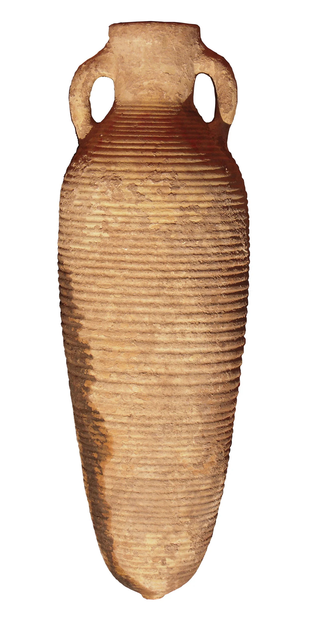
The Trade That Built It
Between the third and mid-sixth centuries, Zafar was a hub of international commerce. Archaeologists recovered roughly 500 sherds of Late Roman amphorae, many of them traced to workshops at Aqaba on the Red Sea coast of Jordan. Aqaba appears to have functioned as a repackaging point where goods from further afield were loaded and re-exported to Zafar. The amphorae carried wine, but fish sauce, livestock, textiles, and meat were also imported. Excavations in the Stone Building at Zafar yielded nineteen cultivated species, including eight cereals, four oil and fibre plants, three pulses, three fruits, and one spice; barley, Hordeum, was the most important. That building also contained most of the 6,000 animal bones recovered on the site, and it appears to have functioned as a slaughterhouse. The city ate well.
The Collapse
Around 525 CE, the Aksumite invasion ended Himyarite rule; by the middle of the sixth century, Sana'a with its fortress Ghumdan had displaced Zafar as the capital of what remained of the highland polity. The archaeological record in Zafar and across the surrounding region breaks off sharply. The reasons for the collapse are debated. Speleothem records from al-Hootha Cave in central Oman, studied by D. Fleitmann, show megadroughts around 530 CE that may have afflicted the entire peninsula. Zafar's environment also suffered from depletion: tree cover was eliminated during the empire period, upland soils were chronically eroded, and the 500 millimeters of annual rainfall was insufficient to sustain both agriculture and forest. Civil strife and the epidemics that swept the sixth-century Mediterranean world likely contributed too. Whatever the combination of causes, the city emptied out.
Four Hundred Fifty Farmers
Today, roughly 450 farmers work the land where Zafar's 25,000 once lived. The ruins of Husn Raydan, the tombs, the square stone court on its southwestern flank that appears to have been a temple, all remain visible in the landscape. In 1970, the Italian orientalist Giovanni Garbini discovered a Sabaean inscription on a column at Bayt al-Ashwal near Zafar, over which a later fourth-century CE hand had written, in Assyrian Hebrew script, 'The writing of Judah, of blessed memory, Amen shalom amen.' The inscription is a reminder of the city's cosmopolitan past. Mapping and excavation by the University of Heidelberg continued from 1998 to 2010, when the Stone Building site was roofed and conservation measures were put in place. The site museum was reinstalled in 2002. Ongoing conflict in Yemen has since made the site inaccessible to visitors; a Zafar Virtual Museum now presents some of what the team recovered.
From the Air
Coordinates: 14.21°N, 44.40°E. Approximately 130 km south-southeast of Sana'a, 10 km southeast of Yarim. Yemeni highlands plateau at around 2,800m. Sana'a International Airport (OYSN) is the nearest major field. Recommended viewing altitude: 15,000-20,000 feet MSL given terrain elevation. Active airspace restrictions apply throughout Yemen; check current NOTAMs. Morning visibility often excellent; afternoon haze common.
Nearby Stories
- Raid on Yakla 21 km away
- 2013 Radda airstrike 43 km away
- Ashrafiya Mosque 61 km away
- Yemen Eyalet 98 km away
- Al Hudaydah offensive 115 km away
- 2020 Aden Airport Attack 118 km away
- Mokha 119 km away
- Marib Dam 141 km away