Zamora-Chinchipe Province
The Spanish founded a city here on October 4, 1549, and called it Zamora de los Alcaides. Fifty years later, the Shuar drove them out. The Spanish came back. The Shuar drove them out again. The pattern repeated for nearly four centuries, until 1921, before any colonial settlement finally stuck. Zamora-Chinchipe is the southeastern corner of Ecuador where the Andes plunge into the Amazon basin, and where the rivers carrying gold down from the mountains have shaped almost every chapter of human history in the province.
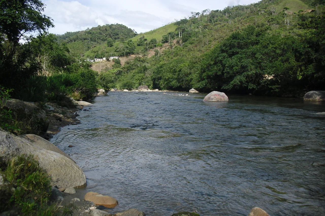
Mountains in the Amazon
Most of Ecuador's Amazonian provinces are flat lowland forest. Zamora-Chinchipe is not. It covers about 10,559 square kilometers of folded mountain country where the eastern slope of the Andes refuses to settle into jungle. Ridges, gorges, and waterfalls define the landscape, and waterfalls in particular have become one of the province's signatures. The terrain, the rivers, and the dense biodiversity it shelters all stand in sharp contrast to the surrounding Amazon Basin provinces. The province takes its name from the merger of two cantons, Zamora and Chinchipe, formalized when the autonomous province was created on November 10, 1953, after a twelve-year campaign led by Loja native Benjamin Carrión.
Older Than Anyone Thought
Human habitation in this region goes back to at least 4500 BCE, anchored in what archaeologists call the Mayo-Chinchipe cultural complex. That is older than the rise of most Andean civilizations and pushes the story of organized society in this corner of the Amazon back several thousand years. The French geographer Charles Marie de La Condamine surveyed the territory during his 1743 expedition. In 1781, the Spanish made another attempt to control the region, drawn back by the gold deposits, and again were unable to dominate the indigenous population. The Apostolic Vicariate of Zamora was finally founded by the Catholic Church on March 12, 1921, and that, after centuries of failure, is when permanent reoccupation by colonists actually took hold.
A Border Drawn in Wars
On July 5, 1941, Peru invaded Ecuador, and parts of Zamora-Chinchipe ended up under Peruvian occupation. The Rio Protocol, brokered by the United States, Brazil, Chile, and Argentina, ended the war on paper but left the boundaries unsettled and bitter. After the war, drought in neighboring Loja Province pushed waves of impoverished migrants into Zamora-Chinchipe, finally populating territory that Spanish soldiers, Catholic missionaries, and rubber speculators had failed to hold. In 1981, fighting flared again over the Cenepa River in the Cordillera del Cóndor, centered on Paquisha, Mayaycu, and Manchinaza. The dispute reignited in 1995 and was only definitively settled in 1999 with the peace agreement between Ecuador and Peru, which finally drew the southern border that defines the province today.
Who Lives Here Now
The 2010 Ecuadorian census recorded 80.3% mestizo, 15.6% indigenous, with smaller white, Afro-Ecuadorian, and montubio populations. The indigenous communities are not relics. The Shuar, who fought off four centuries of Spanish encroachment, still live in the province, and the Saraguro, who arrived from Azuay in waves of internal migration, anchor the Yacuambi Canton. The province is divided into nine cantons, with the city of Zamora as its capital. Mining still drives much of the economy, particularly large-scale gold and copper extraction in places where the Cordillera del Cóndor meets the Amazon, projects that have brought both jobs and ongoing conflict with indigenous communities trying to protect water and forest.
The View From the Cordillera
From the air, Zamora-Chinchipe is a study in transitions. The high cordillera in the west holds the cloud-forest cool of Podocarpus National Park, where the namesake conifers grow alongside more than a thousand orchid species. As the land falls east toward the Amazon, the forest thickens and the rivers braid through hidden valleys. The Cordillera del Cóndor, which forms the border with Peru, rises again in the southeast as a sandstone tableland of unusual flora and abrupt cliffs. Between them, waterfalls drop hundreds of meters off ridges that have never been seriously logged. The same isolation that frustrated four centuries of would-be rulers has preserved one of the more biodiverse stretches of the eastern Andes.
From the Air
Located at 4.17°S, 78.88°W in southeastern Ecuador. The province lies at the junction of the Andes and the western Amazon basin. From cruising altitude, the high cordillera and the descending river valleys are visible to the west, with the Peruvian frontier and Cordillera del Cóndor to the east and south. Nearest airports are Catamayo (SETM) serving Loja, and Mariscal Lamar (SECU) at Cuenca; Mariscal Sucre International (SEQM) at Quito is about 440 km away. Best viewing altitudes 8,000 to 18,000 feet AGL; valley fog is common in early morning and visibility is best in the dry months June through September.
Nearby Stories
- Zaruma 26 km away
- Loja Province 33 km away
- Santa Ana (La Florida) 36 km away
- Ayabaca province 40 km away
- Saraguro People 44 km away
- Cueva de los Tayos 93 km away
- Borja, Peru 95 km away
- 2021 Northern Peru Earthquake 177 km away