Loja Province
Two valleys tell most of the story. The first is Cuxibamba, Quechua for Smiley Valley, where the city of Loja sits at 2,225 meters, wrapped by the Zamora and Malacatos rivers. The second is Vilcabamba, about 45 kilometers south, where researchers from Reader's Digest and National Geographic once came to study how the inhabitants lived so long. Between them, Loja Province compresses into one small territory the range of what the Ecuadorian Andes can do: paramo, cloud forest, tropical jungle, and coffee plantations, all inside a single mountainous grid of sixteen cantons. Eighty-six percent of the province is hills or mountains. The rest is the bits of flatter ground where people gathered to build their towns.
The Smiley Valley
The Cuxibamba Valley sits between two rivers, which was no accident when the Spanish captain Alonso de Mercadillo refounded Loja here in 1548. The earlier site at La Toma had been lost to earthquakes and malaria, but the Cuxibamba offered water, elevation, mild temperatures, and multiple microclimates within easy reach. Those microclimates still shape life in the province. The humid Amazon basin lies to the east, the dry Peruvian sechura desert to the south. In between, the landscape shifts through paramo (the high treeless plateaus of the Andes), cloud forest where mist stays most of the day, and jungle draping the lower slopes. The province's sixteen cantons stretch across this varied terrain, and the province's provincial capital, Loja city, has become known as a friendly and pleasant place. In 2001, it won a community involvement award for the residents' ongoing efforts to protect the environment.
The Valley of Longevity
About 45 kilometers south of the capital, Vilcabamba drew global attention in the late 20th century when observers noticed an unusually high number of elderly inhabitants. Researchers and journalists descended on the town. National Geographic and Reader's Digest ran features speculating about the reasons: the mild climate, the water from local hot springs, the fresh diet, the paced rhythm of village life. The claims that Vilcabambans routinely lived to 120 or 130 have been walked back by more rigorous demographic studies, which found that birth records in the region had sometimes been confused across generations. Still, the longevity in Vilcabamba is real enough to have drawn continuous research interest, and the town has leaned into its nickname, the Valley of Longevity. Today Vilcabamba is a tourist destination in its own right, attracting foreign retirees and travelers who want to taste the slower pace.
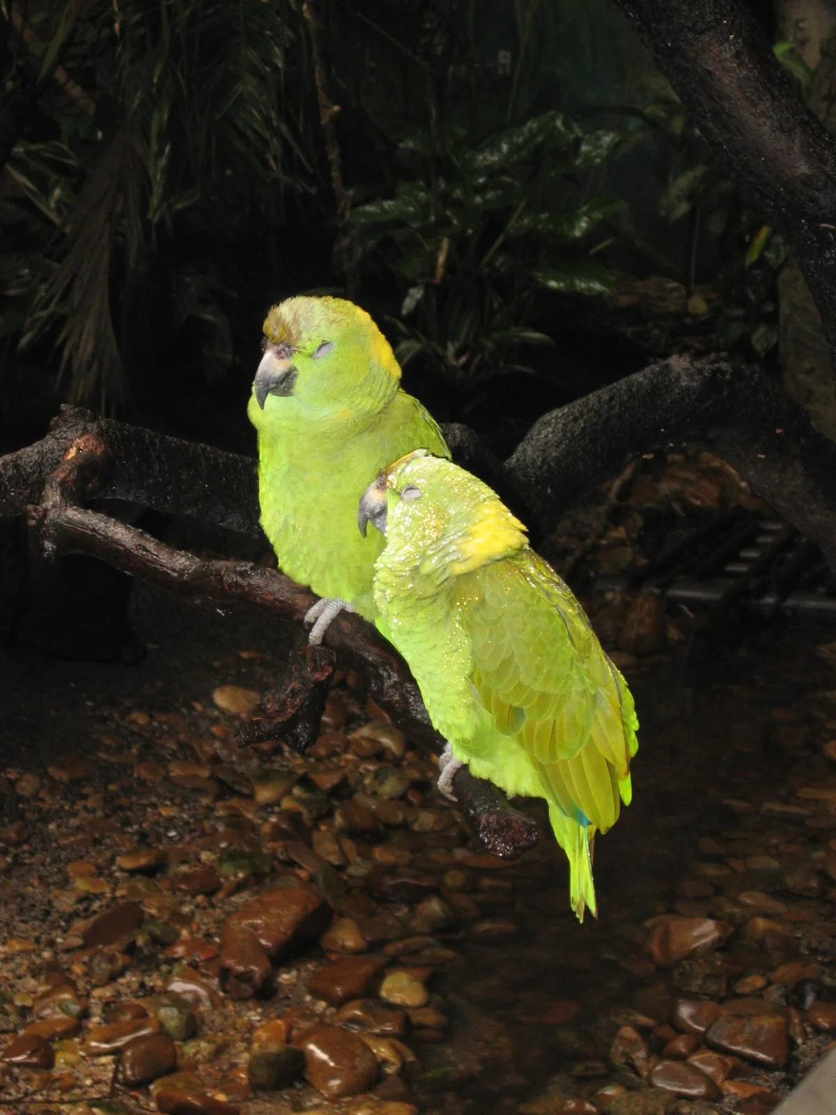
Podocarpus and the Living Forest
Loja Province's most important protected area is Podocarpus National Park, a 1,463-square-kilometer reserve of cloud forest and paramo spanning elevations from 1,000 to 3,690 meters. More than 40 percent of the park's 3,000 to 4,000 plant species are endemic, found nowhere else on Earth. Over 600 species of birds live here, and the forest also shelters spectacled bears, pumas, and populations of rare amphibians. The park is accessible through the Cajanuma gates just minutes from Loja city, which makes it unusually convenient for a national park of this size. In the lower elevations of the province, cherimoya trees grow wild. The fruit, with its soft white flesh and dark seeds, occurs naturally around the towns of Amaluza, Cariamanga, Gonzanama, and Vilcabamba, thriving at altitudes between 1,500 and 2,000 meters where annual temperatures average 18 to 20 degrees Celsius.
Work in the Mountains
The economy of Loja Province has always depended on what the hills could give. Cochineal farming, raising small insects that produce a red dye used in textiles and cosmetics, has drawn significant recent investment. La Toma, the site of the first ill-fated founding of Loja, has long provided suitable conditions for sugar plantations. Coffee is the province's signature agricultural product, though most of the crop is sold domestically rather than exported. The province has also seen significant mining, primarily gold and bauxite, which has damaged the environment in ways the community has been trying to confront for decades. Demographically, the province is predominantly mestizo (90.2 percent in the 2010 census), with smaller populations of indigenous, white, Afro-Ecuadorian, and Montubio residents. The indigenous presence, though small in official census numbers, includes the Saraguro people, whose distinctive dress and language mark them as one of the more visible indigenous groups in southern Ecuador.
Cultural Capital, Political Province
Loja city, the provincial capital, is known nationally as the Musical Capital of Ecuador and home to the Conservatorio Nacional de Musica, which has trained generations of the country's most influential musicians. Two universities, the Universidad Nacional de Loja and the Universidad Tecnica Particular de Loja, give the province an outsized role in higher education for southern Ecuador. The province runs on the same three-institution system as the rest of Ecuador: a municipio with an elected mayor, a prefectura with an elected prefect responsible for all sixteen cantons, and a gobernacion whose leader is appointed by the national president. Every September, the Virgin del Cisne festivals fill the streets of Loja city with pilgrims from across the province, and the annual rhythm of religious, civic, and musical events binds the sixteen cantons into something that feels, despite the mountains that divide them, like one coherent place.
From the Air
Located at 4.03 degrees S, 79.73 degrees W in southern Ecuador, a mountainous province bordering Peru's northern provinces. Best viewed from 12,000 to 16,000 feet to see the dramatic vertical layering from Amazonian jungle in the east to sechura desert influence in the south. Nearest airport: Ciudad de Catamayo Airport (SETM/LOH) near Loja city, serving connections to Quito and Guayaquil. Mountainous terrain demands careful attention to weather and cloud layers; morning flights typically offer the clearest conditions across the paramo and cloud forest zones.
Nearby Stories
- Zaruma 3.3 km away
- Podocarpus National Park 13 km away
- Zamora 21 km away
- Gonzanamá 22 km away
- Tumbes 35 km away
- Department of Tumbes 49 km away
- Poechos Reservoir 63 km away
- Tarqui, Cuenca Canton 76 km away