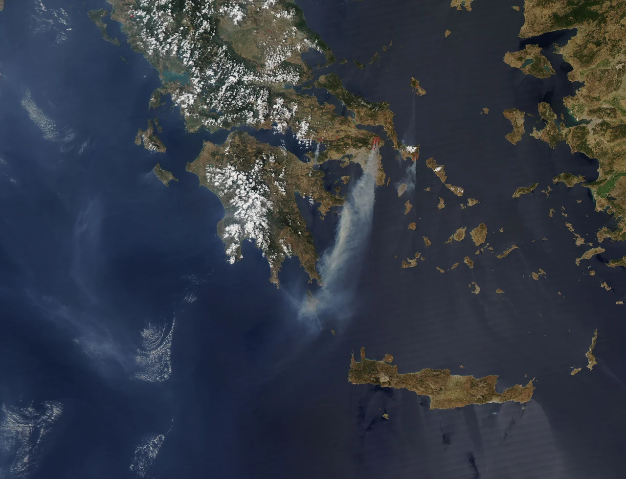

2009 Greek Forest Fires
It started on a Friday night in the hills above the village of Grammatiko, roughly 40 kilometers northeast of Athens. By the time the smoke cleared four days later, fire had run through some 21,000 hectares of pine forest, olive groves and scrub, swept across fifteen communities, and pushed to the edge of the capital's northern suburbs. Ten thousand residents of Agios Stefanos were told to leave their homes. No one died in the 2009 Greek forest fires, a mercy that locals and firefighters earned the hard way. But the land itself, and the trust in those meant to safeguard it, did not come through unburned.
Four Days of Smoke
The fires broke out on the night of 21 August 2009 and burned for the better part of four days. They began near Grammatiko and climbed into the mountains of eastern Attica, destroying 60 homes outright and damaging another 150; in Grammatiko alone some 72 houses were hit, and the communities of Stamata and Rodopoli were badly scorched. The response was enormous. More than a thousand firefighters and soldiers worked through the weekend, backed by nineteen planes and helicopters, with aircraft drafted in from Italy, France and Cyprus. On 24 August alone the fleet hammered the flames with water drop after water drop. Hiring fourteen helicopters for roughly 120 flying hours cost an estimated 30 million euros, a staggering sum to fight a fire that, the WWF argued, never should have grown so large.
The Ground Beneath Marathon
This was sacred earth. The fire's path ran close to the plain of Marathon, where in 490 BC the Athenians turned back a Persian army, and to the cluster of antiquities that commemorate it: the battle site, the Tomb of the Marathon Warriors, the Marathon Museum, the Tomb of the Plataeans, and the ancient fortress of Ramnous. None of the monuments burned, but the landscape that gave them meaning, the open country in which they sit, was charred around them. The sites were saved by two things. One was a northerly wind that turned the flames before they reached the wetlands of Schinias. The other was sheer stubbornness: local residents, many of them already fighting the construction of a landfill outside Grammatiko, stood through the night of 23 to 24 August and held the line.
A Failure Decades in the Making
The WWF was blunt: the destruction "confirms the inability of the state to effectively manage the country's forests." Eastern Attica is a forested-suburban patchwork notorious for illegal ribbon development, where thousands of unauthorized homes have been quietly legalized by successive governments hunting for votes. The forests had almost no one watching them. Attica had just 49 forest guards for 3,500,000 stremmata of woodland, leaving each guard responsible for an impossible 83,000 stremmata. The chronology of Attic fires reads like a slow surrender: Avlona in 1992, Pendeli in 1993, Parnitha in 2007. After 2009, the government promised a special agency to demolish illegal homes on burned land and a satellite system to catch new construction. Whether the lessons stuck is a question later Attic summers would answer in their own smoke.
From the Air
The 2009 fires centered on Grammatiko in northeastern Attica, near 38.20 degrees N, 23.965 degrees E, with the burn spreading across the hills toward Stamata, Rodopoli and the plain of Marathon to the east. From altitude the recovering scrubland, the Marathon coast, and the wetlands of Schinias are the navigational landmarks. Nearest major airport is Athens International (LGAV), about 25 km to the south-southwest. Attic summers bring strong, dry meltemi winds that drive fire behavior and reduce visibility in smoke season.
Nearby Stories
- German Submarine U-565 2.2 km away
- Castle of Cuppa 6.7 km away
- Zoodochos Pigi Church, Dervenosalesi 7.6 km away
- Brauron 9.1 km away
- Anthedon (Boeotia) 9.2 km away
- Battle of Andros (1790) 26 km away
- Andros 32 km away
- Aegean Sea 60 km away