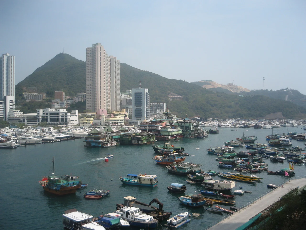

Aberdeen Typhoon Shelters
When a typhoon bears down on the South China Sea, the question of where to put a boat becomes urgent in a way that landlocked geography cannot quite convey. Aberdeen's answer was to create two distinct zones of shelter between Hong Kong Island and Ap Lei Chau — enclosed by breakwaters completed in the 1960s — where fishing vessels and live-aboard boats could ride out storms behind engineered protection. The result was not just a storm refuge. It became a neighbourhood.
West and South: Two Shelters, Two Characters
Aberdeen West Typhoon Shelter occupies the channel directly between Aberdeen town and the northern shore of Ap Lei Chau, incorporating the bay known as Shek Pai Wan or Aberdeen Bay. This is the shelter most closely associated with the floating village — the dense cluster of sampans, junks, and live-aboard boats that has defined the harbour's visual character for generations. Aberdeen South Typhoon Shelter spreads further east into Aberdeen Channel, running between Wong Chuk Hang on Hong Kong Island and the eastern shore of Ap Lei Chau. It is a larger, more open expanse, containing the bays of Sham Wan — where Aberdeen Marina is located — and Po Chong Wan. The Ap Lei Chau Bridge and Aberdeen Channel Bridge divide the two shelters roughly at their boundaries. Together, they enclose what would otherwise be an exposed coastal channel into something that boats can actually trust.
A Floating Community's Home Waters
The Aberdeen floating village exists within the West Typhoon Shelter, and has for as long as living memory extends. The people who have lived aboard boats here — primarily the Tanka, a maritime community whose history in these waters predates the British colonial period — organised their lives around the harbour's rhythms rather than the city's. Boats served as homes, as workplaces, as the social fabric of a community that didn't need the shore for most of what daily life required. Neighbours were the boats moored alongside you. Paths between households were the gaps between hulls. Children grew up knowing the water's movements before they knew much about the land. Over the second half of the twentieth century, government housing programmes resettled most boat-dwelling families ashore. The floating village today is far smaller than it once was, but people still live on the water in the shelter, maintaining a way of life that simply hasn't fully dissolved into the surrounding city.
After the Floating Palace
For forty-four years, the South Typhoon Shelter was also home to the Jumbo Kingdom, a floating restaurant designed as an elaborate replica of an imperial Chinese palace — layered roofs, gilded ornamentation, red and gold paint — moored in the channel between the residential towers of Ap Lei Chau and the hills of Wong Chuk Hang. The restaurant opened in 1976, attracting over 30 million visitors before closing in 2020 as pandemic restrictions took hold. In 2022, it was towed away from the shelter for the last time. While being moved through rough seas near the Paracel Islands, it capsized and sank. The closure ended an era: the South Typhoon Shelter is now without its most recognisable landmark, and the floating restaurants that once made Aberdeen Harbour famous have passed into history.
From the Air
The Aberdeen Typhoon Shelters lie at approximately 22.246°N, 114.154°E, in the channel between southern Hong Kong Island and Ap Lei Chau. From the air, the two shelters are clearly distinguishable as the enclosed water between the two landmasses, divided by the Ap Lei Chau Bridge visible as a road crossing the channel. At 1,500 to 2,500 feet, the density of boats in the West Shelter and the more open marina waters of the South Shelter are both visible on clear days. The breakwater structures at the shelter entrances are identifiable. Hong Kong International Airport (VHHH) is approximately 20 nautical miles northwest. The channel between Hong Kong Island and Ap Lei Chau runs roughly east to west and is a useful coastal navigation landmark.
Nearby Stories
- Lok Ma Chau Loop 2.3 km away
- Portas do Cerco 2.3 km away
- Kweilin Incident 17 km away
- Wanshan Archipelago Campaign 34 km away
- Nanxiong Formation 115 km away
- Battle of Nanpeng Island 148 km away
- Heyuan 169 km away
- Cape Maobitou 632 km away