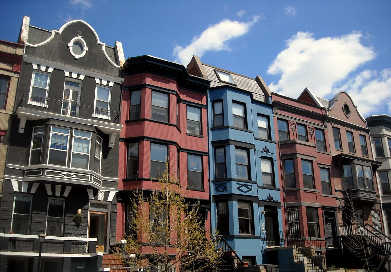

Adams Morgan
The name does not refer to a person. There was no Mr. Adams-Morgan. The neighborhood is named for two elementary schools - the all-Black Thomas P. Morgan School and the all-white John Quincy Adams School - that desegregated and merged in 1955 in the wake of the Supreme Court's ruling in Bolling v. Sharpe. A community council formed in 1958 to make the integration work by drawing a single neighborhood boundary around the catchment areas of both former schools, cutting straight through four older Washington enclaves: Washington Heights, Lanier Heights, Kalorama Triangle, and Meridian Hill. They called the combined territory Adams Morgan. The hyphen was eventually dropped. The neighborhood became something the city had not really had before: a place that was integrated by design, with the design literally encoded in its name.
Before the Schools Merged
Before there were schools to merge, there were country estates. When Congress created the District of Columbia in 1791, the land north of the planned city core belonged to two large landowners, Robert Peter and Anthony Holmead. As Washington grew through the nineteenth century, the land was subdivided into the country seats of the rich - Meridian Hill, Cliffbourne, Holt House, Oak Lawn, Henderson Castle, parts of Kalorama, and the horse farm of William Thornton, the architect of the U.S. Capitol. The Civil War accelerated the breakup. By the 1890s the streetcar lines had reached the area, and the lots filled with Victorian rowhouses, Beaux Arts apartment buildings, and the embassies of countries that did not have the money for the legation row along Massachusetts Avenue. In 1948, in a small storefront at 2461 18th Street NW, Charles Lazarus opened a baby furniture store he called Children's Supermart and later expanded into a toy retailer. By the 1960s it had become Toys R Us. In 1955 Herbert Haft started Dart Drug in the same neighborhood. Both companies would grow into national chains.
Riots and the Late Hours
The first decade after the 1955 desegregation was one of relative stability. Then came 1968. The riots that followed the assassination of Martin Luther King Jr. devastated the commercial corridors of 14th and U Streets just south of Adams Morgan, and the white flight that had begun in the late 1950s accelerated. Tenants and small landlords formed the Adams Morgan Organization to protect rental housing from speculators. Hazel Williams opened Hazel's on 18th Street, a blues and soul food joint that became a regular stop for Dizzy Gillespie and Muhammad Ali when they were in Washington. The hardcore punk scene that produced Bad Brains, Minor Threat, and Fugazi developed in the basements and small venues here in the early 1980s. By the late 1980s there were roughly a hundred liquor licenses inside the small core of 18th Street and Columbia Road. The city imposed a moratorium on new ones in 2000 because the density of bars had become a quality-of-life issue. The moratorium is still in effect.
Gateway for the Americas
Since the 1960s Adams Morgan, along with its neighbors Mount Pleasant and Columbia Heights, has been Washington's gateway community for immigrants from Latin America. Salvadorans displaced by the civil war of the 1980s settled here. Guatemalans, Hondurans, and Nicaraguans came after them. By the 1990s the corridor was the heart of Spanish-speaking Washington. The pupuserias and tacquerias along Mount Pleasant Street and Columbia Road have anchored Salvadoran D.C. for forty years. The neighborhood has also drawn African, Caribbean, and Asian immigrants, and a smaller but visible community of diplomats, with the embassies of the Central African Republic and Gabon both located on neighborhood streets. The Mama Ayesha's Restaurant Presidential Mural - a large outdoor portrait of every U.S. president from Eisenhower through Obama painted on the side of a Syrian-Lebanese restaurant on Calvert Street - is a kind of neighborhood landmark that captures the mix: an immigrant business, an explicitly American subject, painted by an artist of Iraqi descent named Karla Rodas. The portrait was repainted to add Trump and Biden in subsequent years.
The Jumbo Slice Question
Adams Morgan is where the jumbo slice was popularized - an oversized New York-style pizza slice, typically about 18 inches long, sold from a handful of competing pizzerias along 18th Street for the after-bar crowd. Two of the original operators - Pizza Mart and Pizza Movers - became local legends. The Travel Channel's Food Wars covered the rivalry. Madam's Organ Blues Bar, the venue named in 1990s Playboy and Stuff magazine roundups as one of the best places to hear live blues in the country, still operates on 18th Street under a four-story mural of a buxom woman with red hair. The neighborhood has been featured on screen many times - as the home of Carrie Mathison in Showtime's Homeland, as Frank Horrigan's apartment building in In the Line of Fire, as the place where Reese Witherspoon's character lives in How Do You Know. Census data tells a different story than the cultural one: between 1980 and the 2020s the white non-Hispanic share of the neighborhood population rose from 51 percent to 68 percent. Average household income more than doubled in real terms over the same period. The integrated neighborhood that was named for two desegregated schools is now one of the most gentrifying parts of Washington. The murals are still on the walls. The jumbo slice is still 18 inches. The schools that gave the place its name no longer exist as separate institutions. The Adams campus serves grades 4 through 8 of the merged Oyster-Adams Bilingual School. The bilingual instruction is in Spanish.
From the Air
Adams Morgan sits in northwest Washington at roughly 38.92 degrees N, 77.04 degrees W, bounded by Rock Creek Park to the west, Florida Avenue to the south, 16th Street to the east, and Harvard Street to the north. The neighborhood center at 18th and Columbia is about 2.5 miles north-northwest of the White House. The Duke Ellington Bridge crosses Rock Creek to Woodley Park. This is all inside Class B airspace and the Washington Special Flight Rules Area. Reagan National (KDCA) is 5 miles south. Aerial photography is restricted - coordinate with Potomac TRACON.
Nearby Stories
- Gunston Hall 1.1 km away
- 2023 Baltimore Shooting 4.9 km away
- Battle of Middleburg 6.6 km away
- Crownsville Hospital Center 10 km away
- Battle of Loudoun Heights 13 km away
- First Battle of Rappahannock Station 20 km away
- Howard County, Maryland 21 km away
- Harriet Tubman Underground Railroad 50 km away