.jpg)
Adulis
Ptolemy III Euergetes of Egypt had a fleet of war elephants he had captured in East Africa, and he wanted everyone to know about it. Around 240 BCE, somewhere near the African Red Sea coast, he commissioned an inscription boasting of his victories - a triumphal monument that listed the exotic animals he had brought back from campaigns abroad. Centuries later, a Byzantine Christian traveler named Cosmas Indicopleustes found the inscription still standing at a port city called Adulis, and he copied it down before continuing on his way. The copy is how we still know it. The original is gone, along with the city that held it. What remains of Adulis are the ruins beneath the modern Eritrean town of Zula, and the knowledge that this stretch of African coast was once a hinge of world trade.
The Africans Who Traded
Adulis was a port of the Kingdom of Aksum, the African civilization that rose in the highlands of modern Ethiopia and Eritrea and for several centuries was one of the four great powers of its world, ranked by the 3rd-century Persian prophet Mani alongside Rome, Persia, and China. The kings of Aksum minted coins in gold, silver, and bronze, converted to Christianity in the 4th century, and ran a trading empire that stretched from the Mediterranean to India. Adulis was their outlet to the sea. About forty kilometers south of Massawa, in the Gulf of Zula, the city sat near the coast but not on it - its actual port lay some twenty stades away, a distance the ancient sources call the harbour of the Adulitae. This matters because it suggests a specific social structure: the city and its port were different places, occupied by partly different people.
Puntland
The archaeology beneath Adulis reaches back further than Aksum itself. Fragments of glass vessels found in the lowest excavated layers match specimens from Egypt's Eighteenth Dynasty, around 1450 BCE, suggesting active trade contact with New Kingdom pharaohs more than three thousand years ago. Some scholars have argued that Adulis may correspond to Wddt, a region recorded in the geographical lists of Egypt's 18th dynasty as part of the Land of Punt - the legendary African trading partner of the pharaohs, source of myrrh, frankincense, ebony, ivory, and the exotic animals that adorned royal courts. Late prehistoric settlements dating from the mid-2nd to early 1st millennium BCE lie beneath the Aksumite city. The location has been connecting Africa to the wider world for at least thirty-five hundred years.
Pliny and the Periplus
Pliny the Elder is the earliest European writer to mention Adulis, in his Natural History. He got the etymology wrong - he thought the name meant the place had been founded by escaped Egyptian slaves - but he correctly identified it as the principal mart for the Troglodytae and the people of Aethiopia. The anonymous 1st-century Periplus of the Erythraean Sea, a practical merchant's guide to Red Sea and Indian Ocean trade, describes Adulis as an emporium exporting ivory, hides, and enslaved people captured from the interior, alongside imported goods flowing the other way. Roman merchants used the port in the 2nd and 3rd centuries CE. The exports include enslaved people, a reminder that this prosperity, like so much ancient Mediterranean prosperity, rested in part on human bondage.
Inscriptions and a Bishop
Two inscriptions at Adulis were famous in the ancient world. One was a copy of Ptolemy III's triumphal record of his war-elephant campaigns. The other, called the Monumentum Adulitanum, was inscribed in the twenty-seventh year of an Aksumite king - perhaps named Sembrouthes, perhaps the earlier king known as GDRT - and boasted of victories in Arabia and northern Ethiopia. Cosmas Indicopleustes copied both in the 6th century while visiting the town under the governorship of a man named Asbas during the reign of King Kaleb of Axum. A 4th-century text ascribed to Palladius of Galatia describes an Egyptian lawyer's journey to India in search of Brahmin philosophy; he was accompanied part of the way by a man named Moses, Bishop of Adulis - confirming the existence of a Christian bishopric here centuries before Islam reached these shores.
The End
Historians agree that Adulis declined sometime in the 8th century CE. They disagree about how. Traditional accounts say the city was destroyed by an Arab expedition in 640 CE; excavations have revealed traces of fire, but historical records suggest the Arab expedition was considered a failure and the evidence remains inconclusive. The Russian scholar Yuri Kobishchanov detailed a series of Aksumite raids on the Arabian coast, the latest in 702 when the port of Jeddah was briefly occupied, and argued that Adulis was eventually destroyed in retaliation. What is clear is that the naval power of Aksum waned during these decades, and the port was abandoned sometime around the 8th century. The sea trade that had flowed through Adulis for a millennium moved elsewhere, and the African kingdom that had anchored it faded.
Unfinished Business
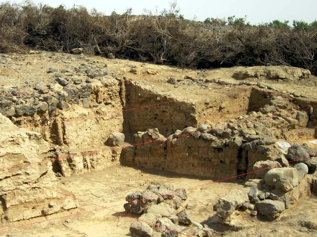
The first archaeologists arrived in 1840 - a French mission that mapped three structures they believed were temples. In 1868, soldiers attached to Britain's Napier expedition against Emperor Tewodros II of Ethiopia stopped at Adulis and exposed the foundations of a Byzantine-style church. Serious excavations followed under Richard Sundström in 1906 and Roberto Paribeni in 1907; the Italians found wine amphorae imported from Aqaba, the so-called Ayla-Axum Amphoras that have since turned up at other Eritrean sites. One specialized object at the site was a Menas flask, stamped with the image of an Egyptian saint, probably brought to Adulis as a pilgrim's keepsake. Since Eritrean independence, the National Museum of Eritrea has been petitioning Ethiopia to return the artifacts of these excavations, currently held in Addis Ababa. So far those requests have been denied - one more unfinished piece of the story this coast keeps telling.
From the Air
Coordinates: 15.264°N, 39.661°E. Adulis lies in southern Eritrea's Gulf of Zula, about 40 km south of Massawa, immediately inland from the modern town of Zula. The ruins appear as scattered mounds and foundations against the arid coastal plain. Nearest airport: Massawa International (HHMS) to the north. Eritrean airspace requires careful permissions and flights are limited. Recommended altitude 3,000-5,000 feet for the archaeological zone; Red Sea visibility generally excellent except during summer haze.
Nearby Stories
- Arkiko 13 km away
- Southern region (Eritrea) 16 km away
- Kagnew Station 17 km away
- Northern Red Sea region 59 km away
- Danakil Depression 81 km away
- Dallol (hydrothermal system) 112 km away
- Italian Submarine Guglielmotti (1938) 192 km away