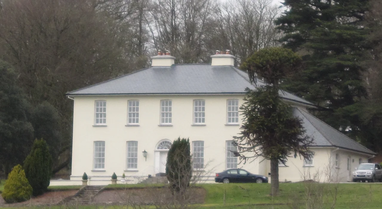

Aghavrin House
Drive northwest out of Coachford village in mid-Cork, follow the lane for about three miles through dairy country, and a quiet Georgian house emerges from a screen of trees. Aghavrin House does not announce itself. It sits low to its small demesne, five bays wide, two storeys over a basement, with the kind of restrained proportions that mark a builder who had money but not so much money that he needed to shout about it. The house was raised around 1810. The view is over the valley of the River Lee, where the better land of mid-Cork drained from the hills toward the sea, and where the Anglo-Irish Big Houses sited themselves with one eye on the soil and the other on each other.
Symmetry and Limestone
The National Inventory of Architectural Heritage logs the details with quiet approval. Symmetrical chimneystacks bracket the roofline. Tall windows pull light deep into the rooms. The front door sits beneath a centralised arched doorcase, approached by a limestone perron, a ceremonial flight of steps that lifted the family above ground level when they greeted visitors. A gate lodge marked the entrance from the road on the 1841 Ordnance Survey map but has since vanished. A summer house, sketched onto the 1901 OS map as a garden feature, survives only as a roofless semi-circular ruin, its stone walls now wrapped in ivy. The whole composition is what the period called a small but well planted demesne, the phrase Samuel Lewis used in his 1837 dictionary when describing the Crooke family's estate.
The Crookes and the Blockade
The Crookes built Aghavrin House and lived in it for generations. The tithe applotment book for the parish of Aghabullogue records Thomas Crook Esquire occupying around 130 acres in the early 19th century. Lewis named him as Captain T. E. Crooke, a hint that the family carried a military thread. The hint becomes solid just south of the house, where a small private folly known as Crooke's Castle still stands. It was built by Thomas Epinetus Crooke, who had served during the Napoleonic Wars on board HMS Shamrock, a Royal Navy blockade ship. The Napoleonic blockade of French ports was one of the longest, dullest, most demanding operations the Royal Navy ever ran. Crooke spent years on Shamrock and came home to mid-Cork to build himself a miniature castle, perhaps the only architectural style that felt large enough after a war that size.
The Uninvited Guests
The Irish Tourist Association surveyed the country in 1944 and confirmed Aghavrin House as the residence of Mrs Scott, born Crooke, whose family had built the place. The survey carries one quiet line: during the War of Independence, IRA members billeted themselves on the premises without invitation from the owner. The Crookes were Protestant gentry. The IRA was conducting a guerrilla campaign across mid-Cork against British forces, and country houses with good rooms and stables made useful temporary bases. The phrasing of that survey line, without invitation, is restrained but pointed. The Crookes did not refuse out loud. They could not. They simply waited for the war to pass through their drawing room and out the other side.
Brigadier and Private Residence
In the twentieth century, Aghavrin House passed to Brigadier Michael John Cahill, who held the Order of the British Empire and died in 1968. He lies in Christchurch graveyard in nearby Coachford, beside a small Church of Ireland parish where the Crooke names still appear in the registers. Today the house remains a private residence, hidden from the road, not open to visitors. The valley around it is still good land. The dairy farms of mid-Cork press their milk into the co-operatives that supply Cork city, and the lane to Aghavrin runs past hedgerows that have not been straightened in two hundred years. The summer house is a ruin. The gate lodge is gone. The main block, with its limestone perron and arched doorcase, still keeps the rain out and still looks over the same valley it was built to watch.
From the Air
Located at 51.93 degrees N, 8.81 degrees W in mid-Cork, 4.8 km northwest of Coachford village in the valley of the River Lee. The Lee here flows east toward Cork city through a broad agricultural valley flanked by low ridges. Cork Airport (EICK) lies about 22 km southeast, an easy reference for orientation. The house sits in private grounds and is not visible from any main road; from the air at 1,500-3,000 feet on a clear day, look for a small, dark cluster of mature trees on the slope above the river, with the village of Coachford as a tighter knot of buildings just below.
Nearby Stories
- Páirc Uí Chaoimh 4.9 km away
- Clonakilty 7.9 km away
- Killarney National Park 8.7 km away
- Carrigeenamronety Hill 9.7 km away
- Ahakista 13 km away
- Tralee 16 km away
- Ballybeg Priory 20 km away
- Walter Siepmann 23 km away