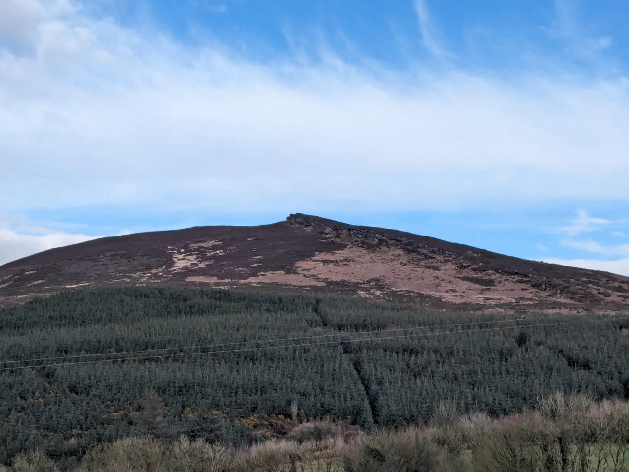

Carrigeenamronety Hill
In the year 976, the brother of Ireland's most famous high king was murdered in the gap below this hill. Mahon mac Cennetig, brother of Brian Boru and King of Munster, walked into a conspiracy of Norse Limerick, the King of Desmond, and the King of Hy Carbery, and never walked out. The killing place was a chasm between Carrigeenamronety and Coolfree known as Bearna Dhearg - the Red Gap - on the high road from Limerick into south Munster. A stone at the spot still marks where he is reputed to have fallen. The Annals of the Four Masters recorded the story. The Irish bards kept it alive. And the modest sandstone hill that watches the gap today still carries the weight of that ancient betrayal.
The Red Gap
Carrigeenamronety rises to 401 metres on the Cork-Limerick border, with a prominence of 226 metres that earns it a place among the Marilyns - that strange British and Irish category of hills distinct enough to count. The pass below it, Bearna Dhearg, sometimes anglicised as Red Chair, was one of the most celebrated mountain passes in south Munster, traversed by hostile bands moving between the rich plains of Cashel and the fertile valleys of the Funcheon and the Blackwater. The 19th-century antiquarian who recorded the local names called it "so often the scene of a bloody contest." The murder of Mahon - confirmed by the annals and by O'Donovan's 1856 translation - is the most famous of those contests. Brian Boru would avenge his brother within a few years, but Mahon's death lit the fuse on the war that eventually carried Brian to the High Kingship of Ireland.
Quern Hill
The hill carries another name in the local memory: Carrig na mBronta, or Quern Hill, for the millstones once quarried along its southern slope. The conglomerate rock here, where Old Red Sandstone meets Silurian beds in a band of escarpment near the summit, was good stone for grinding grain. Walk the slope today and the evidence remains. Hollows mark where finished millstones were dragged out. Partially completed stones still lie in the ground, abandoned at some stage of their long journey from rock to flour. The quarry crosses the county border into Boleynanoultagh and Gortacurrig townlands - one hill, two counties, generations of stonemasons who came up here to cut the discs that ground the bread of the surrounding farms.
The Citadel
Near the top sits a structure the National Monuments record calls "the Citadel." In 1984 surveyors recorded a circular enclosure 34 metres across, perched 2.5 metres above the surrounding ground, bounded on the west by a six-metre sandstone cliff and on the other sides by a double ring of stone banks. At the highest point within, a cairn marks what is thought to be the stub of a post-medieval tower. Locals call it the lios. The Atlas of Hillforts of Britain and Ireland logs it as a fort. What it was, exactly, and when it was built, nobody can say with certainty. Iron Age people raised hillforts on Irish summits for centuries. Later occupants reused them. On a south-facing slope below the summit, a mass rock - a sandstone slab a metre across with a cross carved into its face - records another chapter, when Catholic priests held outdoor Mass in defiance of the penal laws.
A fern among the heath
The hill became a Special Area of Conservation in 2017, designated for two reasons: dry heath habitat and the Killarney fern, Trichomanes speciosum. The fern is one of Ireland's botanical treasures - a delicate, translucent thing that grows in dripping, sheltered crevices where humidity stays high. Victorian collectors nearly wiped it out across Britain; in Ireland, in shaded grottoes like the ones tucked into this hill, it survived. Sixty percent of the protected site is dry siliceous heath, ten percent wet heath, threaded with unimproved grassland of purple moor-grass at lower elevations. Hen harriers and peregrine falcons hunt the slopes. The Ballyhoura Darragh Hills Loop walk crosses the summit, and the Ballyhoura Way - part of the long Beara-Breifne Way commemorating Donal Cam O'Sullivan Beare's 1602 march from West Cork to Leitrim - passes close by.
The witch's pipe
The Irish Folklore Commission's Schools Collection, recorded in 1937-38 by children in Kildorrery, preserves a stranger story. Petticoat Loose, the witch or evil spirit of folklore, lived at Labbacallee - a wedge tomb near Glanworth in County Cork, twenty miles south. Her brother lived on Carrigeenamronety. When he wanted a smoke, she threw the pipe across the intervening hills. When she wanted it back, he threw it home. Another version names the witch Nora, a chieftain's daughter who lived in a cave called Seomra Nora, Nora's Room, on the hill itself. The cave exists. Whether anyone ever played pipe-throw with Labbacallee across the valleys of north Cork is another matter. The story belongs to the way these hills were once lived in - by people who saw the connections between standing stones and mountain tops as the obvious geography of the supernatural.
From the Air
Carrigeenamronety Hill sits at 52.29 N, 8.44 W on the Cork-Limerick border, summit 401 m (1,316 ft). The Ballyhoura Mountains form a low east-west ridge between the Galtees and the Nagles. Cork (EICK) is 28 nm south; Shannon (EINN) 32 nm north-northwest; Waterford (EIWF) 50 nm east. Recommended viewing altitude 3,000-4,000 ft AGL to see the broader pattern of hill, gap, and the farmland of north Cork falling away to the south. Mountain weather can change rapidly; expect summit cloud and rotor turbulence on windy days.
Nearby Stories
- Adare 1.2 km away
- Doon, County Limerick 5.2 km away
- Inislounaght Abbey 6.1 km away
- Old Parish 7.3 km away
- Ballingarry Coal Mines 11 km away
- Aghavrin House 12 km away
- Clonmult Ambush 12 km away
- Dromagh Castle 22 km away