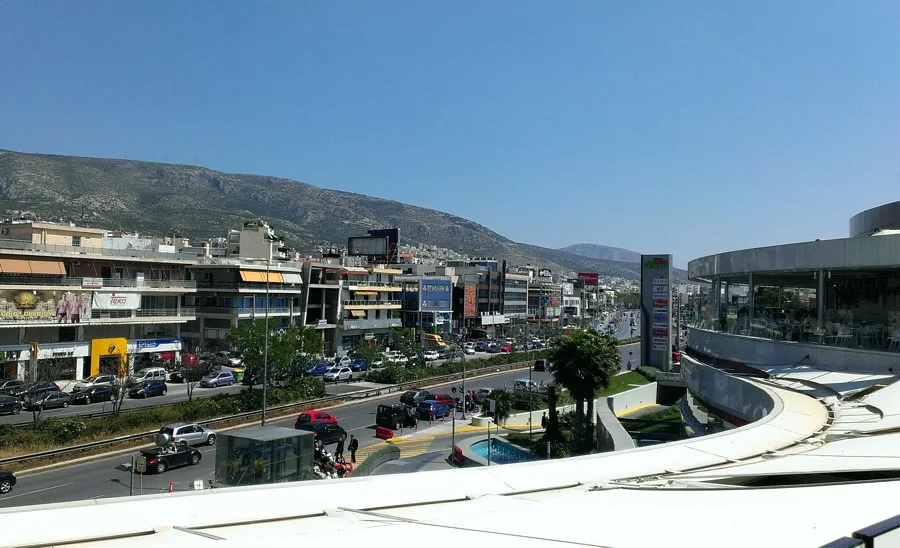

Agios Dimitrios
The name on the sign is Agios Dimitrios — Saint Dimitrios — but for most of its modern existence this corner of southern Athens answered to a different name entirely. Brahami. The word echoes an Ottoman past: the land here once belonged to Braham Pasha, and the village that grew up in its fields carried his name into the 20th century. In 1928, a Greek government decree swept that history away and replaced it with the name of a Christian martyr. But the pasha's legacy persists, quietly, in the way locals still occasionally call this place by its old name — a whisper of occupation carried across a century of reinvention.
The Pasha's Land
During the centuries of Ottoman rule, the broad agricultural plain south of Athens was not divided into the tidy suburbs it would eventually become. It was a single vast estate — running from the church of Saint John at Kareas all the way west to Kavouri — split between two Ottoman lords. Braham Pasha held the northern portion, giving his name to the village of Brahami. Hassan Pasha held adjoining land, and his name lodged itself into the neighborhood now called Hassani. When the Greek state began reasserting control over Attica after independence, these estates were gradually parceled out. Athens donated or sold the land in sections, and clusters of new settlements took root where pastures had been — Brahami, Agia Varvara, Pikrodafni, Agios Kosmas, and a settlement then called Katsipodi that would later become Dafni.
A Community Finds Its Shape
The Community of Brahami was formally established in 1925, the year Athens finally relinquished administrative control over the village. For the next three years it operated as a distinct entity, then came the renaming. The church of Saint Dimitrios, around which the original village had coalesced during the interwar years, provided the new identity. It was converted into a municipality — with its administrative base in the neighboring area of Dafni — in 1942. Then came another division: a 1947 decree separated the Brahami settlement from Dafni and set it on its own path as an independent community. The final shape of the municipality arrived in 1963, when the Home Secretary approved the formal conversion that established the boundaries still recognized today.
Five Kilometers South
Situate yourself five kilometers south of central Athens and four kilometers from the Saronic Gulf coast, and you are standing in Agios Dimitrios. The municipality covers just under five square kilometers — a compact urban pocket that is nonetheless full of daily life. Vouliagmenis Avenue, one of the main arteries linking central Athens to its southern suburbs, runs through here. More significantly for modern commuters, Line 2 of the Athens Metro threads through the area, with its own Agios Dimitrios station providing a direct, swift connection to the city center. The sea is not visible from most of the neighborhood, but it is close — close enough that the climate borrows its Mediterranean character from the coast, delivering hot, dry summers and mild, wetter winters.
Neighborhood Pride
Every Greek neighborhood measures something of its identity through sport, and Agios Dimitrios is no different. The football club Agios Dimitrios F.C. carries the municipality's name onto pitches around Attica. Thyella Agiou Dimitriou adds another football presence. On the basketball courts, Cronus Agios Dimitrios competes in the city's club scene. These clubs are not famous beyond Athens, but they are fiercely local — each one a small expression of a community that carved its identity out of a pasha's estate, a government decree, and a century of ordinary Greek life. The suburb's twin city is Pozzuoli, the volcanic port suburb of Naples — another place where ancient ground lies just below the modern surface.
From the Air
Agios Dimitrios lies at approximately 37.93°N, 23.73°E, roughly 5 km south of central Athens. Approaching from LGAV (Athens International Airport, Eleftherios Venizelos) to the northeast, the suburb appears as a dense residential grid between the ridge lines of southern Attica and the glittering surface of the Saronic Gulf. A viewing altitude of 1,500–2,500 feet allows a clear read of Vouliagmenis Avenue cutting southward through the urban fabric. On clear days the gulf coast is visible 4 km to the west, with the peninsula of Kavouri distinguishable further south.
Nearby Stories
- Parnitha 3.4 km away
- Kea (island) 7.3 km away
- Sanctuary of Apollo Maleatas 11 km away
- Sousaki Volcano 12 km away
- Battle of Leuctra 14 km away
- Great Sand Beach 18 km away
- Agios Georgios (island) 23 km away
- Skyros 84 km away