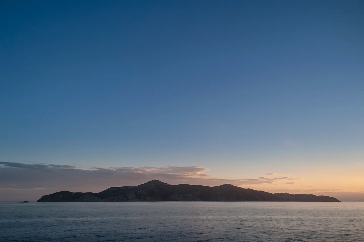

Agios Georgios (island)
Herodotus records a sharp exchange between Themistocles, the architect of Athenian naval power, and a political opponent named Timodemos from Afidnes. Timodemos taunted Themistocles by pointing out that his fame rested on Athens, not on his own merits. Themistocles replied that neither he nor Timodemos would have been famous if they had been born on Belbina. Belbina was, apparently, the ancient byword for nowhere in particular — the island at the entrance to the Saronic Gulf that nobody important came from. Today that island is called Agios Georgios, or San Tzortzis in the Venetian rendering, and at 4.3 square kilometers it remains the largest uninhabited island among the Saronic group. It has spent most of its history quietly absorbing the classifications of successive authorities: Attic administrative territory, Hydra municipal district, wind energy site. The taunt that Themistocles deflected with wit still has a certain geographical accuracy. This is a place defined more by where it sits than by what it contains.
Belbina and the Battle That Wasn't
In antiquity, the island bore the name Belbina and supported a town of the same name. Beyond Herodotus's passing mention, it appears occasionally in ancient sources as a piece of administrative geography — part of Attica, part of the Argolid, depending on which source and which period. A more dramatic claim attached to it for a time: some scholars proposed that Belbina should be identified as the ancient Psyttaleia, the island where Persian forces landed during the Battle of Salamis in 480 BC, and where Athenian forces subsequently trapped and destroyed them. The identification would have given Agios Georgios a starring role in one of antiquity's most consequential naval battles. The scholarly consensus, however, places ancient Psyttaleia at the island long known as Lipsokoutali and now formally renamed Psyttaleia — leaving Belbina, and by extension Agios Georgios, outside the drama. It was, as Themistocles might have said, just Belbina.
Wind Over Water
In 2016, Terna Energy completed construction of a 73 MW wind farm on Agios Georgios — the first wind farm built on a rocky islet in Greece. The installation delivers approximately 220 GWh of electricity per year to Athens, transmitted via undersea cable. The island's topography, exposed position at the mouth of the Saronic Gulf, and uninhabited status made it a practical site: no residents to consult, reliable Aegean wind, and proximity to the mainland grid. The wind turbines now define the island's silhouette as seen from passing ferries on the Athens–Hydra route. For an island that Herodotus's contemporaries considered the embodiment of provincial obscurity, it has found a quietly functional role in the modern Greek energy system.
A Question of Ownership
Administratively, Agios Georgios has belonged to the municipality of Hydra since 1834 — an arrangement that made the island's wind farm revenues a matter of considerable interest to neighboring jurisdictions. In recent years, the municipality of Lavreotiki challenged Hydra's ownership of the island, and with it the associated income from the wind energy operation. The dispute went to court. In 2017, a legal judgement reaffirmed Hydra's claim. The case illustrates something persistent about small Greek islands: even the uninhabited ones can accumulate surprising economic value, and where there is value, ownership questions tend to follow. Belbina, the island that stood for insignificance in Themistocles' witticism, turned out to be worth arguing over.
From the Air
Agios Georgios lies at approximately 37.475°N, 23.925°E at the entrance to the Saronic Gulf, roughly midway between the mainland port of Lavrio and the island of Hydra. From the air, it appears as a mid-sized rocky island with the distinctive towers of its wind farm visible on the higher ground. The nearest major airport is Athens International Airport Eleftherios Venizelos (LGAV), approximately 50 km to the north. The island is best viewed on the approach to or departure from LGAV when routing via the Saronic Gulf corridor; it lies south-southeast of the Lavrio ferry terminal. Flying at 5,000–8,000 feet on a clear day, the full island is easily distinguishable, and the wind turbines are visible even at higher altitudes. Visibility in the Saronic Gulf is generally good, though sea fog can reduce visibility in spring and autumn.
Nearby Stories
- Saronic Gulf Islands 4.9 km away
- Kalaureia 6.8 km away
- Gyaros 14 km away
- Brauron 17 km away
- Battle of Andros (1790) 23 km away
- Archaeological Museum of Sifnos 35 km away
- Spetses 37 km away
- Serifos 39 km away