
Saronic Gulf Islands
Each island in the Saronic Gulf has worked out its own arrangement with the mainland. Salamis is so close — barely two kilometres from Athens' port — that it functions as a suburb, reached by a ferry that runs like a city bus. Aegina, an hour out, draws day-trippers to its ancient temple. Hydra banned motor vehicles decades ago, making it the only island in Greece where the only sounds are footsteps, voices, and the occasional complaint of a donkey. Spetses packs in the summer crowds; tiny Agistri offers pine shade and quiet. The cluster is small enough to explore in a week, varied enough to take much longer.
The Island That Stood at the Centre of History
Salamis is the largest of the Saronic Islands — 93 square kilometres — and in 480 BC the narrow strait between it and the Attic mainland was the scene of one of the most consequential naval battles in ancient history, where the Athenian-led Greek fleet broke Persia's advance. Today it is a working island: ferries, shipyards, and the Salamis Naval Base, headquarters of the Hellenic Navy, define its northeastern shore. The western and southern coasts are quieter, with pine forests and beaches. A frequent short ferry runs from Perama on the mainland; from Piraeus a foot-passenger service operates on weekday mornings. The island is partially restricted due to the naval base, and its proximity to Perama's heavy industry shapes its character more than tourism does.
Aegina and the Temple on the Hill
Aegina is the easiest island to visit: barely an hour from Piraeus by conventional ferry, less by hydrofoil. The main attraction is the Temple of Aphaea, a well-preserved Doric temple on the island's eastern heights, dating to around 500 BC. The goddess Aphaea was a local deity, distinct from the Olympians, and her temple commands views across the gulf toward Athens on one side and the Peloponnese on the other. The town of Aegina itself is pleasant and unhurried, with a waterfront of caiques and tavernas. Agistri, a small pine-clad island beside Aegina — its name means 'fish hook' — offers simpler pleasures: the traditional village of Milos, a small beach resort at Skala, and a pace of life that the larger islands have mostly lost.
Poros, Hydra, and the Car-Free Shore
Poros is two islands in one, connected by a bridge: Sfairia, where the town sits on a hillside above a busy strait, and the larger, quieter Kalavria behind it. The town of Poros is separated from the Peloponnese mainland by barely 200 metres of water, with ferries crossing constantly from Galatas opposite. Further down the coast, Hydra is the island that chose a different direction entirely. Decades ago, it prohibited motor vehicles — no cars, no motorbikes, no scooters. Goods are carried by donkeys; people walk. The old harbour, ringed by stone mansions built by shipping merchants in the 18th and 19th centuries, has been carefully preserved. It draws artists and architects, and a steady flow of visitors who find the silence disorienting at first, then restorative. Spetses, the southernmost of the main islands, has resisted some motor traffic but is substantially more developed, popular and crowded in summer.
Getting There and Getting Around
All the main islands are reached from Piraeus, Athens' port, which connects to the city by metro. Fast hydrofoils serve foot passengers in summer, running frequently but subject to cancellation in bad weather. Conventional ferries are slower, carry vehicles, and operate year-round. Poros is so close to the Peloponnese that driving to Galatas and taking the short crossing is often faster than coming from Piraeus. On the islands themselves, buses are sparse and not designed for exploration. The Wikivoyage advice is characteristically direct: consider hiring a taxi for a few hours rather than baffled map-reading up a dirt track with 'a droll goat looking on.' Hydra solves the problem by removing the question entirely — on foot is the only way.
What Each Island Keeps
The Saronic Islands are primarily visited by Greeks — Athenians on weekends, families in summer. International tourists tend to pass through on cruise ships or skip them in favour of the Cyclades. What this means in practice is that the islands have not been fully reshaped for foreign tourism: the tavernas at each port serve the food that locals eat, the churches and monasteries scattered across hillsides are genuinely used rather than merely picturesque, and the walking trails reward the effort with views of the gulf rather than a gift shop at the summit. Aegina holds the only major classical antiquities in the group. The rest of the islands offer something quieter: the sensation of a sea that has been sailed for three thousand years, and islands that have not forgotten it.
From the Air
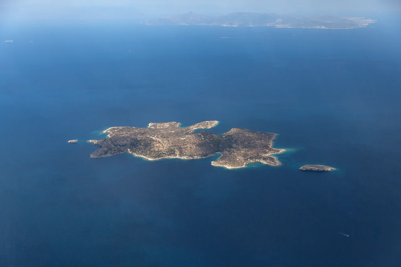
The Saronic Gulf Islands lie at approximately 37.80°N, 23.50°E, southwest of Athens. From altitude, the cluster is visible against the blue Aegean: Salamis closest to the Attic coast, then Aegina to the south with its distinctive triangular profile, Agistri just west of Aegina, Poros near the Peloponnese, and Hydra and Spetses further south. Viewing altitude of 5,000–10,000 ft provides excellent perspective on the gulf's geography. Nearest major airport: LGAV (Athens International Airport, Eleftherios Venizelos), approximately 35 km northeast of Aegina. The Corinth Canal is visible at the northwestern end of the gulf on clear days.
Nearby Stories
- Eleutherae 3.6 km away
- Methana Volcano 3.8 km away
- Marathon, Greece 5 km away
- Tiryns 5 km away
- Spata Training Centre 8.6 km away
- Corinthia 9.8 km away
- Agios Georgios (island) 16 km away
- Mount Helicon 23 km away