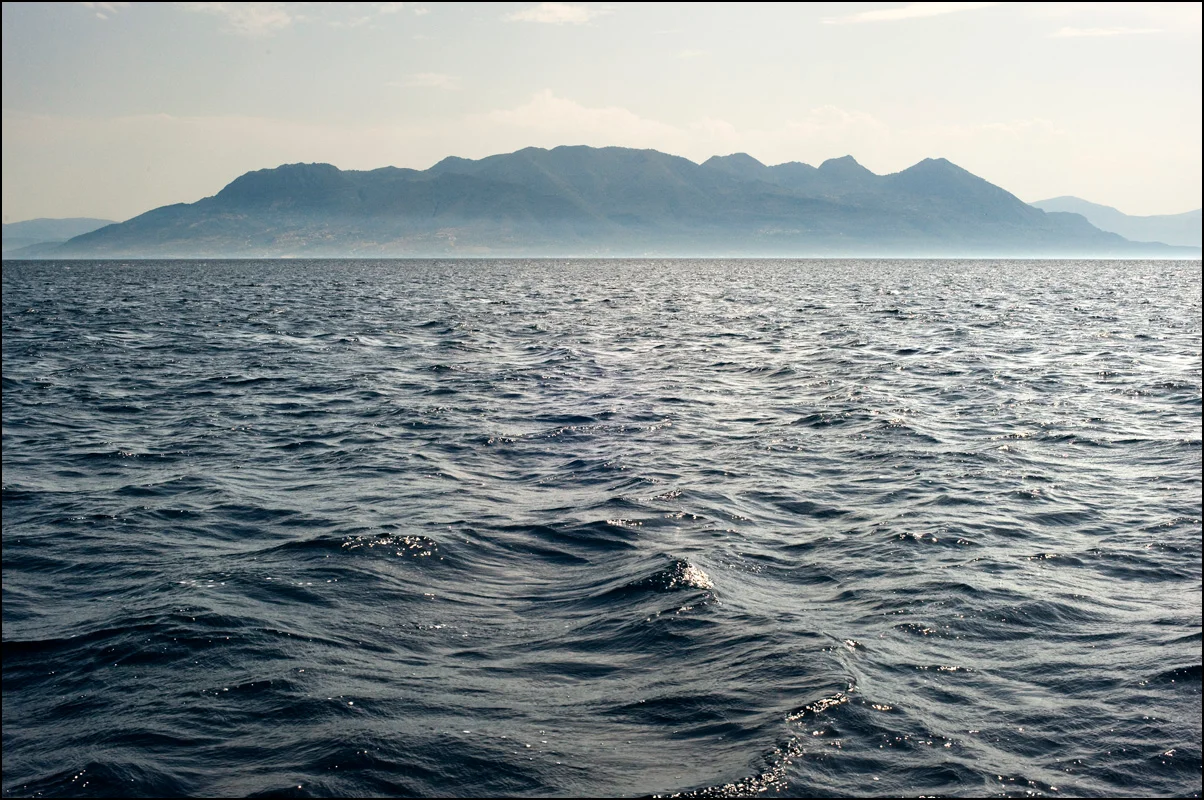

Methana Volcano
Ovid wrote about it. Strabo measured its gases. Pausanias described the hot springs that rose in the eruption's wake. The volcano on the Methana peninsula has been attracting the attention of writers and travellers for more than two thousand years — because it has repeatedly reminded them that the Aegean is not merely beautiful, it is alive. Methana sits at the northwestern end of a chain of active volcanic areas that extends through Milos and Santorini to Nisyros in the southeast, an arc of fire where the African tectonic plate dives beneath Europe and sends heat and magma upward through the crust. On this peninsula, that process has been going on for a million years.
Thirty-Two Mouths of the Earth
The Methana peninsula contains approximately 32 volcanic eruption centres — not a single cone but an entire field of them, distributed across the landscape like the remnants of a very long geological argument. Most are andesitic and dacitic lava domes: thick, viscous formations that pushed slowly upward rather than exploding dramatically. The rock is hard, dark, and unforgiving. Many of the peninsula's hills, which look at first glance like ordinary Greek countryside, are actually solidified volcanic domes from eruptions that occurred tens of thousands of years ago. The major tectonic fault that cuts through the area runs west to east directly through the town of Methana itself, a reminder that the ground here is not passive. Volcanic activity began roughly a million years ago and has continued sporadically ever since. The most recent confirmed eruption on land was the lava dome near Kameni Chora, which Ovid, Strabo, and Pausanias all described as occurring around 230 BCE.
The Historic Eruption at Kameni Chora
The ancient writers were unusually specific about the Kameni Chora eruption. Ovid included it in his Metamorphoses; Strabo described the event in his Geography; Pausanias, writing in the second century CE, added detail about the hot springs that appeared in the eruption's aftermath. The lava dome near Kameni Chora, in the northwestern part of the peninsula, is the only onshore eruption in the area with a firmly historical date. A later event — submarine this time — is recorded in 1700, when eruptions occurred from an underwater volcano north of Kameni Chora. In August 1922, numerous observers reported activity in the Kaimeno Vouno crater, but this has never been confirmed as a genuine eruption. The submarine and subterranean activity, together with the peninsula's thermal springs and mofettes — volcanic gas exhalations seeping from fissures in the ground — make clear that the system remains active. Geologists classify Methana, along with Milos, Santorini, and Nisyros, as one of the four active volcanic areas in the Aegean.
Ten Thousand Years of People
The peninsula has been inhabited for roughly ten thousand years — humans were here at the end of the last ice age and have never really left. The first settlements date to around 6000 BCE. By the Mycenaean period (1500–1200 BCE), there was a village and sanctuary near the town of Methana at the site of the chapel of Saints Constantine and Helen; artefacts from this settlement are preserved in the museums of Poros island and in the Piraeus Archaeological Museum in Athens. Ancient sanctuaries from the Geometric period, roughly 800–700 BCE, have also been found near the village of Kounoupitsa. There are two ancient acropoleis on the peninsula — Paliocastro and Oga — and numerous ancient farm sites scattered across the volcanic terrain. People came for the hot springs, stayed for the fertile hillside plots, and built on land that occasionally pushed back.
A Landscape Still Breathing
Standing on the Methana peninsula today, the volcanic origin of the landscape is unmistakable — the dark, jagged rock formations, the sulphur smell from thermal vents, the way the ground near the water sometimes steams in cool weather. The peninsula's thermal springs have drawn visitors for centuries, first as curiosities, later as a spa destination. The town of Methana's highest point is Helona Mountain at 740 metres, and from its upper slopes on a clear day the full extent of the Saronic Gulf is visible: Aegina to the north, Poros to the east across the narrow strait, the mountains of the Peloponnese rising behind. Since 1991, ETH Zürich geologists have worked systematically across the peninsula producing detailed topographic maps of the entire volcanic field at a scale of 1:25,000. The picture that emerges is of a landscape in an interglacial pause, not a finished one. Geologists consider Methana capable of future eruptions.
From the Air
The Methana Volcano peninsula is at approximately 37.62°N, 23.34°E, about 50 km southwest of Athens. From altitude, it appears as a dark, mountainous thumb protruding into the Saronic Gulf, distinctly rougher in texture than the surrounding limestone coastal areas — the volcanic rock gives the hillsides a different tone and drainage pattern. The narrow isthmus connecting the peninsula to the Peloponnese is visible as a pale sandy sliver. The closest major airport is LGAV (Athens International Eleftherios Venizelos), approximately 60 km to the northeast. At 5,000 feet, Aegina is visible to the north and Poros to the east. Approach from the west over the Argolid Peninsula for the best aerial perspective on the volcanic dome field.
Nearby Stories
- Agios Vasileios, Corinthia 4.4 km away
- Nafplio 6.1 km away
- Agios Georgios (island) 6.3 km away
- Tsakonia 8.6 km away
- Saronic Gulf Islands 11 km away
- Brauron 17 km away
- Spetses 21 km away
- SS Heraklion 49 km away