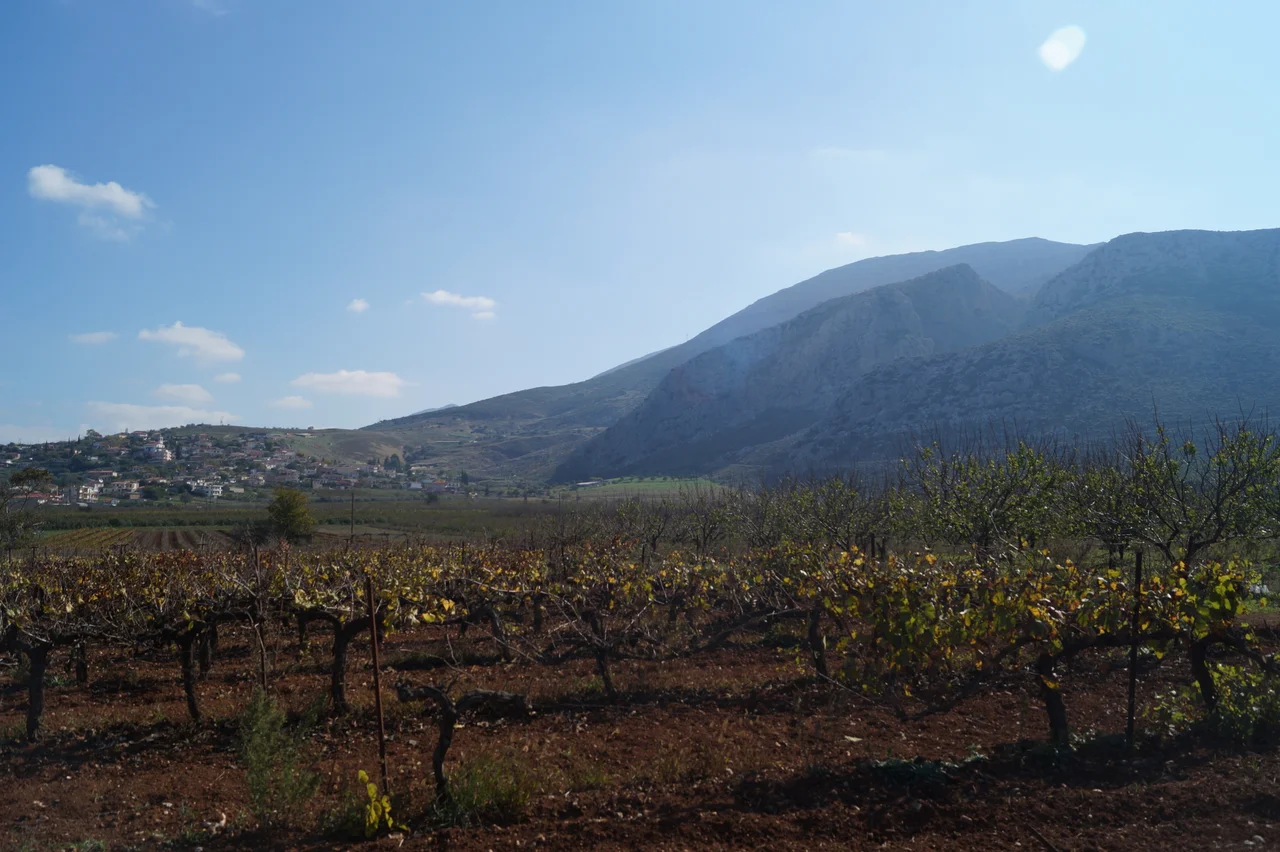

Agios Vasileios, Corinthia
In 1377, when a Frankish administrator drew up a list of the nine fortresses in the Principality of Achaea, Agios Vasileios ranked second in size after Corinth itself. A village of 85 houses holding the Chouni Pass — that was the entire entry. Seven centuries later, the village still holds the pass, still sits 25 kilometers south of Corinth along the old road to Argos, still produces olives and apricots in the shadow of the Dafnias mountains. The fortress is ruins. The farms endure.
Obsidian and Bronze
Fragments of obsidian — the volcanic glass that ancient people shaped into blades and scrapers — scatter across the hillsides around Agios Vasileios. They turn up in the Chouni Pass, in the cave of Antonis near Agios Sostis, on the slopes of Dafnias mountain. Each shard is evidence that people moved through this corridor long before anyone thought to record their names.
At Zygouries, just west of the village, the American archaeologist Carl William Blegen excavated a Bronze Age settlement in the 1920s, finding remains that dated to around 1300 BC. It was, by his reckoning, one of the most important prehistoric sites in the Balkans. Agricultural clearing and forestry have since damaged the site significantly, and much of what Blegen uncovered has been lost to later land use. The loss is real. But the obsidian fragments remain, scattered testimony to a way of life that preceded even Zygouries.
Hadrian's Water, Homer's Town
The Romans knew this country well. Emperor Hadrian's aqueduct, which drew water from Lake Stymfalia and carried it to Corinth, ran directly through Agios Vasileios. Traces of the channel survive today at the western entrance to the Chouni Pass and on two private properties in the village — quiet evidence of engineering on an imperial scale.
Northwest of the village, on the hill of Archaies Kleones, stood the ancient settlement of Cleonae. Homer described it as well built. The walls of its acropolis are still preserved on the hill's northern face. More recently, excavations in the nearby area of Varella uncovered the farmstead of a wealthy landowner decorated with intricate mosaics — a reminder that prosperity, in this fertile corridor between Corinth and Argos, did not belong only to cities.
The Fortress Above the Pass
Sometime between 1204 and 1250, Frankish rulers built a fortress on Dafnias mountain overlooking the Chouni Pass. It sat on the foundations of an older Mycenaean fort — the latest occupants in a long line stretching back through every power that had ever wanted to control the road south. When the archaeologist A. Bon excavated the Frankish structure, he estimated it measured 225 meters by 130 meters.
In 1365, a tax document listed the fortress as belonging to the Florentine banker Niccolò Acciaioli — and in the same breath noted that the village below had grown into a regional center. That document contains the earliest written use of the name Agios Vasileios, which means Saint Basil. By 1377, the settlement counted 85 houses and claimed second place among the principality's towns. Then the wars came: the Venetians seized it in 1463, and the fortress was destroyed in 1467, again in 1469, and yet again in 1471. By the Venetian census of 1700, the village had contracted to 27 families and 97 people, none of whom, on average, had yet reached fifty.
The Battle at the Pass
On 26 July 1822, the Battle of Dervenakia was fought in these hills. Ottoman forces under the commander Dramali, pushing south through the Peloponnese, were caught in the passes by Greek fighters under Theodoros Kolokotronis. The battle ended in the decisive defeat and near-elimination of the Ottoman force. Afterward, Kolokotronis posted guards at the fortress of Agios Vasileios to ensure that no Ottoman supplies could slip through the Chouni Pass. The pass that had mattered to Mycenaeans and Franks and Venetians had mattered once more, at the founding moment of the modern Greek state.
In 1836, Agios Vasileios was declared a municipality and absorbed the surrounding villages of Stefani, Archaies Kleones, and Vousbardi. By 1885, its population had reached 700. The 20th century brought contraction: administrative reclassification in 1912 reduced it to a commune, though new parishes continued to form within it as recently as 1972.
Honey Melons and Olive Trees
In the middle decades of the 20th century, Agios Vasileios was known across the region for its honey melons — sweet, fragrant, the kind of local specialty that defines a place in the memory of everyone who grew up eating them. That reputation has faded as agriculture diversified. Today the farms around the village produce olives, apricots, wheat, wine grapes, tobacco, and vegetables, their terraces stepping down the hillside much as they have for centuries.
The Chouni Pass still carries traffic between Corinth and Argos, though paved roads have replaced the old national road for most travelers. The Frankish fortress sits in ruins above the village, its stones gradually returning to the hillside. Below it, the village continues — quiet, agricultural, tucked between mountains that have always known how to keep the world at bay.
From the Air
Agios Vasileios sits at approximately 37.793°N, 22.801°E, about 25 km south of Corinth in the foothills of the Dafnias mountains near the Chouni Pass. Approach from the northeast at 4,000–6,000 feet for a clear view of the pass corridor linking the Corinthian plain to the Argolid. The nearest major airport is Athens International Eleftherios Venizelos (LGAV), approximately 85 km to the northeast. In clear weather, the Gulf of Corinth is visible to the north and the broad Argive plain opens to the south beyond the pass.
Nearby Stories
- Aigosthena 2.2 km away
- Kefalari (Argolis) 2.4 km away
- Cleitor 4.2 km away
- Helike 8.7 km away
- Stemnitsa 9.1 km away
- Methana Volcano 12 km away
- Megara 18 km away
- 1981 Gulf of Corinth Earthquakes 24 km away