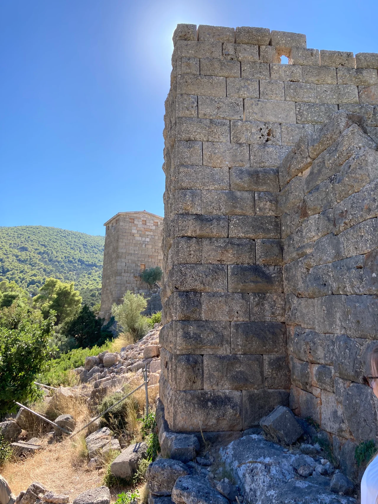

Aigosthena
Porto Germeno is easy to overlook on a map — a tiny beach resort with a permanent population of 80, tucked into a bay on the Gulf of Corinth where the mountains come down to the water. But climb a little above the village and you find yourself inside a Hellenistic fortress that has no business surviving this well. The towers rise two, three, four stories. The walls still stand to full height in stretches. The masonry is so carefully cut and fitted that scholars still argue about who built it, debating whether Demetrios Poliorcetes constructed it himself or simply moved in after someone else did the work. The ancient name is Aigosthena, and it is among the best-preserved fortifications of its era anywhere in Greece.
At the Edge of the Megarid
Aigosthena occupied the northern tip of the Megarid, the small territory of ancient Megara that stretched between Attica and the Corinthian plain. It was the city's only port on the Gulf of Corinth — its western maritime window — set at the inlet of a sheltered bay in what is now called the Alkyonides Gulf. Mount Cithaeron rises to the north, its wooded slopes pressing close; Mount Pateras stands to the south. The result is a site that feels both protected and isolated, connected to the sea but cut off from the interior by mountains. Ancient Xenophon mentioned it in the Hellenica, and Pliny the Elder noted it in his Natural History — brief references, but evidence that the place mattered.
The Fortress That Remains
The ancient site of Aigosthena consisted of an acropolis citadel on a low hill 450 meters from the sea, connected to the waterfront by two long fortification walls forming a corridor to the harbor. The citadel measured roughly 90 by 187 meters, trapezoidal in plan, defended by eight artillery towers built into its perimeter. Eight towers meant eight platforms for catapults and bolt-throwers — this was not simply a refuge but a designed fighting machine. The walls show multiple phases of construction, with sections in isodomic ashlar, pseudo-isodomic, and polygonal masonry, suggesting rebuilding over time. The northern wall to the sea survives for 370 meters, six towers and a fortified gate running in nearly a straight line from the citadel to the water. Some of the final tower's foundations are now underwater.
Towers That Still Stand
What makes Aigosthena exceptional is not its plan, which is conventional for Hellenistic military architecture, but its condition. The towers at the southeastern corner of the citadel rise to heights rare among surviving Greek fortifications. Scholars rate the walls among the finest preserved examples of Hellenistic military construction in Greece, distinguished by the quality of craftsmanship: hammered-face ashlar with drafted corners, fitted without mortar to tolerances that have resisted two thousand years of earthquakes, floods, and neglect. There are quarry marks still visible in the bedrock south of the southeast tower, where the builders cut stone directly from the hillside. The fortress was fortified after 370 BC, according to the design analysis of the artillery towers; the late 4th century BC is the most commonly accepted date.
League Cities and Beach Visitors
Aigosthena passed through the hands of several powers in the Hellenistic period. The site was under the control of the Achaean League between 243 and 224 BC, then joined the Boeotian League from 224 to 146 BC. An inscription of around 420 AD still listed it as a free city, long into the Roman period. Medieval builders added a five-aisled Christian basilica inside the lower fortified area, and a monastery complex occupied the citadel. Then the site slipped from memory, and the walls were left to the mountain air. The village that grew at the fortress's foot — Porto Germeno — is now a summer destination, small and quiet, where visitors swim in the gulf and look up at towers that were already old when the Romans came.
From the Air
Aigosthena (Porto Germeno) sits at approximately 38.147°N, 23.229°E on the eastern shore of the Alkyonides Gulf, an inlet of the Gulf of Corinth. Flying northwest from LGAV (Athens International Eleftherios Venizelos) — about 48 km by air — the terrain rises sharply as the plane crosses the mountains separating Attica from Boeotia. The Gulf of Corinth opens to the west, and the village of Porto Germeno appears below the wooded flanks of Mount Cithaeron. The fortress walls are visible from low altitude against the hillside above the village. Recommended viewing altitude 2,000–3,000 feet for the clearest view of the wall circuit and towers.
Nearby Stories
- Spata 1.1 km away
- Helios Airways Flight 522 5.7 km away
- Anthedon (Boeotia) 6.1 km away
- Euboea 8.2 km away
- Salamis Island 9.9 km away
- Davleia 11 km away
- Corinthia 11 km away
- Mount Helicon 14 km away