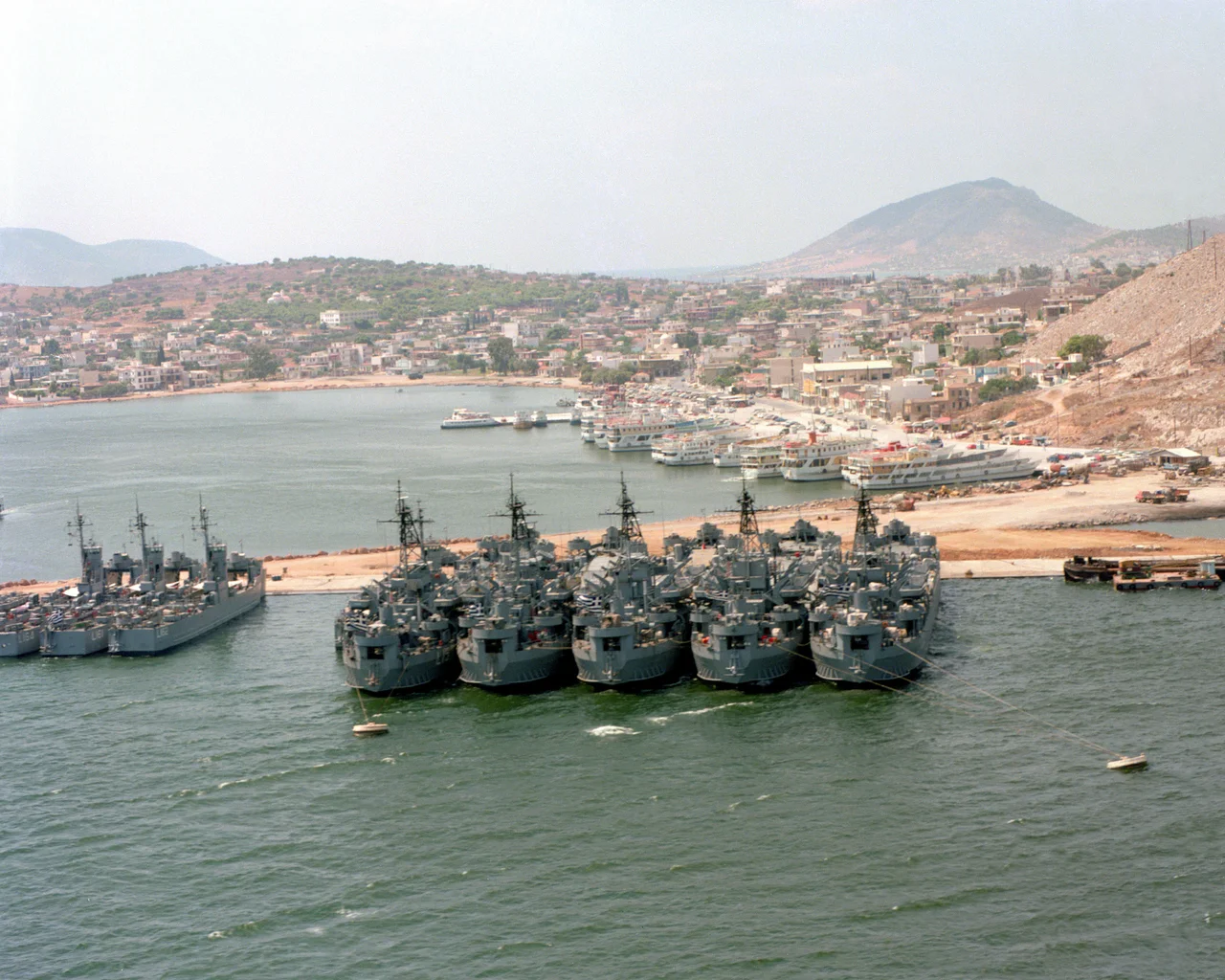

Salamis Island
The Athenians who rowed into the Strait of Salamis on a September morning in 480 BC were fighting for their city's life. Persia's fleet — hundreds of triremes — had bottled them in. What happened next in these narrow waters would decide whether the Persian Empire swallowed Greece, or Greece survived to become the seedbed of philosophy, democracy, and drama. The Greeks won. And on the island that gave the battle its name, that morning still hangs in the air.
The Day That Changed Everything
Themistocles chose the strait deliberately. The narrow channel neutralised Persia's numerical advantage: where hundreds of ships cannot manoeuvre freely, a smaller fleet of nimbler triremes can punch through. The Persian fleet — estimates range from 300 to more than 1,000 vessels — crowded into a killing ground it could not escape. The Athenian-led Greek fleet, with roughly 370 triremes, shattered it. Xerxes I watched from a throne on the shore of Attica as his armada was destroyed before him. He retreated to Persia shortly after. The battle in 480 BC is considered one of the most consequential naval engagements in history — a moment when the survival of Greek culture, and by extension much of what the West would later build on, hung on the outcome of a single afternoon. Salamis the island was there at the centre of it. The playwright Euripides was said to have been born on the island on that very day.
Myths, Kings, and a Counting Board
The island's story stretches far beyond that single battle. In mythology, Salamis was the daughter of the river god Asopus; her son Cychreus became the island's first legendary king. Ajax the Great — Homer's towering warrior of the Trojan War, who led twelve ships from Salamis — was said to have been born here, and the island's second-largest town, Aianteio, still carries his name. In 1846, something stranger than mythology surfaced: the oldest known counting board in the world, carved in marble, was discovered on the island. Scholars believe it was used around 300 BC — possibly Babylonian in origin — with Greek symbols and parallel grooves worn smooth by calculation. It sits now in the Epigraphical Museum in Athens, an artefact of ordinary life in an extraordinary place. The hero Georgios Karaiskakis, a central figure of the Greek War of Independence in the 1820s, is buried here too; the island seems to collect the weight of Greek history without quite trying.
A Crescent Island, Two Lives
Salamis covers 93 square kilometres and curls in a crescent shape — which is why locals called it Koulouri, meaning 'bread ring,' for centuries, until the ancient name was officially restored in the 19th century. Its highest point, Mavrovouni, reaches 404 metres. The island wears two faces depending on which coast you approach. The northeastern shore, closest to the industrial port of Perama and the Salamis Naval Base, buzzes with shipyards, ferries, and naval traffic. The southwestern side is quieter — pine forests unusual for this part of Attica, sandy beaches at places like Kanakia and Kaki Vigla, and the 18th-century Monastery of Saint Nicolas set in forest outside Aianteio. The monastery of Faneromeni, near which the poet Angelos Sikelianos kept a cottage, adds another layer of quiet dignity. The island has roughly 31,000 permanent residents, but that number swells toward 300,000 in summer when Athenians arrive for weekends and holidays.
Greece's Naval Heart
The Salamis Naval Base — Nafstathmos in Greek — is the headquarters of the Hellenic Navy and one of the reasons the island carries its particular dual identity: ancient monument and active military installation. The base occupies a significant portion of the northeastern coast, and parts of the island remain restricted. The ferry connection to Perama is so frequent and so short that Salamis functions almost as a suburb of Athens — the crossing from Paloukia takes minutes. Yet the island has resisted full domestication. The heavy industry on the Attica shore opposite, pollution from port activity, and the patchwork development of the junta years in the 1960s and 70s have left scars, particularly on the eastern coast. What the island keeps is harder to erase: the strait between Salamis and Attica is still the same strait where the Persian fleet broke apart in 480 BC, and on a clear day, standing at the water's edge, the scale of what happened here is easy to feel.
What Remains of a World-Altering Morning
There is no grand monument to the Battle of Salamis on the island itself — the Athenians built their victory temple on the Acropolis, not here. What Salamis has instead is presence: the water, the hills of Attica visible across the narrow strait, the sense of a place that has been inhabited continuously since before recorded Greek history. Visitors come by short ferry from Perama or Piraeus, walk the harbour at Paloukia, eat at tavernas in the town of Salamina, and sometimes climb toward Mavrovouni for the view over the gulf. The island is close enough to Athens to feel familiar, far enough to feel apart. For a place that helped decide the fate of Western civilisation on one September morning in 480 BC, it wears its significance lightly — and is perhaps more honest for it.
From the Air
Salamis Island lies at approximately 37.94°N, 23.49°E, roughly 16 km west of central Athens. From the air at 5,000–8,000 ft, the crescent shape of the island is clearly visible, with the Strait of Salamis — the site of the 480 BC naval battle — separating it from the Attic mainland to the east. The Salamis Naval Base occupies the northeastern shore; the port of Paloukia is the main ferry terminal. Nearest major airport: LGAV (Athens International Airport, Eleftherios Venizelos), approximately 25 km east-northeast. The Saronic Gulf stretches south; Piraeus and its massive port complex are visible to the east.
Nearby Stories
- Eleutherae 3.6 km away
- Methana Volcano 3.8 km away
- Marathon, Greece 5 km away
- Tiryns 5 km away
- Spata Training Centre 8.6 km away
- Corinthia 9.8 km away
- Agios Georgios (island) 16 km away
- Mount Helicon 23 km away