Airlines PNG Flight 4684
The last words the tower heard from Flight 4684 were not a mayday. They were a farewell in Tok Pisin: "Thank you very much, morning long you." The crew had just finished a routine exchange with another Twin Otter climbing out of Kokoda, and they were minutes from landing themselves. No alarms, no anomalies, just the usual crosstalk between two small aircraft threading the same narrow gap in the Owen Stanley Range. Then silence. On 11 August 2009, somewhere in the cloud wrapped around a ridge eleven kilometres southeast of Kokoda airstrip, the thirteen people aboard flew an otherwise airworthy aeroplane straight into a mountain they never saw.
The Gap That Won't Forgive
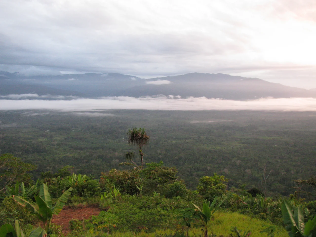
The Kokoda Gap is not really a gap. It is a dip in the Owen Stanleys, roughly eleven kilometres wide, low enough for small piston and turboprop aircraft to pass through on visual rules and punch down into the Yodda Valley toward Kokoda's short grass strip. On a clear morning, pilots descend through the saddle using terrain as their map: ridge here, river there, the palm-thatched roofs of the government station ahead. That morning, clouds filled the gap. Visibility dropped below the five kilometres required for a visual descent. The Twin Otter, flown by Captain Jannie Moala and First Officer Rodney Souka, was climbing to 9,000 feet and running a schedule that had left Port Moresby's Jacksons International Airport at 10:50 a.m. They had roughly half an hour of flying left. The ridges of the eastern Owen Stanleys rise above that altitude in several places.
Two Pilots, One Instrument Rating
Investigators later pieced together the flight's last minutes from a small GPS tracker carried aboard the aircraft. Twin Otters are not required to carry a cockpit voice recorder or a flight data recorder, so the telemetry device became the only witness. What it showed, combined with weather reports and eyewitness accounts, was an aircraft that had drifted east of its planned track and was descending into cloud over rising ground. Captain Moala had logged 2,177 flying hours, 1,836 of them on the Twin Otter. First Officer Souka had logged 2,150 hours, 1,940 on type. They were not inexperienced. But only one of them held a current instrument rating, and the Accident Investigation Commission could find no solid evidence that either had been trained in the aircraft's GPS approach procedures. The flight had been planned under instrument flight rules; the conditions demanded instrument flight skills; the cockpit, by regulation, did not have the full set of those skills available.
A Heart That Nobody Knew About
The investigation took an unexpected turn when pathologists examined First Officer Souka. His postmortem revealed critical coronary artery disease, severe enough that the examining doctor said a medical emergency could have occurred at any time. Souka's own family had known nothing of it. Whether something happened to him in those final seconds cannot be proven. The Australian Transport Safety Bureau, assisting the Papua New Guinea investigators, could only note the possibility: if Souka had collapsed or become incapacitated as the aircraft approached the cloud bank north of the gap, Captain Moala's workload would have spiked at the exact moment she least needed a distraction. That, combined with terrain she could not see, is the textbook recipe for what pilots call CFIT, controlled flight into terrain. An otherwise airworthy aircraft flown into the ground by a crew unaware the ground is there.
Twelve Passengers, One Captain, One Co-Pilot
The thirteen people aboard were not abstractions. Among them was Matthew Leonard, a part-time tour guide and the son of a Western Australian police inspector, on his way to meet trekkers starting the Kokoda Track. Several Victorians and Queenslanders had booked the flight for the same reason, to walk the wartime route their grandfathers had fought along. For many Australians, flying into Kokoda is an act of remembrance before it is a holiday. Searchers located the wreckage the day after the crash, deep in timbered jungle on the eastern slope of the gap. There were no survivors. The Kokoda Track trekking season paused. In Perth, Brisbane, Melbourne and across Papua New Guinea, families waited for confirmations that came slowly because the terrain itself resisted recovery. Captain Moala and First Officer Souka died at their controls, doing a job that connects remote communities to hospitals, schools and markets across a country where roads hardly exist.
What the Wreckage Changed
Kokoda Airport in 2009 had no ground-based navigation aids of its own. Pilots approaching the strip relied either on GPS, which both crew had apparently used without formal approach-procedures training, or on the distance-measuring equipment at Girua Airport near Popondetta, well off the direct line from the gap. The accident became part of a wider conversation about how small operators in remote Pacific nations train their pilots, what avionics are required on aircraft serving weather-prone approaches, and whether the Twin Otter, beloved workhorse of bush aviation, should still be flying without recorders that might have told a fuller story. Airlines PNG later rebranded as PNG Air. The Kokoda run continued, because it must. Every pilot who has flown the gap since has done so knowing what the cloud can hide, and what happened in August 2009 to thirteen people who simply wanted to reach the other side of the mountains.
From the Air
Crash site located at 8.88 degrees south, 147.73 degrees east, on the eastern slope of the Kokoda Gap roughly 11 km southeast of Kokoda Airstrip (AYKO). The gap is a low saddle in the Owen Stanley Range, useful for VFR traffic between Port Moresby (AYPY, Jacksons International) and the Yodda Valley. Recommended viewing altitude 9,000 to 12,000 feet, well above the surrounding ridges. Weather in the gap is notorious for fast-forming cloud and reduced visibility; minimum 5 km visibility is the standard for visual descent. Nearby airports: Jacksons International (AYPY) 120 km southwest, Girua (AYGR) near Popondetta 45 km northeast, Kokoda (AYKO) 11 km northwest of site.
Nearby Stories
- Battle of Mission Ridge-Brigade Hill 19 km away
- Invasion of Buna–Gona 25 km away
- Kokoda Track 27 km away
- Papua New Guinea National Museum and Art Gallery 34 km away
- Wards Airfield 63 km away
- Battle of Wau 156 km away
- Battle of the Bismarck Sea 158 km away
- Japanese Submarine Ro-103 265 km away