Aitape
On a map, Aitape is easy to miss - a dot on the north coast of Papua New Guinea, roughly halfway between Wewak and Vanimo, eighteen thousand people living beside a warm blue sea. On the ground, it is one of the most haunted coastlines in the Pacific. Aitape has been hit by three tsunamis in ninety years, occupied by both the German Empire and the Imperial Japanese Army, and watched an Australian intelligence soldier beheaded on its own beach in 1943. It has electricity, a bank, a supermarket, two airstrips, and a hospital. It also has a collective memory that stretches back further than any of them.
Sails from Afar
Contact between the Aitape region and the outside world is believed to have begun in the fifteenth century, when large Chinese sailing expeditions reached these shores. By the early seventeenth century, Malay fishing fleets were working along the Sepik coast and recruiting local island men as navigators. Long before Europeans arrived, the Siau villages at Sissano, Malol, and Arop, together with the Bakla islanders of Tumleo, Ali, and Seleo, made annual trading expeditions down to the area around Wewak. These were substantial, organised communities with routes and rhythms of their own. When the Society of the Divine Word established its first mission on Tumleo Island in 1896, it was entering a coastline that already had a long history of outside contact and a clear sense of itself.
A German Prison and a Powerful Radio
Aitape began as a formal settlement when German colonists built a station here in 1905, part of German New Guinea. The Germans found the Siau and Bakla people difficult to govern - the district was officially classed as 'uncontrolled' throughout the German colonial period - but they built a solid prison in town anyway, and installed a radio powerful enough to speak directly with Europe. By 1914 there were 68 missionaries and six mission stations along the coast. Then the First World War ended German rule overnight. Australia took over, and Aitape became part of the Territory of New Guinea, administered under a League of Nations mandate. The coastal catholic mission continued its work, now under Australian oversight.
The Beach, 24 October 1943
When Japan occupied the Territory of New Guinea in 1942, Aitape fell along with the rest of the north coast. The following year, on 24 October 1943, Australian intelligence sergeant Leonard Siffleet was beheaded on the beach by his Japanese captors. A photograph of the moment before the execution survived the war, and Siffleet's face - calm, direct, knowing - became one of the most enduring images of the Pacific conflict. American forces retook Aitape on 22 April 1944 as part of Operation Persecution, deliberately bypassing the larger Japanese garrison at Wewak. A base grew here, repulsed a major Japanese counter-attack along the Driniumor River, and then passed to Australian command while General MacArthur moved on toward the Philippines. The Aitape-Wewak campaign that followed, from November 1944 to August 1945, was the last Australian land campaign of the war.
Three Waves in Ninety Years
Long before the war, in 1908, a tsunami struck the coast between Arop and Sissano hard enough to collapse a strip of shoreline into the sea, creating the Sissano Lagoon where villages had stood. A second tsunami hit in 1935. Then, in July 1998, the worst of them: a magnitude 7.0 earthquake just offshore triggered an undersea landslide, and waves averaging ten and a half metres swept over the narrow spit where Warapu village sat, about eight kilometres west of Aitape. More than 2,000 people died. Entire settlements simply ceased to exist. The survivors rebuilt further back from the water, but the memory of what the sea can do in a matter of minutes here remains very close to the surface.
A Town That Keeps Going
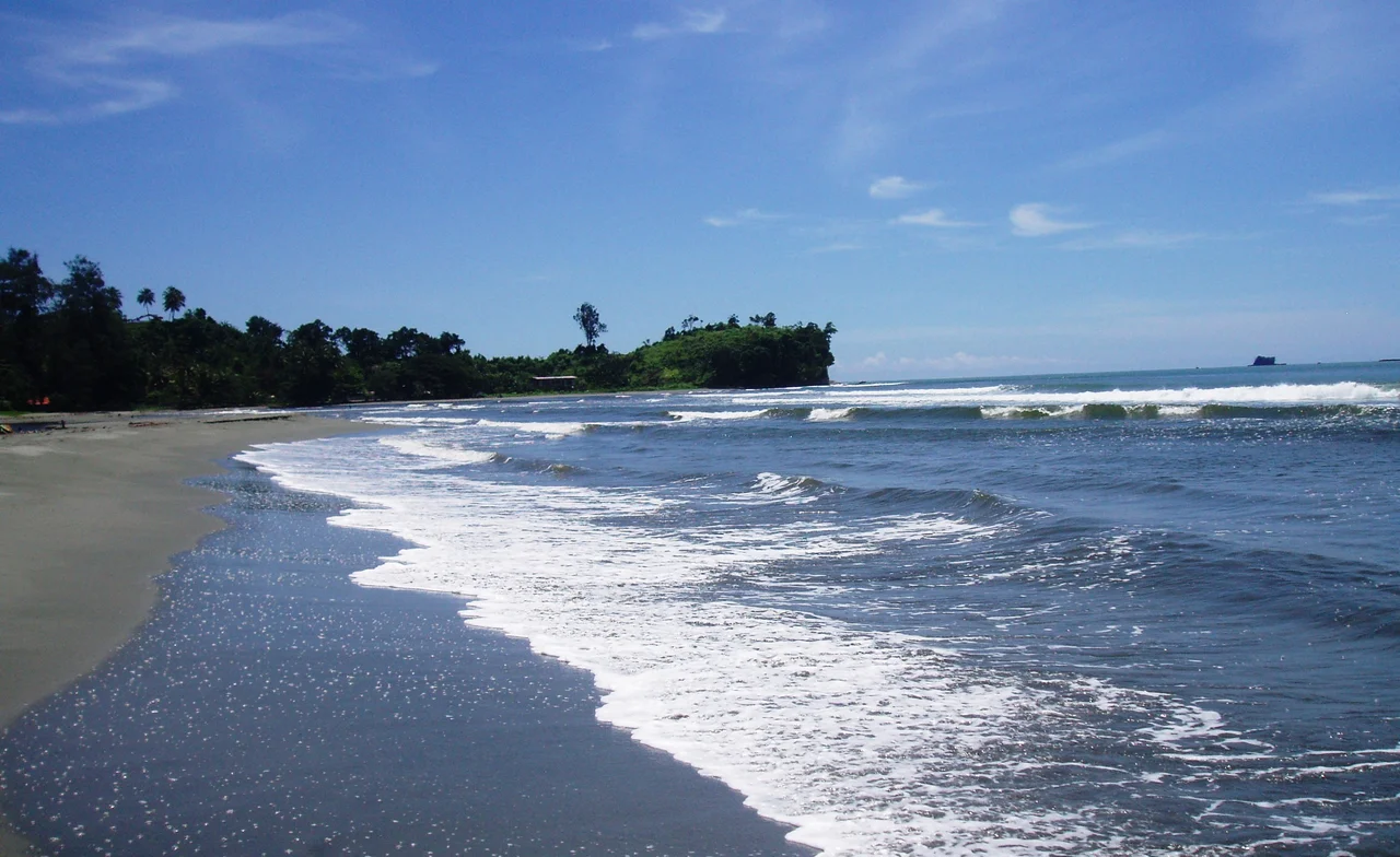
For all of that, Aitape is a working town, not a ruin. It has 240-volt power running more or less around the clock, telephones, a courthouse, a police station, a supermarket, and a hospital. Two airstrips serve it: Tadji (TAJ), ten kilometres east, where most flights land, and the smaller Aitape airstrip (ATP). The road to Wewak - 180 kilometres of logging track - is the lifeline to the east; the road to Vanimo has been non-functional since at least 2017, so boats have taken over that route. The climate is classic tropical rainforest, with heavy rain year-round. On clear days the reef islands offshore show pale against the dark blue of the Bismarck Sea, and the mission continues its long work along the coast.
From the Air
Aitape lies on the north coast at roughly 3.13 degrees south, 142.35 degrees east, between Wewak to the east and Vanimo to the west. Tadji airport (AYTA / TAJ), the former WWII Allied airstrip, is the primary air gateway, located 10 km east of town. The smaller Aitape airstrip (ATP) serves light aircraft. Wewak (AYWK / WWK) is 180 km to the east by road or short flight. From altitude the Sissano Lagoon is visible immediately west of town - a long, pale, enclosed body of water separated from the sea by the low spit that was overtopped by the 1998 tsunami. Expect heavy tropical rain year-round and frequent afternoon cloud buildups over the coastal ranges inland. The shoreline runs east-west with small offshore reef islands (Tumleo, Ali, Seleo) visible just off the coast.
Nearby Stories
- 2002 Sandaun Earthquake 34 km away
- Operation Copper 95 km away
- Trikora 109 km away
- Battle of Hollandia 123 km away
- 2024 East Sepik Earthquake 138 km away
- Dutch New Guinea 168 km away
- Merpati Nusantara Airlines Flight 9760D 192 km away
- Manus Island 470 km away