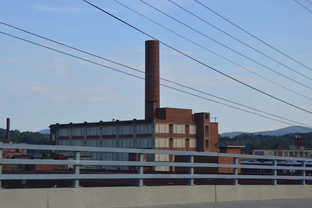

American Viscose Plant Historic District
Before nylon, before polyester, before all the synthetic miracles of the late twentieth century, there was viscose. The British called it artificial silk. Americans called it rayon. And in 1916, a British textile giant looking for a place to make the stuff settled on 212 acres along a bend of the Roanoke River, where the water ran fast enough and clean enough to feed an industry. Within a decade, the American Viscose plant in Roanoke had ballooned into what was reportedly the largest rayon producing mill in the world, employing more than 5,000 people and pulling whole rural communities into its orbit.
The Town That Rayon Built
Construction began in 1916 on the first of three enormous processing plants, each with two spinning units. A second went up in 1921, a third in 1925. By 1922, more than a thousand women were on the payroll, many of them recent arrivals from surrounding farms learning to thread the spinnerets that pushed cellulose solution into fiber. American Viscose did not build company housing, but it did not have to — Southeast Roanoke filled in around the plant with single-family houses, and the Wasena neighborhood across the river grew through the 1920s on viscose paychecks. The plant ran its own 2,000-seat cafeteria around the clock. It had an infirmary, athletic fields, and by 1923 a social club with 2,800 members.
Boom, Bust, Lend-Lease
By May 1926, a fifth spinning unit was operational. That same year, the company laid off 1,200 workers and cut the remaining workforce to 32 hours. The roller-coaster years that followed brought a 40-hour week in 1937, a union contract in 1939, and then a strange wartime twist: when the United States pushed Britain to liquidate American assets to help pay for Lend-Lease, the Roanoke plant changed hands. The trouble started after the war. American Viscose had built newer mills in Front Royal and in Nitro, West Virginia, and rayon itself was losing market share to nylon. By 1958, the Roanoke plant — once the world's largest — was shut. A group of local investors bought the property in 1961 and converted it into an industrial park, where it has spent the past sixty years quietly leasing warehouse space.
What Remains
Sixteen of the original buildings still stand, most of them little altered from the spinning days. The complex has chimneys that have, fittingly, started failing one by one against the weather. The federal Superfund program took an early look in the late 1980s and concluded the contamination did not warrant priority cleanup; the EPA confirmed the assessment in 2001. A flood-control project by the Army Corps of Engineers was delayed by the complex's industrial history. The district was added to the National Register of Historic Places in 2019, recognizing what it had been — and hinting at what it might become.
Riverdale: The Next Chapter
In 2023, the Roanoke City Council approved a deal to remake the property as a mixed-use neighborhood called Riverdale. The city offered a $10 million forgivable loan in exchange for at least $50 million in private investment over seventeen years. Almost immediately, the brownfield reality set in: preliminary testing flagged a high vapor-intrusion risk from a hazardous waste tank that had once sat next door. Chemsolv, a tenant of the park, had been fined more than $600,000 in 2014 for improper waste storage, and had removed the tank before investigators could fully measure its damage. A deed restriction currently prohibits residential development on the site. The owners hope further remediation will lift it. The future of the place where 5,000 Roanokers once spun artificial silk is still being negotiated.
From the Air
Located at 37.255°N, 79.922°W along the Roanoke River in Southeast Roanoke, just east of downtown. The long industrial complex is visible as a distinctive cluster of large early-twentieth-century buildings between the river and the rail lines. Nearest airport: Roanoke-Blacksburg Regional (KROA), roughly 4 nm northwest. Cruise altitudes of 4,000-6,000 ft AGL provide clear views of the river valley between the Blue Ridge ridges.
Nearby Stories
- Radford University 6.2 km away
- Hargrave Military Academy 10 km away
- Monroe County, West Virginia 14 km away
- Botetourt County, Virginia 20 km away
- Battle of Galudoghson 21 km away
- Poplar Forest 25 km away
- Martinsville, Virginia 27 km away
- Galax, Virginia 46 km away