_(2).jpg)
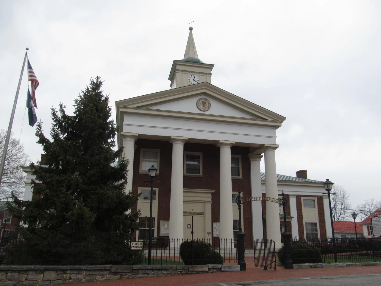
Botetourt County, Virginia
When Botetourt County was carved out of Augusta County in 1770, it included the southern half of present-day West Virginia and all of Kentucky. Most of a continent answered to a county seat in the Blue Ridge foothills. Over the next eighty years, pieces broke off to form new counties - Fincastle in 1772, eventually Kentucky in 1792, and so on - until in 1851 the boundaries shrank to roughly what they are today. The name comes from a man who barely lived to see the county: Norborne Berkeley, the 4th Baron Botetourt, who served as governor of the colony of Virginia from 1768 until he died unexpectedly in office in 1770. The colonists liked him. The county kept his name.
Where the James Begins
The James River is Virginia's defining waterway, running 348 miles from the Blue Ridge to the Chesapeake. It begins here, in Botetourt County, just south of the Alleghany County line near the village of Iron Gate. Two streams converge there - the Cowpasture River, flowing down from Highland County, and the Jackson River, draining the Allegheny highlands - and the combined flow becomes the James. From Iron Gate the river runs south to Eagle Rock, where it bends east and meanders through the county, passing Springwood and James River High School before entering Buchanan. In Buchanan it turns sharply north and crosses into Rockbridge County toward Glasgow. Two mountain ranges hold the county in place: the Blue Ridge runs along its eastern flank, and the Ridge-and-Valley Appalachians run along the west, the two coming so close together at Buchanan that the town and the river fit through the gap together.
Fincastle, County Seat
The town of Fincastle, founded in 1772, is the seat of Botetourt County. Its name remembers the Fincastle County that was briefly carved from Botetourt - itself named for Viscount Fincastle, a son of Lord Dunmore. Fincastle today is small and tidy, with a historic district that traces its 18th- and 19th-century roots. The county was first proposed in the House of Burgesses in 1767, three years before it came into being. Norborne Berkeley, 4th Baron Botetourt, the man whose name marks the county, served as colonial governor for two years before his sudden death. He had been a popular figure with the colonists, helping to manage relationships in the run-up to the American Revolution. The county he never visited has carried his name for over two and a half centuries.
Orchards Becoming Subdivisions
Botetourt County is part of the Roanoke metropolitan statistical area, and in recent decades the southern parts of the county have suburbanized rapidly. The farmland and orchards that once defined this stretch of valley have given way to residential subdivisions and businesses pushing north from Roanoke. The 2020 census counted 33,596 people - up from 30,496 in 2000 - and the median age was 48, well above the national median, reflecting both the suburban-retiree pattern and the steady aging of rural America. Lord Botetourt High School in Daleville, opened in 1959, serves the southern part of the county. James River High School in Springwood, opened the same year, serves the northern part - the more rural, more river-bordered part where the James winds through Eagle Rock and Springwood and the Cowpasture meets the Jackson.
Parkway, Forest, and the National Lands
Three federally protected areas overlap Botetourt: the Blue Ridge Parkway runs through the eastern edge, the George Washington National Forest covers stretches of the higher ridges, and the Jefferson National Forest takes in much of the western mountain country. These public lands shape the experience of driving through the county. Heading east from Roanoke on Route 460, then turning onto the Parkway, you enter a different kind of geography - one of overlooks, blooming rhododendron in June, and slow time. The Peaks of Otter, the three-summit cluster that defines the eastern county skyline - Sharp Top, Flat Top, and Harkening Hill - rise just over the line in Bedford County but are clearly visible across much of Botetourt. The James River, running through the heart of the county, was once a working river of canal barges and ferries. Now it carries kayaks and the silence that follows.
From the Air
Botetourt County sits at 37.55 N, 79.80 W just north of Roanoke and east of the Allegheny ridge country. Cruise at 5,500 to 8,500 feet MSL for terrain clearance and valley orientation. The James River origin near Iron Gate is visible in clear conditions; the river winds east through Eagle Rock, Springwood, and Buchanan. The Blue Ridge Parkway runs through the eastern county; the Peaks of Otter rise just east of the county line. Nearest airport is Roanoke-Blacksburg Regional (KROA), about 20 nautical miles south. Watch for ridge-induced turbulence in westerly winds and possible mountain wave.
Nearby Stories
- Sweet Briar College 3.3 km away
- Paint Bank, Virginia 10 km away
- Battle of White Sulphur Springs 11 km away
- Murders of Alison Parker and Adam Ward 14 km away
- 2023 Virginia Cessna Citation Crash 16 km away
- Blacksburg 24 km away
- The Omni Homestead Resort 29 km away
- Red Hill Patrick Henry National Memorial 32 km away