
Amposta
The town's name tells you where it stands. Amposta comes from the Latin for 'placed on the river,' and the river in question is the Ebro, Spain's mightiest, in the final stretch before it slows and fans out into a vast delta of rice paddies and salt pans. Sit on its banks and you understand the name instantly. The wide brown water slides past the old facades, herons stalk the shallows downstream, and everything about the place, its living, its history, its horizon, flows from the river it was placed upon.
Placed on the River
Amposta is the gateway to the Ebro Delta, and it wears that role with quiet pride. The whole area lies within the Terres de l'Ebre, a UNESCO Biosphere Reserve, and the pilgrim route known as the Ebro Way of Saint James threads straight through the city on its long inland course. The town's most distinctive face turns toward the water: a river frontage unique in Catalonia, where handsome buildings such as the Lafont house, the López i Soler house, and the old Miralles mill line up along the bank and gaze out over the current. It is a townscape composed for the river, by people who never forgot what put them there. The old Miralles mill among them recalls the days when the Ebro itself was a highway, carrying grain, timber, and travelers up and down a waterway that stitched the Spanish interior to the sea long before any motorway did.
A Bridge Like Brooklyn's
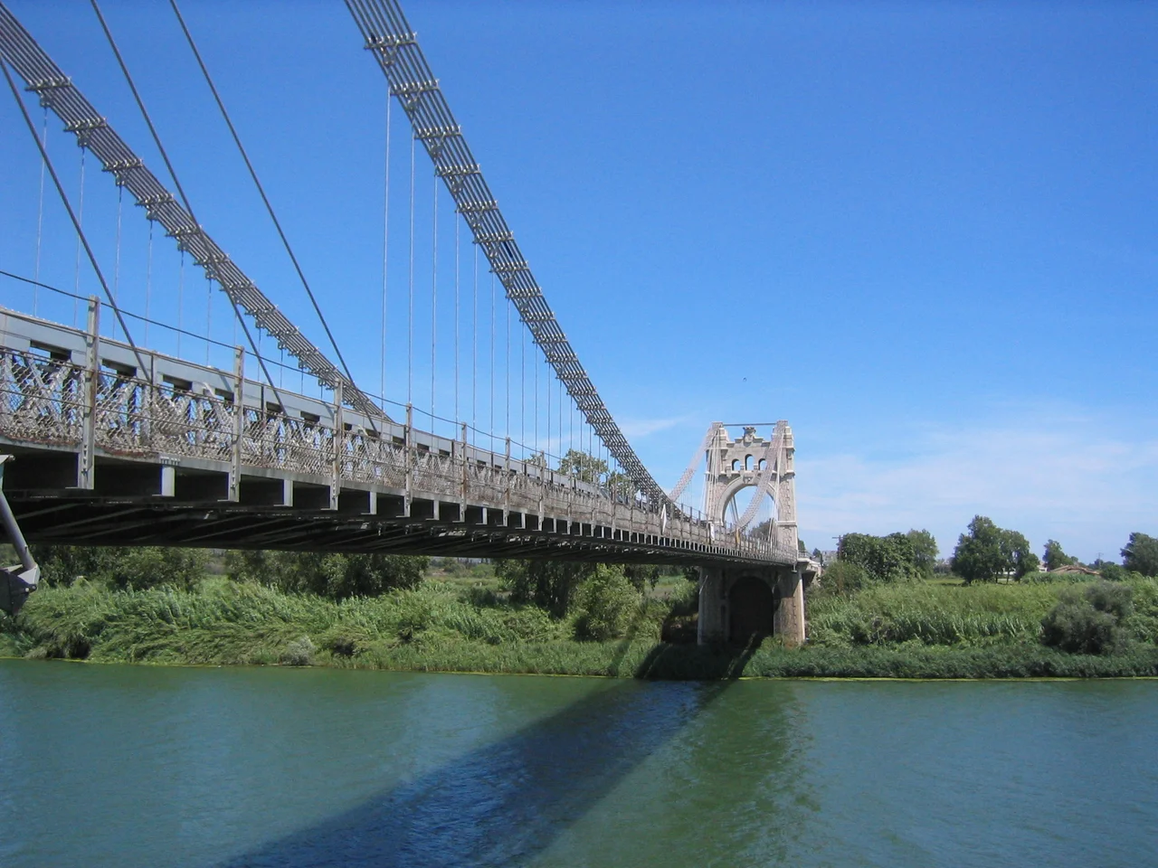
The structure that defines Amposta's skyline is a suspension bridge, and it has an unlikely pedigree. Begun in the years around 1915 and completed by the early 1920s, the Pont Penjant was among the first reinforced-concrete suspension bridges in the world, and it was openly inspired by New York's Brooklyn Bridge. Two great stone pylons shaped like triumphal arches anchor its cables on either bank of the Ebro, a bold flourish of engineering for a Catalan delta town. The bridge did not escape the twentieth century unscathed. During the Spanish Civil War it was bombed as a vital crossing on the lower Ebro, then rebuilt, and it still spans the river today, part monument and part working road.
The Hospitallers' Seat
Long before the bridge, a castle raised in the twelfth century made Amposta a place of consequence. Its exposed coastal position, without natural barriers to shield it, left the early town open to constant raids from the sea, and it grew slowly and warily as a result. But its fortress became the seat of the Castellany of Amposta, the principal house of the Knights Hospitaller across the Crown of Aragon, giving this river town a weight in medieval affairs far beyond its size. From here the order administered lands and drew revenues, and the name of Amposta echoed in charters and councils well removed from the muddy banks of the Ebro. Placed on a coast with no natural defenses, the town learned early that the same river which fed it also laid it open to whoever came sailing up the estuary, and it grew slowly, always with one eye on the water.
Delta of Rice and Salt
Step beyond the town and the delta takes over, one of the great wetlands of the western Mediterranean. The Delta de l'Ebre Natural Park spreads out in a mosaic of lagoons such as la Tancada and l'Encanyissada, where birdwatchers come for herons, waders, and the pink drift of flamingos feeding in the shallows. The land is astonishingly productive. Rice grows in flooded fields, salt is raked from coastal flats, oysters and mussels are farmed at the river's mouth, and the markets brim with clementines, olive oil, shellfish, and delicate baby eels. It is a landscape where the boundary between river, land, and sea blurs into a single, teeming whole, and Amposta sits right at its threshold.
From the Air
Amposta lies at 40.71°N, 0.58°E on the Ebro river at the head of the Ebro Delta, roughly 10 km inland from the coast in Tarragona province. View it at 2,000–4,000 ft; the delta's flat expanse of rice fields, lagoons, and salt pans fans out to the southeast toward the sea. Reus (LERS) sits to the north, Valencia (LEVC) to the southwest, and Castellón–Costa Azahar (LECN) further down the coast. The broad Ebro and its suspension bridge at the town are the standout landmarks, with the geometric grid of flooded rice paddies and the shimmer of coastal lagoons making the delta unmistakable from the air in clear weather.
Nearby Stories
- Benicarló 8.9 km away
- Miravet 11 km away
- Morella 12 km away
- Reus 23 km away
- Penyagolosa 37 km away
- Roman Theatre (Tarraco) 49 km away
- Battle of Belchite (1937) 74 km away
- Banyalbufar 149 km away