
Anna Creek Station
A single cattle property out here is larger than the State of Israel. Anna Creek Station covers roughly 23,677 square kilometres of arid country in the Far North of South Australia, which makes it the largest working cattle station on the planet. To stand at its heart is to be a long way from anywhere: the only township is tiny William Creek, which the station completely surrounds, and the nearest town for freight is the opal-mining outpost of Coober Pedy. The scale is hard to hold in the mind. Anna Creek is more than 8,000 square kilometres bigger than its closest Australian rival, and over seven times the size of the largest ranch in the United States. Yet for all its vastness, this is thin, hard country, and it has always been Arabana land first.
Arabana Country
Long before any lease was drawn on a colonial map, this land belonged to the Arabana people, and in law it belongs to them still. The country around the great salt lake the Arabana have always known, the lake settlers later called Lake Eyre, carries their stories and their water knowledge. In 2012 the Federal Court formally recognised Arabana native title over more than 68,000 square kilometres, an area taking in Anna Creek and the lake itself. The determination affirmed Arabana rights to use the natural waters of the determination area and to share and exchange traditional resources across it. The pastoral lease and that native title now sit over the same ground, two systems of belonging laid one atop the other, the older one reaching back tens of thousands of years.
Sheep, Dingoes, and a Switch to Cattle
The European story began in January 1863, when Julius Jeffreys, John Warren, and William Bakewell took up the lease from the colonial government and built their first homestead at Strangways Springs. They tried sheep. The land had other ideas. A brutal drought gripped the property between 1864 and 1866, and dingoes harried the flocks relentlessly until the owners gave up on wool and turned to cattle instead. That decision shaped everything that followed. Cattle could range across the saltbush plains and gibber flats in a way sheep never could, and the station settled into the rhythm it keeps to this day, its herd swelling and collapsing with the desert's violent cycles of flood and drought.
The Day Canberra Stepped In
For most of its history Anna Creek was part of the cattle empire of S. Kidman & Co. When that empire came up for sale in 2016, Anna Creek became briefly famous for reasons that had nothing to do with cattle. A Chinese-led consortium moved to buy the Kidman holdings, but Anna Creek lies inside the Woomera weapons-testing range, and Federal Treasurer Scott Morrison blocked the foreign sale in the national interest. The standoff was resolved in December 2016 when the South Australian family firm Williams Cattle Company bought Anna Creek for an estimated sixteen million dollars, while the rest of the Kidman empire passed to a consortium led by mining magnate Gina Rinehart. With one purchase the Williams family doubled the area they held under pastoral lease.
Mustering an Empire
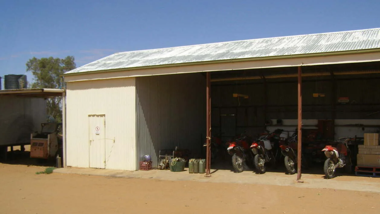
Running cattle across a property this size demands a different kind of work. In the old days a large crew of stockmen rode the boundaries on horseback, weeks at a time in the saddle, gathering scattered cattle across distances most farms could never imagine. Today the muster is done from the air and the saddle of a motorbike: light aircraft spot the mobs from above and ringers on trail bikes push them in, a far smaller workforce covering far more ground. The herd itself rises and falls dramatically with the seasons. In the drought-stricken 2000s the station carried as few as 1,500 head; after the floods of 2010 refilled the country it climbed past 10,000, and in good seasons it can run upward of 16,500 head across its endless paddocks. Scattered through that immensity stand reminders of an earlier age, the heritage-listed ruins of the Strangways Springs and Peake telegraph stations, relics of the line that once carried messages across the continent's red heart.
From the Air
Anna Creek Station is centred near 28.85°S, 138.13°E in the Far North of South Australia, an immense expanse of red gibber plain and saltbush with almost no relief. There is no single landmark to find; instead, navigate by the surrounding features, the gleaming white of Lake Eyre to the east and the tiny settlement of William Creek roughly in the station's midst, served by an airstrip (YWMC) on the Oodnadatta Track. The vast pale scar of Lake Eyre is the dominant visual reference from altitude. Best viewing of the open country is from 4,000 to 8,000 feet AGL. This is genuinely remote airspace: refuel and check NOTAMs carefully, as the station borders the Woomera Prohibited Area, and large stretches of restricted military airspace lie to the south. Coober Pedy (YCBP) is the nearest substantial aerodrome for fuel and services.
Nearby Stories
- Killalpaninna Mission 7.2 km away
- Lake Eyre 40 km away
- Cooper Creek 42 km away
- Marree 51 km away
- Ediacara Hills 73 km away
- Mungerannie 101 km away
- William Creek 124 km away
- Olympic Dam mine 152 km away