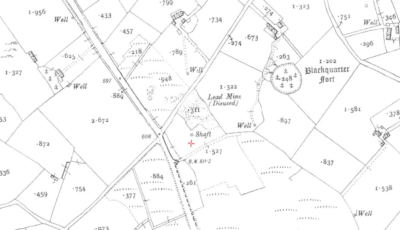

Annaglogh Lead Mines
On the property of Philip McAdam in Annaglogh, County Monaghan, two mine shafts opened up in the year 2010. Nobody had been quite sure they were still there. The shafts swallowed nothing important; the Office of Public Works arrived, back-filled them, and made the ground safe again. They had collapsed before, in the late 1960s, and were filled in then too. Above ground, all that marks the spot is a stone chimney base, some old spoil heaps, and the new house built where the mine agent's residence stood until 2007. Below ground, in a vein of galena running south to north through the drumlin country near Castleblayney, lies a buried piece of the 19th-century industrial Atlantic that almost nobody now remembers.
The Captain From The Angel Hotel
On Monday 6 April 1846, at the Angel Hotel in Liverpool, a group of investors held a shareholders' meeting and capitalised the North Eastern Mining Company of Ireland at £8,000. Their man on the ground was Captain James Skimming, born 1817, a Scot whose career took him from the Bond Mine to Coolartragh, Lemgare, Lisdrumgormley, and Hope, all within a few miles of the Armagh-Monaghan border. He worked alongside a Cornish mining engineer named George Henwood, and at one point the two of them held licences covering 120 square miles of the west of Ireland through the Galway and Mayo United Mining Company. Skimming lived at Annaglogh through the working years of the mines. His wife Elizabeth died there in 1872. He followed her in 1880, eight years before the Castleblayney company that had bought him out closed the last shaft for good.
What They Were Chasing
The mineral was galena, the heavy grey lead-sulphide ore that catches the light like polished hematite when freshly broken. The Annaglogh lode ran north into Lemgare and Lisdrumgormley along a fault line in the local slates, with a footwall of Tertiary basalt and a matrix of quartz and calcite. Some shafts reached forty fathoms, around 240 feet down. At Annaglogh itself, production peaked between 1860 and 1865 at 300 to 400 tonnes of ore raised annually. The Lisdrumgormley lode further north was said to be still rich in argentiferous galena, lead ore laced with silver, at the deepest workings. The real money, when there was any, came from the Tassan Mine south of Tonagh townland. Tassan opened in the late 1840s under Captain Joseph Backhouse and was worked hardest by the Castleblayney Mining Company from 1856 until it closed for good in 1867.
The Cost-Book Companies
Annaglogh was financed in a way that has almost vanished from modern memory: the cost-book company. Investors put up small shares of capital, paid calls when needed, and took dividends when ore was raised. Most of these companies never listed on the London Stock Exchange and so never filed the reports that the Mining Journal would have preserved for posterity. The result is that detailed records of what was actually mined, by whom, and how deep, are now patchy at best. The Geological Survey of Ireland has admitted in correspondence that its maps "do not necessarily capture the full extent of a feature, particularly if it is inaccessible." Translation: nobody is entirely sure where some of the shafts go. The 2016 hearings on EirGrid's North-South Interconnector ran into exactly this problem when the pylon route was proposed straight across these old workings.
Holes That Open By Themselves
Lead mining ended here in 1867. The reminders did not. In the early 2000s, an active quarry at Lemgare broke into uncharted underground workings from the Coolartragh mines, last worked over a century before. In 2010, the two shafts on McAdam's farm collapsed. In 2012, a shaft opened on James Watters's property at the old Lisdrumgormley mine. At the original Annaglogh chimney site, a series of shafts collapsed across the 1960s and 1970s, and each time the landowner, Patrick Morgan, filled them back in himself, not knowing that the state had a responsibility to make the workings safe. The ground here is not stable. It hasn't been since Captain Skimming's day, and probably will not be again.
Reading The Field
Visit the spot today and the most visible thing is the base of the stone engine-house chimney, which still rises from a hummock above the spoil heaps. The 1857 Ordnance Survey 6-inch map marks five shafts at Tassan; almost no trace of them survives at the surface. Lemgare Mine was briefly reopened in the early 1950s by Billiton NV during prospecting work, and the adit there extends about 110 metres along a fault zone, with a 10-centimetre rib of galena still visible on the fault plane. Walk the drumlin country between Annaglogh and Lemgare on a quiet afternoon and the past is in the texture of the fields: the hollows where engine houses stood, the slight rise of the spoil heaps, the slightly different green where lead-bearing rock was once piled up to weather. The mines are gone. The geometry remains.
From the Air
Annaglogh sits at 54.19°N, 6.76°W in the rolling drumlin country of County Monaghan, about three miles southwest of Castleblayney and just south of the Northern Ireland border. From altitude, the area is a patchwork of small fields and lakes; the old mine workings are not visible from the air but the proposed North-South Interconnector pylon line crosses this ground. Best viewed at 3,000-5,000 ft. Nearest airports: Belfast International (EGAA) about 45 nm north-northeast, Dublin (EIDW) about 50 nm south-southeast.
Nearby Stories
- Castlecaulfield 2.1 km away
- Miami Showband killings 3.6 km away
- Cabra Castle 7.8 km away
- Crom Castle 7.9 km away
- Crumlin, County Antrim 16 km away
- Kesh Ambush 22 km away
- Clonfin Ambush 26 km away
- Mornington 28 km away