Araguaia National Park
Bananal Island sits in the middle of the Araguaia River in the state of Tocantins, a freshwater island roughly the size of Jamaica and the second largest inland river island in the world. Four indigenous peoples - the Javae, Karaja, Ava-Canoeiro, and Tuxa - live in sixteen villages on its southern two-thirds, a cultural reserve where non-indigenous Brazilians are not allowed to settle. The northern third is Araguaia National Park, 557,700 hectares of flooded forest and grassy savanna that became a national park in December 1959. To get there, you fly to Palmas, take a bus or hired car to a river town called Caseara, and hire a boat. There is no bridge. Driving is impractical except during the two driest weeks of the year, when you might ford the river in a truck.
An Island in a River
The Araguaia is a slow river that does not like to stay in one channel. Somewhere in its long journey north to meet the Tocantins, it split around an obstruction in its bed and never rejoined - or rejoined only at the island's downstream tip, far enough north that a landmass the size of a small country grew between the two branches. That landmass is Bananal. Inhabitants along the banks have always treated it as both island and opposite shore. The park covers only the northern end, about 100 kilometers from its northern tip south to the boundary with the indigenous preserve. Riverfront shoreline dissolves into extensive swamps and marshes in the rainy season, and the denser rainforest stands further inland, above the reach of the seasonal floods.
Four Nations, One Island
Under Brazilian law, the southern two-thirds of Bananal is reserved for indigenous populations, and has been since 1973 when legislation was passed to designate much of the island as a reserve. The four nations living in the sixteen villages there are distinct. The Javae and Karaja are Karaja-speaking peoples with deep ties to the Araguaia, traditionally fishing communities whose ceremonies marked the rise and fall of the river. The Ava-Canoeiro are a small group whose contact history is recent and traumatic. The Tuxa are originally from the lower Sao Francisco River far to the east, displaced communities who resettled on the island. Non-indigenous Brazilians cannot live on Bananal Island. The park to the north is the buffer between their world and the wider economy pressing on every other side.
Between Two Biomes
Bananal sits at the meeting point of two great South American biomes: the Amazon rainforest to the north and the cerrado savanna to the south. The park contains both, depending on whether you are near water or not. The flooded forests and marshes hold rainforest species. The drier inland grasslands carry cerrado fauna - rheas, large flightless birds you might mistake for small ostriches, stride through grass that hides quail and other ground-nesting species. In the water below, you find marsh deer in the reeds and jaguars in the denser forest, as well as the maned wolf, a tall-legged animal that looks like a fox on stilts. The river itself has anacondas, black caimans, and two species of dolphin - the pink Amazon river dolphin and the gray tucuxi.
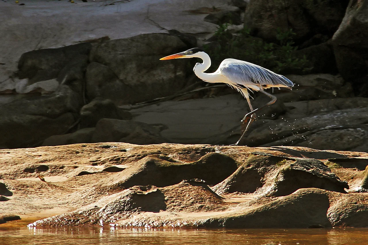
The Birdwatchers' Census
Toucans and macaws are the noisy headliners. But the water is where the real variety turns up - anhinga drying their spread wings after a dive, herons and egrets stalking the shallows, ospreys dropping feet-first into the flooded forest to lift out fish. The savanna contributes rheas and ground-nesting quails. For many of the species, the park is a seasonal waystation: migrants move through on the rise and fall of the Araguaia, using the wetlands as a refueling stop between breeding grounds further south and wintering grounds further north. A patient birder with a decent scope can clock a hundred species in a few days, but only if the water is where it needs to be, which is to say only if the rains have done what they usually do.
Getting There
The airport that matters is in Palmas, the planned capital of Tocantins, reached by flights from Brasilia. From Palmas you take a bus or arrange transport to Caseara, a small river town. From Caseara you hire a boat, which is the practical way to enter the park. Tour guides will drive you to alternate embarkation points, but those options depend on the season. There is no bridge across the Araguaia to Bananal, and driving across the riverbed in a four-wheel-drive is possible only in the driest weeks of the dry season, usually in September. Once on the island, you walk, or you bicycle, or you ride a horse. The absence of other options is the point. The park's remoteness is its protection.
From the Air
Coordinates 10.50 S, 50.17 W. The park occupies the northern tip of Bananal Island, the second-largest river island on Earth. Recommended viewing altitude FL060-FL080 for clear views of the Araguaia splitting around the island. The watershed transitions from Amazon rainforest to cerrado savanna here, giving the landscape a mottled green-and-tan appearance in the dry season. Nearest airports: Palmas (SBPJ) is the commercial gateway, Caseara has a small airstrip. Seasonal flooding (January-April) dramatically expands the wetted area - from altitude, the river appears to swallow much of the island.
Nearby Stories
- Pan Am Flight 202 52 km away
- Cantão State Park 56 km away
- Ilha do Bananal / Cantão Environmental Protection Area 60 km away
- 2021 Palmas FR Plane Crash 116 km away
- Varig Flight 254 222 km away
- Querência 273 km away
- São Miguel do Araguaia 284 km away
- Porangatu 306 km away