Cantão State Park
For two to six months every year, starting in October, the Cantao becomes a lake. The rains come, the Araguaia and Coco rivers rise, and the abandoned channels and oxbow lakes that thread the alluvial plain between them fill and join into a single continuous body of water. What was forest floor becomes river bed. What was river bank becomes submerged root. In this landscape of seasonal flooding, species that cannot adapt to a few months underwater do not persist, so the forest is dominated by plants whose trunks tolerate the annual soaking - igapo, the flooded forest, a uniquely Amazonian ecosystem. The 90,018-hectare park protects it on the Tocantins side of the Araguaia River, directly across from where Bananal Island begins.
Between Two Rivers
The Cantao sits in the municipality of Pium in western Tocantins. Its western boundary is the Araguaia River, the same river that defines the Para state border and wraps around Bananal Island downstream. Its southern boundary is the Javaes River, which separates the park from Araguaia National Park on Bananal Island. To the east lies the Ilha do Bananal and Cantao Environmental Protection Area, a buffer zone that extends the protection into adjacent land. Inside the park, a broad alluvial plain stretches between the Araguaia on the west and the Coco River on the east. The Coco is geologically young in a sense - it was probably a meander of the Javaes at some earlier point, which was itself a branch of the Araguaia, and the whole region reads like a river system that keeps changing its mind about which way the water wants to flow.
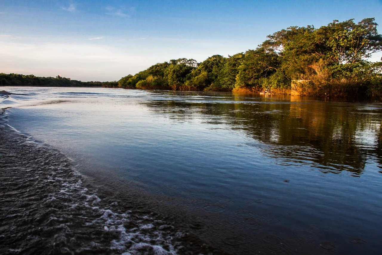
The Rise and Fall
Abandoned channels and lakes dot the alluvial plain. Each one is a memory of a river course that the Araguaia or Coco eventually abandoned. In the dry season, they appear as disconnected ponds, sometimes muddy, sometimes deep and clear, scattered through what looks like flat forest. Then October comes. The rains begin. The rivers rise. Water backs up into the lower ground. For two to six months, the lakes swell, connect, and eventually merge into a continuous inland sea that covers most of the park. Trees stand in it up to their lower branches. Fish swim through what would, in May, be walking paths. When the water recedes at the start of the next dry season, the lakes reveal what the flood carried and left behind - eggs, new silt, whole new generations of fish hatched in conditions that are, for a few months, kind to them.
An Ecotone at Work
The Cantao holds a transition zone - an ecotone - between the Amazon rainforest of the north and the cerrado savanna of the south. Species from both biomes share ground here. You find rainforest mammals and cerrado birds within walking distance of each other. The park supports a large population of jaguars, Panthera onca, at a density higher than many larger protected areas can match. The lakes function as nurseries - fish, turtles, and caimans use the seasonally flooded forest as breeding and juvenile habitat, and the population of predators that feed on them is correspondingly dense. This is an ecosystem that runs on the flood pulse. Remove the flooding, and the productivity collapses. Every construction project upstream that would even out river flow threatens what makes the Cantao work.
Birds and Endemics
One bird survey counted 317 species in the park. Among them are two endemics whose ranges barely extend beyond this stretch of alluvial plain. The bananal antbird, Cercomacra ferdinandi, is a small gray bird of the flooded forest understorey, named for Bananal Island just to the south. The Araguaia spinetail, Synallaxis simoni, lives in dense riparian scrub along the rivers. Both species are on the edge of what qualifies as conservation concern simply because their global range is narrow. Beyond them, the park supports the full cast of Amazonian water birds - toucans, macaws, anhingas, herons, egrets, ospreys - and the savanna complement of rheas, quails, and ground-nesters. On a good day along a sandbar that has emerged in the dry months, you can watch South American river turtles crawl up to lay eggs within sight of a kingfisher diving from a branch.
Law and Infrastructure
The Cantao State Park was created by state law 996 of July 14, 1998, with an original area of 88,929 hectares. Four years later, state law 1,319 of April 4, 2002, expanded the boundaries to the current 90,018 hectares. The management plan was first approved on August 25, 2005, and revised on August 3, 2016. As of 2016, the park was supported by the Amazon Region Protected Areas Program, a federal initiative that funnels international funding into Amazonian conservation. Ordinance 740 set the rules for the Projeto Quelonios, a turtle-conservation program that monitors nesting beaches and protects eggs from poaching. The park itself has the infrastructure rare among Amazonian protected areas - a visitor center, accommodation, a dock, vehicles, boats, a staff residence, and a parking area, plus educational programming. A working park, visited, with rangers on site.
From the Air
Coordinates 9.69 S, 50.07 W. The park sits in the municipality of Pium, Tocantins, on the east bank of the Araguaia River opposite Bananal Island. Recommended viewing altitude FL060-FL080. Look for the chain of oxbow lakes and abandoned channels threading the alluvial plain between the Araguaia and Coco rivers. Seasonal flooding (October-April) dramatically changes the landscape from distinct lakes to a continuous inland sea. Nearest airports: Palmas (SBPJ) about 150 km east, small airstrips in Pium. Clear dry-season (May-September) flying offers sharpest views of the lake network.
Nearby Stories
- Ilha do Bananal / Cantão Environmental Protection Area 12 km away
- Pan Am Flight 202 18 km away
- Araguaia National Park 54 km away
- 2021 Palmas FR Plane Crash 113 km away
- Tocantins 156 km away
- Varig Flight 254 227 km away
- Carajás National Forest 382 km away
- Tapirapé-Aquiri National Forest 410 km away