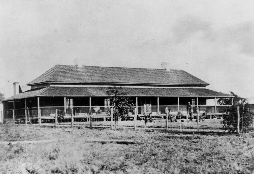

Aramac Station
The name is a riddle solved by a tree. Somewhere on a creek in central Queensland, the pastoralist Robert Ramsay Mackenzie carved his initials into the bark: "R.R. Mac." When the explorer William Landsborough came through in 1859 and found the watercourse, he named it for those letters, and so a creek, and later a station, and later a whole town came to be called Aramac, the contracted signature of a man who would go on to become Queensland's first colonial treasurer and, briefly, its premier. He never lived here. He only left his mark, and the mark became a place.
The People Whose Country This Was
Long before any of that, this was Iningai country. The plains along Aramac Creek, a tributary of the Thomson River, had been home to the Iningai people for thousands of years, and when an archaeologist later excavated one of the old camp sites along the creek he recorded the artefacts of that far older occupation lying beneath the leavings of the Europeans who came after. The newcomers wrote the station's history in stock numbers and sale notices, but they were settling a landscape that was already named, already known, already lived in. That deeper claim runs underneath everything that follows, and it should be remembered first.
A Run on the Frontier
The station was established in 1863, just after neighbouring Bowen Downs, when John Rule and Dyson Lacey settled along the creek and stocked it with sheep. The country tested them at once. Waterholes failed in the dry, and when the rains finally came in June the creek flooded so hard the men found their homestead built too close to the water and had to drag it to higher ground. This was also a violent frontier, and the violence ran in more than one direction. Lacey and one of the station's shepherds were speared by Aboriginal men defending their country. The first manager, Alexander "Long" Gordon, is recorded as having shot a large number of Aboriginal people near Greyrock in nearby Mailman's Gorge, an atrocity that some early accounts tried to explain away. These were not abstractions. They were people killed on contested ground, and the pastoral wealth that followed was built on that dispossession.
Sheep by the Hundred Thousand
Once established, Aramac grew into one of the great runs of the west, sprawling across roughly 850 square miles of grazing and desert country. It changed hands often, each owner reckoned by the size of the flock. Roderick Travers folded it into his Malvern Downs holding; by 1875 Travers and Gibson grazed some 20,000 sheep behind 200,000 acres of new fencing that finally curbed the dingo attacks. Mobs of ten and fifteen thousand sheep were droved overland between stations, arriving, as one report dryly noted, looking remarkably well. By 1900, under the ownership of James Tolson, the run carried 150,000 sheep. The numbers are staggering, and they measure both the richness of the country and the sheer labour, much of it itinerant and hard, that turned grass into wool and wool into fortunes.
Fire, Hardship, and the Carve-Up
Life on the run was precarious for the men who worked it. In December 1876 bushfires swept the station, and Robert Durban, a town volunteer who had come out to help beat back the flames, was burned to death alongside a Pacific Islander labourer, one of the South Sea men whom the records of the day called by the term "Kanaka." The Forsyths, who then held Aramac, set up a fund for Durban's widow. The great run did not last. In 1930 the heavily stocked, worn-down station was subdivided and balloted off in seven blocks, drawing 396 hopeful applicants from across Australia, and the homestead, plant, and stock were sold. New farms rose from the pieces with names like Politic and Edgebaston, and one of the largest sheep stations in the west passed into memory, leaving its borrowed name on the town beside the creek.
From the Air
Aramac Station lies in central-western Queensland near 22.97 degrees south, 145.25 degrees east, close to the town of Aramac, about 83 km south-east of Muttaburra and 162 km north-west of Alpha. From the air this is wide, sparsely settled grazing country threaded by Aramac Creek as it runs toward the Thomson River; expect a flat patchwork of grassland and gidgee scrub with little relief. Nearest sealed field is Barcaldine Airport (ICAO YBAR) to the south; Longreach Airport (YLRE) lies roughly 100 km south-west for larger aircraft, with a basic airstrip at the town of Aramac itself. Clearest viewing comes in the dry season, when the channel country stands out and dust haze is at its lowest.
Nearby Stories
- Edgbaston Reserve 3.4 km away
- Mount Cornish Homestead 27 km away
- Beaconsfield Station Sheep Wash 33 km away
- Shearers' Strike Camp Site, Barcaldine 37 km away
- Bexley Station 60 km away
- Augustus Charles Gregory 155 km away
- Brigalow Belt 241 km away
- Cullin-la-ringo Massacre 252 km away