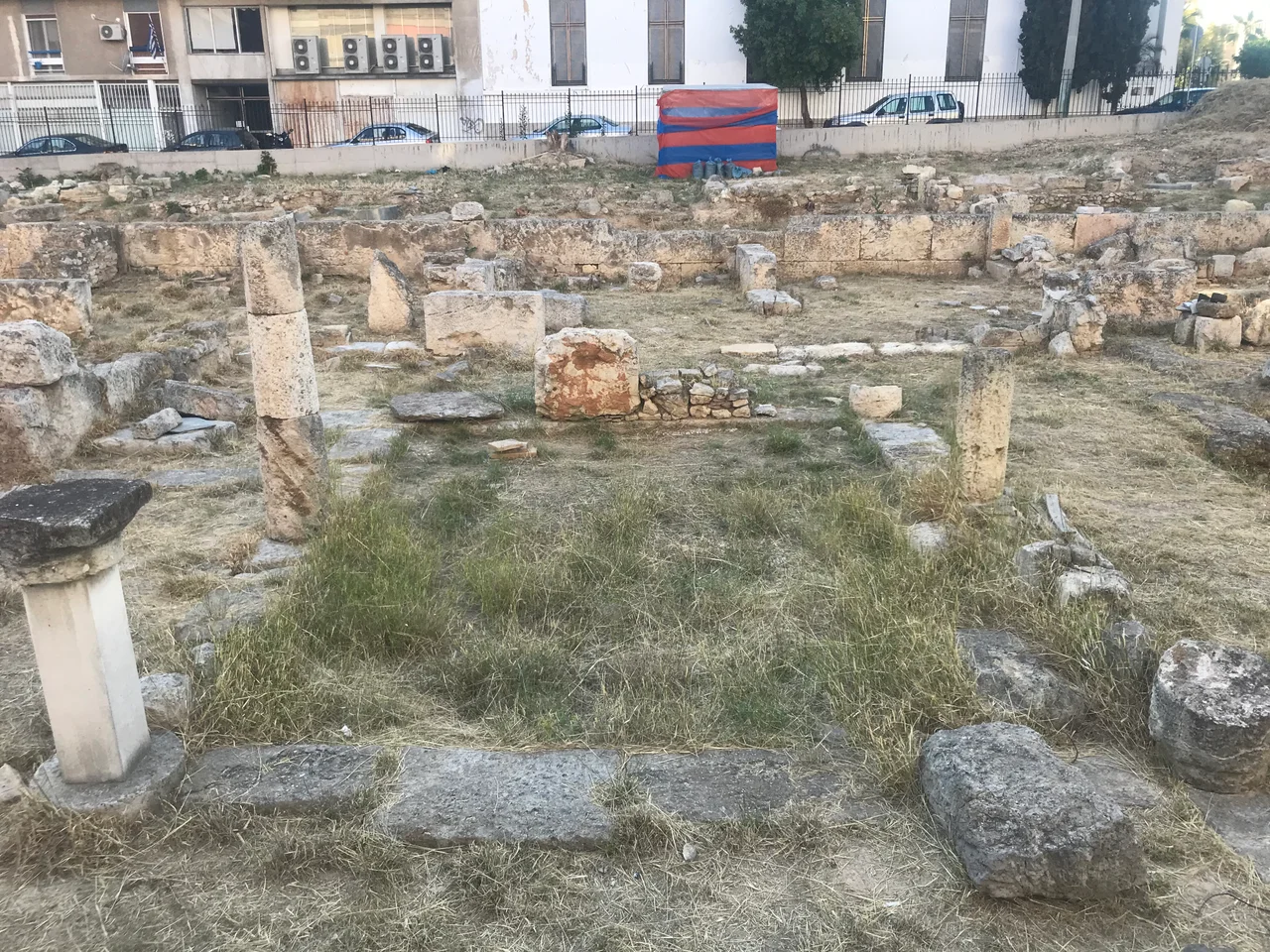

Archaeological Site of Terpsithea Square
Hippodamus of Miletus had a theory: that a well-ordered city produces well-ordered citizens. In the fifth century BC, Piraeus became his laboratory. When excavators dug beneath Terpsithea Square in 1995, they found his experiment intact — block by block, road by road, the rational geometry of the ancient world lying undisturbed beneath the modern port's bustle. A philosopher had drawn these lines. Time had preserved them.
The Philosopher Who Drew the Streets
Hippodamus was not just an architect. Ancient sources describe him as a philosopher, urban planner, and meteorologist — a man who believed cities could be designed from first principles, the way arguments could be built from logic. The street plan he laid out for Piraeus divided the city with precision: private residential zones separated from the naval station, the commercial quarter, and the sacred areas of the port. The underlying geometry was uncompromising. Each urban block measured 40.37 meters by 47.40 meters, divided internally into two rows of four houses. These blocks were grouped into neighborhoods called *synoikies* — a word that shares its root with *synoecism*, the merging of smaller communities into one larger whole. The very name of the neighborhood concept encoded a political philosophy: this was not just a housing arrangement, it was a civic argument made in stone and mortar.
A City Written in Roads
The Hippodamian grid worked through a hierarchy of streets, each with a specific width and purpose. Small Roads, 5 to 5.2 meters wide, threaded through the residential blocks, giving access to the *synoikies*. These fed into Medium Roads, 8 to 8.2 meters across, that circled the neighborhoods and linked them to larger flows of people and goods. Bisecting the entire city were two great arteries — the *plateies odoi*, or Large Roads — each 16.5 meters wide, connecting the public zones and the main city gates. Walking this grid in the fifth century BC, you always knew exactly where you stood: the width of the road beneath your feet told you your place in the urban order. The excavated site at Terpsithea Square contains two parallel Small Roads, one to the north and one to the south, with urban blocks running along both sides of the southern one — a street that, millennia later, now runs parallel to modern Skouze Street.
What the Cisterns Remember
The excavations of 1995–96 and 2000–2001, undertaken during the building of the Ralleios School, revealed more than walls and roads. Underground cisterns of different types emerged, tracing the evolution of Piraeus's drainage and water supply from the Classical Period forward. A sewerage pipeline appeared — evidence that the city's founders thought not only about where people would live, but about what would happen to the water that ran beneath their feet. The cisterns tell a story of an urban system that was improved and adapted across generations, each modification layering itself over the last until the whole became a kind of geological record of civic life.
The Roman Interlude and Its Violent End
Centuries after Hippodamus drew his lines, Rome made Piraeus its own. During the Roman period, someone consolidated the eastern plots of the site, tearing down four classical houses and erecting a single grand mansion in their place. The building was substantial: an atrium with a central peristyle, a pebble floor, a portico giving access to the rooms. It was comfortable, wealthy, ordered in a Roman rather than a Greek way. Then, in 267 AD, the Herulians sacked Athens. The mansion probably did not survive. The coins found on the site — many of them dating to precisely this period — suggest the destruction was sudden, the kind that leaves money on the floor because there was no time to gather it. The mansion was buried, and the street grid beneath it slept undisturbed for seventeen more centuries.
Gods of the Household
Among the objects recovered from the site, a pattern emerges in the religious life of the neighborhood's residents. A votive naiskos — a small shrine — dedicated to Cybele, the Mother of Gods, was found alongside marble statuettes of Aphrodite and clay figurines of Eros. These were not grand temple dedications; they were household objects, the everyday sacred. Cybele and Aphrodite as household cults: this was devotion practiced quietly, in the home, across the span of daily life. The coins on site range from the fifth century BC to the fourth century AD — nearly a thousand years of human occupation, compressed into a single excavation trench beneath a school being built in a modern Greek port city.
From the Air
The archaeological site of Terpsithea Square lies in the heart of Piraeus at 37.939°N, 23.645°E, roughly 10 kilometers southwest of central Athens. From the air, Piraeus appears as a dense urban mass wrapped around its great natural harbor, with the fingers of Zea Marina and Mikrolimano visible to the east of the main port basin. The site itself is inland, surrounded by the tight grid of modern streets — a modern grid that, without knowing it, echoes the Hippodamian one beneath. Approach from the east over Athens and the Saronic Gulf coastline comes into view, the port's container cranes and ferry terminals marking the waterfront. The nearest major airport is Athens International Eleftherios Venizelos (LGAV) approximately 25 kilometers to the east. A recommended viewing altitude of 1,500 feet on approach to LGAV gives a clear perspective of how Piraeus sits at the southwestern edge of the Athens metropolitan basin, separated from the city center by the low ridge of Kastella Hill.
Nearby Stories
- Parnitha 3.4 km away
- Kea (island) 7.3 km away
- Sanctuary of Apollo Maleatas 11 km away
- Sousaki Volcano 12 km away
- Battle of Leuctra 14 km away
- Great Sand Beach 18 km away
- Agios Georgios (island) 23 km away
- Skyros 84 km away