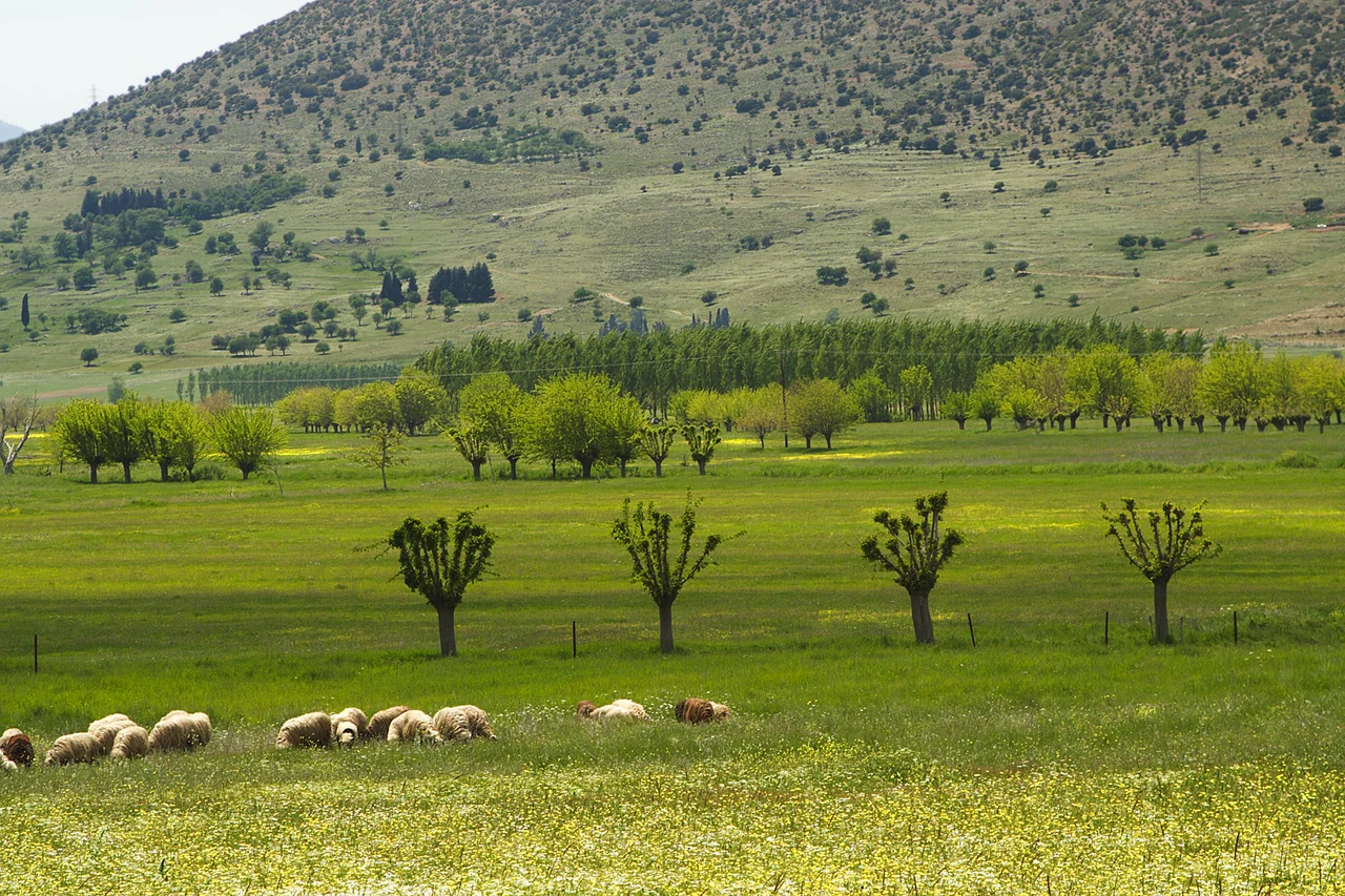

Argon Pedion
Pausanias named it the Untilled Plain — Argon Pedion — and explained it exactly right: the rain-water coming down from the mountains prevents the plain from being tilled, and nothing would stop it from becoming a lake permanently except that the water disappears into a chasm in the earth. He wrote this in the second century CE. Modern hydrogeology has since confirmed every part of his description and added the details: the water that vanishes into the limestone below the village of Nestani travels underground for approximately 190 hours before re-emerging as a submarine freshwater spring called Kiveri at the bottom of the Argolic Gulf, nearly 60 kilometers away as the crow flies. Pausanias called that spring "Dine" — the Whirlpool — and noted that fresh water rose out of the sea there. He did not know the mechanism. He knew the connection.
A Basin That Breathes with the Seasons
Argon Pedion is a polje — a closed karst basin formed in limestone terrain where no surface drainage exists. The basin measures approximately 4 by 2 kilometers and sits in the northeastern corner of the broader Tripoli Basin, which stretches 30 by 6 kilometers across the central Arcadian plateau. Two mountains facing each other at the basin's southern end create a gap 250 meters wide, but this gap sits higher than the basin floor, functioning as a dam: only floodwater reaching more than 5 meters deep can drain aboveground through it. Everything else must find its way out underground.
In wet winters, the sequence is straightforward and dramatic. Rain falls on the surrounding ridges, runs down into the basin, fills the drainage ditches, saturates the grassland, and begins to pool. The single katavothra — a natural drain opening in the limestone wall below Nestani — receives all of this water and must release it slowly through underground fissures. When precipitation is heavy enough, the katavothra cannot keep pace. A temporary lake forms. The lake rose in 2003, in 2014, and again in March 2019, each time turning the plain into an inland sea for days or weeks before the water finally drained away. Come April, the basin is green. By summer, dry.
The Underground Journey
The geology that makes Argon Pedion unusual is the same geology that defines much of the Peloponnese. The peninsula is dominated by carbonate rock — limestone and related formations of the type geologists call Tripoliza — that has been shattered by tectonic activity over millions of years. Water running through those fractures dissolves the calcium carbonate, gradually widening the cracks into channels, then passages, then cave systems. The Peloponnese is riddled with these underground waterways.
In 1983 and 1984, a series of dye-tracing experiments verified the path of Argon Pedion's water. Dye introduced into the katavothra below Nestani eventually appeared in the submarine spring Kiveri in the Argolic Gulf — a journey that, without obstruction, takes approximately 190 hours. The water that emerges at Kiveri does so beneath the sea, on the continental shelf, but it is fresh and of surprisingly good quality: chloride levels are extraordinarily low. A 5-meter-wide concrete canal built to capture this submarine discharge carries the water 15 kilometers inland to the fertile plain of Argos, where it irrigates farmland for thousands of families. The Arcadian highland, in this sense, feeds the Argolic lowland — an ancient hydrological connection now engineered into a modern supply system.
The Ladder Down from Artemisio
Pausanias describes the ancient approach to Argon Pedion from Argos with characteristic precision. The road climbed the mountain chain Artemisio to the Portitsa Pass, then descended abruptly into the basin via a zigzag path he called the Ladder — Klimax. He noted that the descent had steps cut into it. The ancient Portitsa Pass is still visible: a 6-meter-deep incision cut into the rock at the mountain crest, 3 meters wide — broad enough for a wagon, with wheel ruts still visible in the stone. The upper section of the Ladder itself remains, the historical zigzag route down into the basin identifiable on the ground.
The two villages that have long flanked the basin — Nestani at the lower end, Saga at the upper — oriented their lives around its rhythms. The people of Saga cultivated the fertile upper section of the basin and worked slope terraces around the village. The people of Nestani lived beside the katavothra that drained their world. Both communities relied on walled irrigation wells in the dry season, hand-dug and now rusted, some replaced by motorized pumps. Goats, sometimes called the "cows of the poor," grazed the waterlogged grassland in spring and retreated to the rocky slopes in summer when the plain dried.
Arcadia and Its Idea
The name Arcadia carries a weight of literary invention that has almost nothing to do with the actual landscape. It was Virgil who relocated the idealized shepherds of the Greek poet Theocritus to Arcadia, making it the homeland of pastoral idyll. Renaissance Italy, inspired by Virgil and patronized by Lorenzo de' Medici, turned Arcadia into the supreme literary setting for innocent rural life. Nicolas Poussin, painting in Rome, made the phrase Et in Arcadia ego — Even in Arcadia, there am I (death speaking) — into one of the iconic images of seventeenth-century European art.
The real Arcadia is mountainous, dry in summer, cold in winter, and sparsely populated. Its largest city, Tripoli, has around 30,000 inhabitants. There is no industrial production in the region. Migration, particularly after 1945, took many Arcadians to North America and Australia. The Argon Pedion — Pausanias's untilled plain, the geologist's closed karst basin, the shepherd's seasonal grassland — is precisely the kind of place that Arcadia actually is: specific, ecologically constrained, shaped by limestone and water and the slow negotiation between a landscape and the people who have tried, for millennia, to make it yield.
From the Air
Argon Pedion lies at approximately 37.631°N, 22.451°E in the northeastern Arcadian highlands, roughly 20 kilometers north-northeast of Tripoli. From the air, the basin is distinctive: a flat-floored oval depression ringed by higher terrain, with the village of Nestani visible at its southern end and Saga at its upper (northern) section. In winter and early spring, the basin floor may appear flooded or deeply saturated. Viewing at 5,000–8,000 feet gives excellent perspective on the closed drainage character of the polje and the relationship between the basin and the surrounding ridges. The nearest major airport is LGRX (Araxos/Patras), approximately 80 km to the northwest. The Portitsa Pass on the Artemisio range to the east is a distinctive feature visible from altitude.
Nearby Stories
- Peloponnese 5.1 km away
- Lepreum 6.4 km away
- Heraion of Perachora 6.6 km away
- Battle of Lalas 6.8 km away
- Aristarchos 2.3 m Telescope 11 km away
- Arkadiko Bridge 15 km away
- Battle of Chalandritsa 16 km away
- Franchthi Cave 25 km away