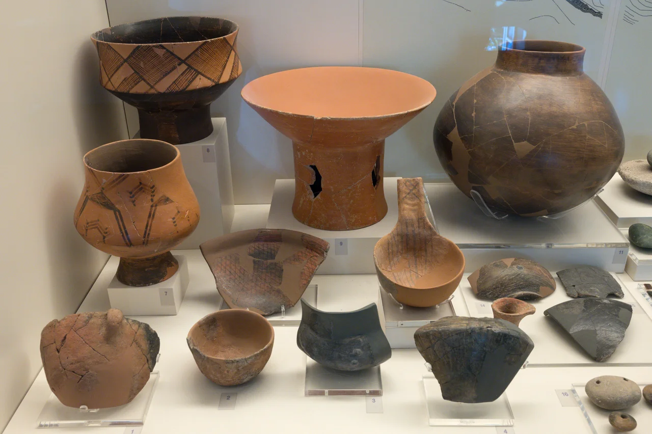

Franchthi Cave
The cave opens toward Kiladha Bay on the Argolic Gulf, and when the first people sheltered here around 38,000 years ago, the sea was not visible from the entrance. Sea levels were roughly 120 meters lower than today, and the Aegean coast lay kilometers farther out — a broad plain that the people of Franchthi watched, over the course of countless generations, slowly disappear beneath rising water. They kept coming back anyway. Franchthi Cave was occupied, with occasional gaps, through the Upper Palaeolithic, the Mesolithic, and the Neolithic, finally abandoned around 3,000 BC. That span of roughly 35,000 years makes it one of the most thoroughly studied Stone Age sites in southeastern Europe — and one of the most remarkable records of early human life anywhere on the continent.
The Long Vigil of Stone Age People
During the Upper Palaeolithic, Franchthi was home to small seasonal groups — probably 25 to 30 people at a time — who hunted wild ass and red deer and carried flint bladelets and scrapers as their essential toolkit. Their occupation intensified after the Last Glacial Maximum, the coldest peak of the last ice age, as conditions gradually moderated. Then, around 13,000 BC, something unexpected appears in the archaeological record: obsidian from the island of Melos, more than 150 kilometers away across open water. It is the earliest evidence of seafaring and navigational skill by anatomically modern humans in Greece. These were not accidental castaways. They went to Melos deliberately, obtained volcanic glass prized for its razor-sharp cutting edge, and returned. The sea, even then, was a road.
A break in occupation occurred during the Younger Dryas, the sharp cold snap around 12,900–11,700 BC that interrupted the warming after the ice age. When people returned to Franchthi, it was with a Mesolithic culture adapted to a warmer, transformed world — one where the coastal plain they had known was now largely underwater.
Seafarers, Tuna Hunters, and the Trade in Shell Beads
The Mesolithic inhabitants of Franchthi were not passive foragers. They broadened their diet considerably from the big-game hunters who preceded them, taking small game, wild plants, fish, and mollusks. The obsidian from Melos continued to flow in, evidence of an active maritime network. For several hundred years between around 7,900 and 7,500 BC, tuna became a major component of the cave dwellers' diet — implying either deep-sea fishing or sophisticated net techniques near the shore. Both possibilities are remarkable for people working without metal tools.
By the Neolithic, beginning around 7,000 BC, the cave's inhabitants were among the first in Greece to show evidence of agriculture. Domesticated plants and animals appear alongside the wild species they had always relied on. Scholars now believe this reflects contact with — and rapid adoption from — emigrants arriving by boat from Pre-Pottery Neolithic B cultures of the Near East around 6,900 BC, who introduced farming to Greece. At Franchthi, this transition seems to have been absorbed, not imposed; the existing hunter-gatherers adapted. During the Early Neolithic, the cave may also have served as a workshop for making cockle-shell beads traded with inland communities.
The Submerged World Below
The Neolithic phase at Franchthi included not just the cave itself but an area outside the entrance called the Paralia — the seaside — where the inhabitants built terracing walls and grew crops. Below the Paralia lay a village that has since slipped beneath the sea as water levels continued their long rise. That village is one of the reasons Kiladha Bay has attracted sustained underwater archaeological attention.
In 2012, a collaboration between the University of Geneva and the Greek Ephorate of Underwater Antiquities launched the Bay of Kiladha Project to map submerged prehistoric landscapes. While conducting training dives nearby in 2014, the team discovered pottery fragments at Lambayanna Beach. When they returned for a full investigation in 2015, they found the ruins of an Early Bronze Age city beneath the water — foundations, stone-paved roads, and what appears to be a fortification wall with three large towers. The Lambayanna site dates to the Early Helladic II era, roughly 2,650 to 2,200 BC, contemporary with the construction of the Great Pyramids. A second layer reaches back to Early Helladic I, and a third layer bridges the Bronze Age and Neolithic — suggesting that the submerged city and the cave community may have overlapped.
Uncovering 35,000 Years
Modern excavation at Franchthi began in 1967 when T. W. Jacobsen, a professor of classical archaeology and classical studies at Indiana University, arrived with fellow researcher M. H. Jameson for what was meant to be a brief single season — a placeholder while they waited on access to a different site. The cave's significance became apparent almost immediately. Jacobsen continued the work for nearly a decade, concluding in 1976, and the finds have occupied scholars ever since.
Isotopic studies of human and animal remains from the cave have refined our understanding of what the people here actually ate. Contrary to assumptions about coastal dwellers, the Mesolithic and Neolithic inhabitants relied primarily on terrestrial food — meat and dairy from sheep and other land animals — with marine resources playing a secondary role. Rising sea levels had pushed the shoreline kilometers away by the Neolithic, reducing easy access to marine food even as the cave remained in use. The cave was abandoned around 3,000 BC, closing a chapter 35,000 years in the making.
From the Air
Franchthi Cave is located at coordinates 37.4224°N, 23.1313°E, overlooking Kiladha Bay on the Argolic Gulf in southeastern Argolis. Approaching from the north, the bay appears as a sheltered indent on the eastern coast of the Argolid Peninsula, southeast of Nafplio. The nearest major airport is Athens International (LGAV), approximately 130 km to the northeast. A viewing altitude of 3,000–5,000 feet over the bay gives good orientation; the cave opening is on the hillside above the water's edge and is best visited on the ground. The Argolic Gulf typically offers excellent visibility in the summer months.
Nearby Stories
- Battle of Doliana 3.6 km away
- Argon Pedion 4.6 km away
- Menelaion 4.9 km away
- Saronic Gulf 10 km away
- The Slamat Disaster 15 km away
- Argolis 18 km away
- Agios Georgios (island) 35 km away
- SS Heraklion 57 km away