
Arrilalah
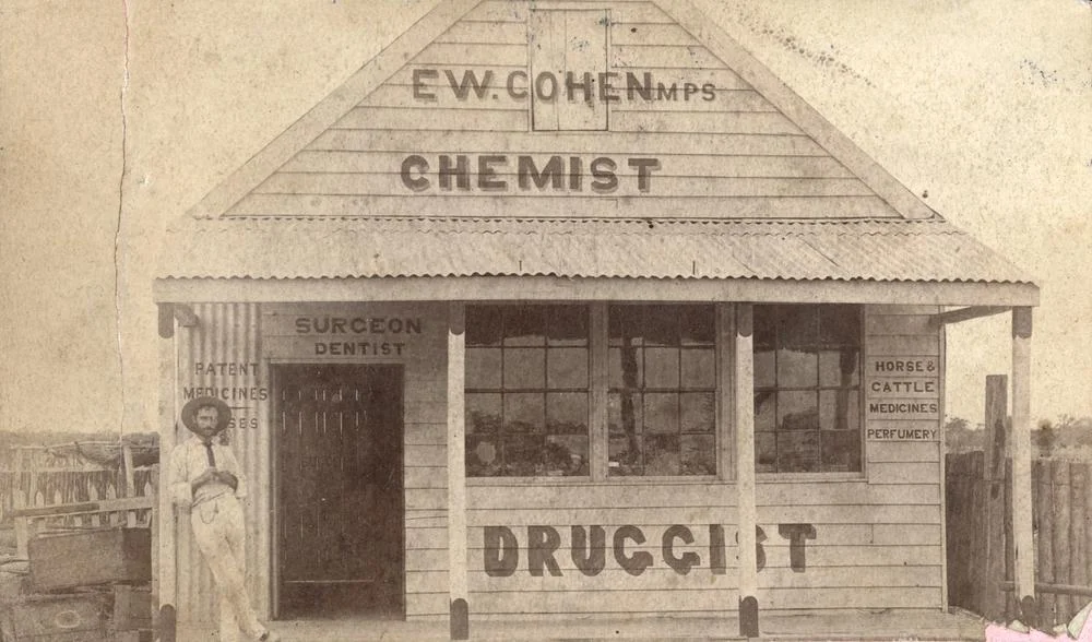
Some towns die slowly enough that you can watch them go. Arrilalah took about seventy years. In the 1890s, this dot on the Thomson River floodplain had two hotels, a billiard room, two bakers, two saddlers, two butchers, two blacksmiths, a police station with three officers, and a racecourse its boosters swore was "the prettiest on the river." Today the traveller driving the lonely road between Longreach and Stonehenge finds heaps of broken bottle glass glinting in the red dirt and a cemetery holding roughly forty graves. The galahs and cockatoos that may have given the place its name still wheel overhead, indifferent to the human story that flickered out beneath them.
From Forest Grove to Arrilalah
The site was first settled in the 1860s under the plain name "Forest Grove," and possibly "Hopkins' Camp" before that. In 1885 it was given a new name of uncertain origin: Arrilalah. One tradition holds that it comes from a First Nations word describing good feeding ground for galahs and cockatoos, and anyone who has watched those flocks pour pink and white across an outback dawn can imagine why the name stuck. The Commercial Hotel had opened the year before, in 1884, but the nearest telegraph station and courthouse were still at Isisford, seventy-five miles away across country that could kill an unprepared man.
A Boom on the Promise of Rails
In November 1885 the government auctioned township land, and the sale carried a tantalising rumour with it: the Central Railway was reportedly "crawling out West very vigorously" from Barcaldine and might come straight to Arrilalah. Speculation did the rest. Land prices climbed, hotels multiplied, the Forest Grove Hotel was rebuilt as the Club Hotel in rammed earth, and a Cobb & Co coach service made the town a genuine staging post on the route south. Arrilalah and rival Stonehenge each insisted their racecourse was the finest on the river. The Arrilalah Race Club was still running meetings in 1929, then revived again in 1936, long after the rest of the dream had curdled.
The Constable Who Walked Into the Bush
In January 1887, the local police constable, F. Moran, set out from Arrilalah for Isisford on a transfer and simply vanished. Fourteen days later he was found alive but barely: emaciated, naked, and bleeding, having lost his packhorse and then been caught by drenching rains and flood. His ordeal became part of a darker pattern of the era, in which young English recruits were posted alone into a country they could not read and left to survive it. Moran did survive. He returned to police the town in February 1889, the same year a proper police station and courthouse were finally built, with a sergeant in charge. The station closed in 1926; the buildings were sold off by the government in 1938.
The Slow Quiet
The deathblow came in 1892, when the railway chose the newer town of Longreach instead. Without rails, Arrilalah had no future, only an afterlife. The provisional school opened and closed in the same year, 1906, for want of pupils. The shearers' strike of 1891 had touched the district; by 1928 the surrounding land was absorbed into grazing homesteads. For a while the town hung on as a node in the Longreach–Windorah telephone line. By March 1950, during widespread flooding, a newspaper described Arrilalah as "a one-house town." By the 1980s, no one lived there at all. The cemetery, rededicated in 2010, remains the most permanent thing the town ever built.
From the Air
Arrilalah sits at 23.67°S, 143.87°E on the Thomson River floodplain, roughly 32 miles (51 km) south of Longreach on the road toward Stonehenge. From the air the site reads as faint clearings and station tracks in flat, channel-country terrain; the braided Thomson River channels to the west are the clearest landmark. Recommended viewing altitude is 2,000-4,000 ft AGL in good light to pick out the old town grid and cemetery. Nearest controlled field is Longreach Airport (ICAO YLRE), about 25 nm north; Isisford's airstrip lies to the southeast. The country is dead flat with few obstacles, but summer heat haze and post-rain flooding can sharply reduce visibility over the floodplain.
Nearby Stories
- Beaconsfield Station Sheep Wash 8.3 km away
- Langenbaker House 17 km away
- Isis Downs Woolshed 37 km away
- Lochern National Park 39 km away
- Bexley Station 42 km away
- Isisford, Queensland 62 km away
- Bladensburg National Park 90 km away
- Warbreccan 96 km away